← Exploring Poland Through Maps: A Personal Journey Across a Fascinating Country Exploring the Map of Switzerland: A Complete Guide to Swiss Geography and Cantons →
Austria is a landlocked country nestled in the heart of Central Europe, bordered by eight nations including Germany, Switzerland, Italy, and Hungary. Understanding its geography is essential for travelers, students, and history enthusiasts alike. A map of Austria reveals a fascinating landscape of alpine peaks, river valleys, and a well-organized federal structure divided into nine distinct states. Whether you are planning a trip to Vienna, tracing the path of the Danube, or simply satisfying a curiosity about European geography, studying the maps of Austria opens window into one of the continent's most culturally rich and geographically diverse nations. The country's terrain shifts dramatically from the towering Eastern Alps in the west to the flat plains of the Pannonian Basin in the east, making cartographic representation both complex and deeply informative.
Austria's States and Capital Cities: A Political Overview
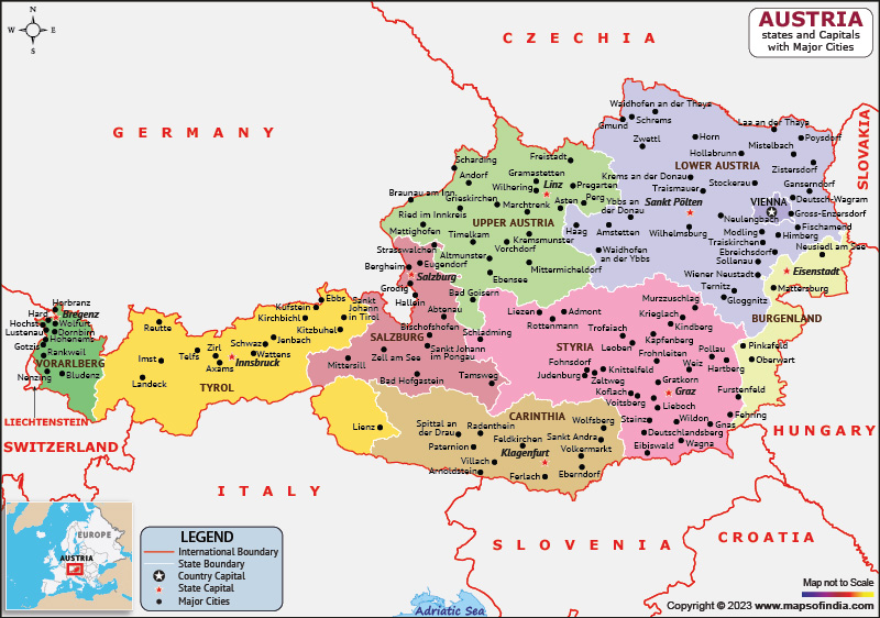
Austria is organized into nine federal states, known in German as Bundesländer. These states are Vienna, Lower Austria, Upper Austria, Styria, Tyrol, Carinthia, Salzburg, Burgenland, and Vorarlberg. A political illustrating these states alongside their respective capitals provides an immediate understanding of how the country is administratively structured. Vienna, which serves as both state the national capital, sits the northeastern corner of the country and functions as the political cultural, and economic hub. Salzburg, famous for its connection to Mozart and its baroque old town, serves as the capital of the Salzburg state. Innsbruck anchors the alpine of Tyrol, while Graz leads Styria in the south. Each capital carries own historical weight architectural identity Examining this type of map is particularly useful for understanding regional governance, tourism planning, and the distribution of Austria's population across varied geographic zones.
Detailed Physical Map of Austria: Cities, Roads, and Airports

A detailed physical map of Austria goes far beyond political boundaries. It charts the country's dramatic elevation changes, highlights major urban centers, traces the network of highways roads connecting them, and marks the locations of key airports. The Austrian road network is-developed, with the Autobahn system linking cities like Vienna, Salzburg, Linz, and Graz efficientlysbruck International Airport and International Airport at Schwechat represent the country's primary air gateways, while several airports serve the alpine tourism industry during both winter ski seasons and summer hiking periods Physically, Austria's terrain is dominated by the Alps cover roughly 62 percent of the country's total area. Rivers such as the Inn, the Mur, and the mighty Danube carve through valleys and plains, shaping settlement patterns and transportation corridors. This of comprehensive indispensable for logistics professionals, tourists navigating mountain passes, and anyone seeking a thorough grasp of Austria's spatial organization. Together physical maps of Austria paint a complete picture of a country where natural grandeur and structured coexist in striking balance.
Tourist Map Of Austria With Cities 60 Photos - Arptravels.com
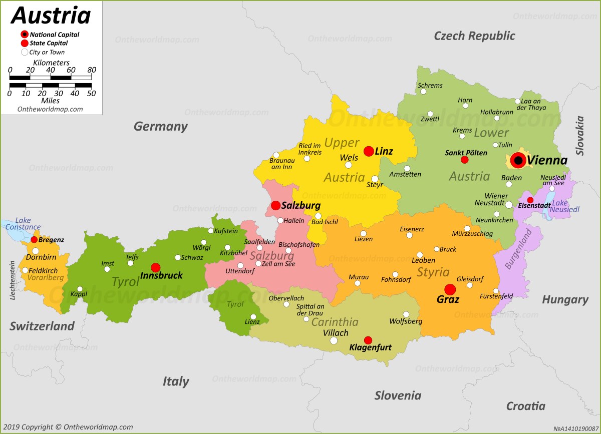
Tourist map of austria with cities 60 photos - Arptravels.com
Austria Maps & Facts - World Atlas
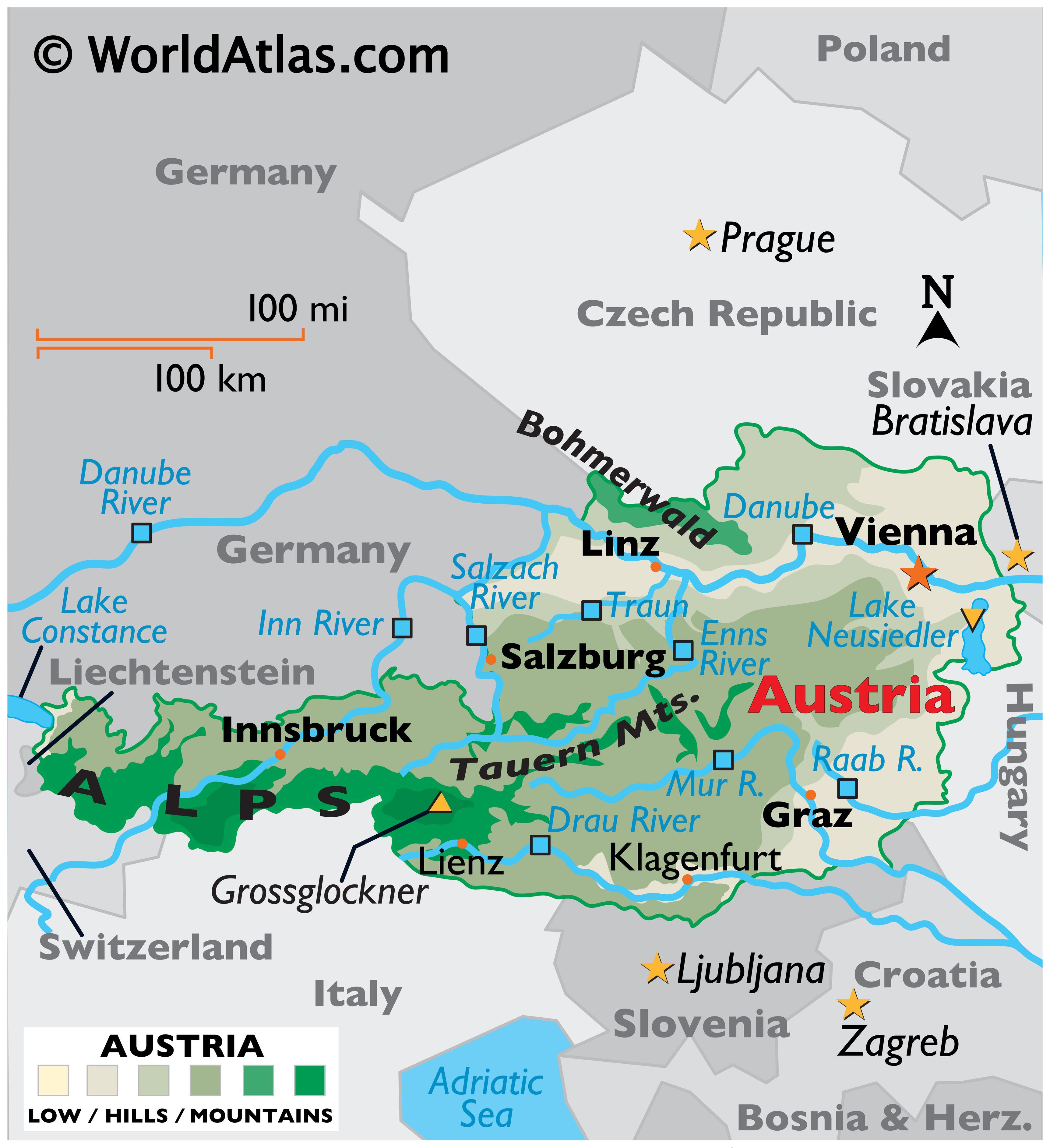
Austria Maps & Facts - World Atlas
Landkarte österreich Zum Ausdrucken: Map Austria Maps Europe Austrian
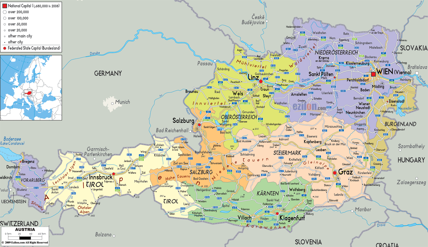
Landkarte österreich Zum Ausdrucken: Map Austria Maps Europe Austrian ...