← Exploring the Map of the United States: A Comprehensive Visual Guide Discover Japan Through Maps: A Journey Across the Land of the Rising Sun →
Canada. The land of hockey, poutine, and apologizing for things that aren't even your fault. It's also home to one of the most entertainingly complicated maps on the planet. With ten provinces and three territories spread across nearly 10 million square kilometers, Canada basically said "hold my maple syrup" and decided to be second-largest country in the world just to make geography teachers cry Whether you're trying to figure out where Saskatchewan ends and Manitoba begins, or you're just wondering why Nunavut looks like it ate rest of Canada for breakfast, this guide has you covered — with a few laughs along the way.
The Big Picture: Canada's Political Map and Why It Looks Like That

Take one good look at this political map and you'll immediately notice something hilarious: Ontario Quebec are basically hogging the entire center of attention like that one relative who dominates every family reunion. Meanwhile, British Columbia is over the far left looking effortlessly cool its mountains and ocean views while the Maritime provinces on the right are huddled together like they're sharing winter coat. And then there's Nunavut, sitting up top covering about 20% of the entire country, containing population smaller than a mid-sized American suburb. The capital cities are sprinkled around like someone sneezed a bag of confetti, and somehow the nation's capital Ottawa, ended up right border of Ontario and Quebec — probably as a compromise after those two couldn't stop arguing about language for five minutes. The whole thing is a gloriously chaotic masterpiece of political cartography.
Provinces, Territories, and the Capitals That Somehow Make Sense
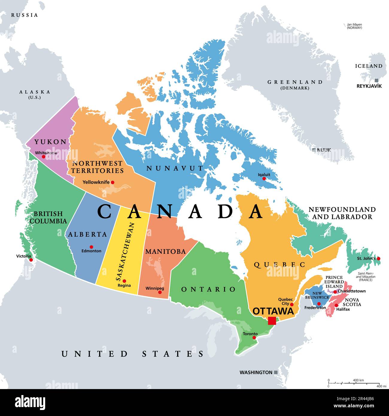
Color-coded maps Canada are a gift to humanity, mostly because without colors'd spend solid twenty minutes trying to figure out where Alberta stops and the Northwest Territories begin. This beautifully labeled version lays it all out — every province, every territory, every capital city neatly identified so you can stop confidently pointing at Winnipeg and calling it "somewhere in the middle." Fun fact: Canada's territories — Yukon, Northwest Territories, and Nunavut — cover an enormous chunk of the north but have combined population that most major cities would at.kon's capital, Whitehorse, sounds like a fantasy novel character Regina, the capital of Saskatchewan, is pronounced "ruh-JYE-nah" which catches absolutely newcomer off guard every single time. And let's not forget Fredericton, the capital of New Brunswick, a city so pleasantly under radar that most Canadians outside Atlantic Canada couldn't confidently locate it on a map without squinting. Canada is endlessly, wonderfully weird, and its proves it with labeled cheerfully named capital city.
Map Canada
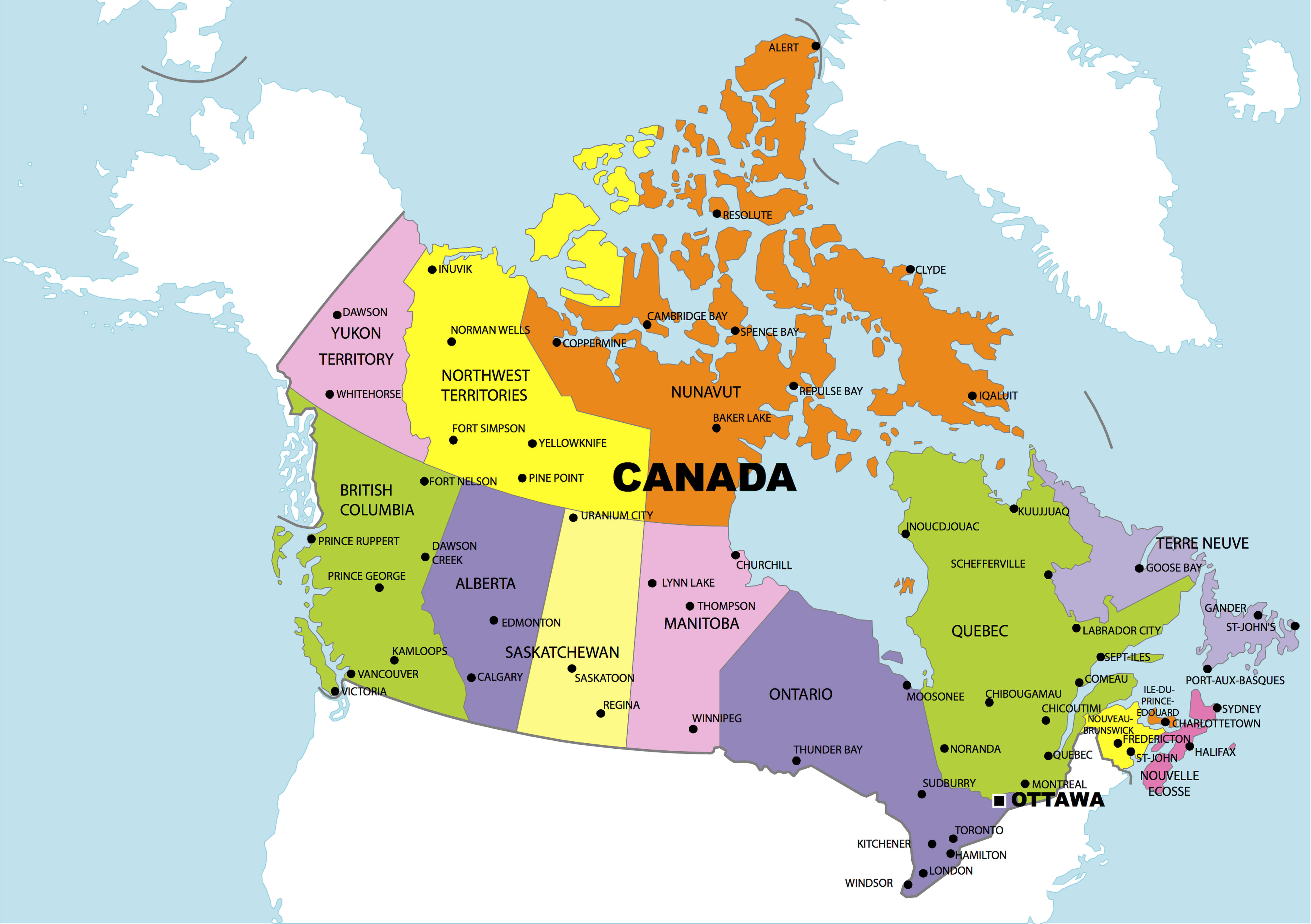
Map Canada
Printable Canadian Map With Cities
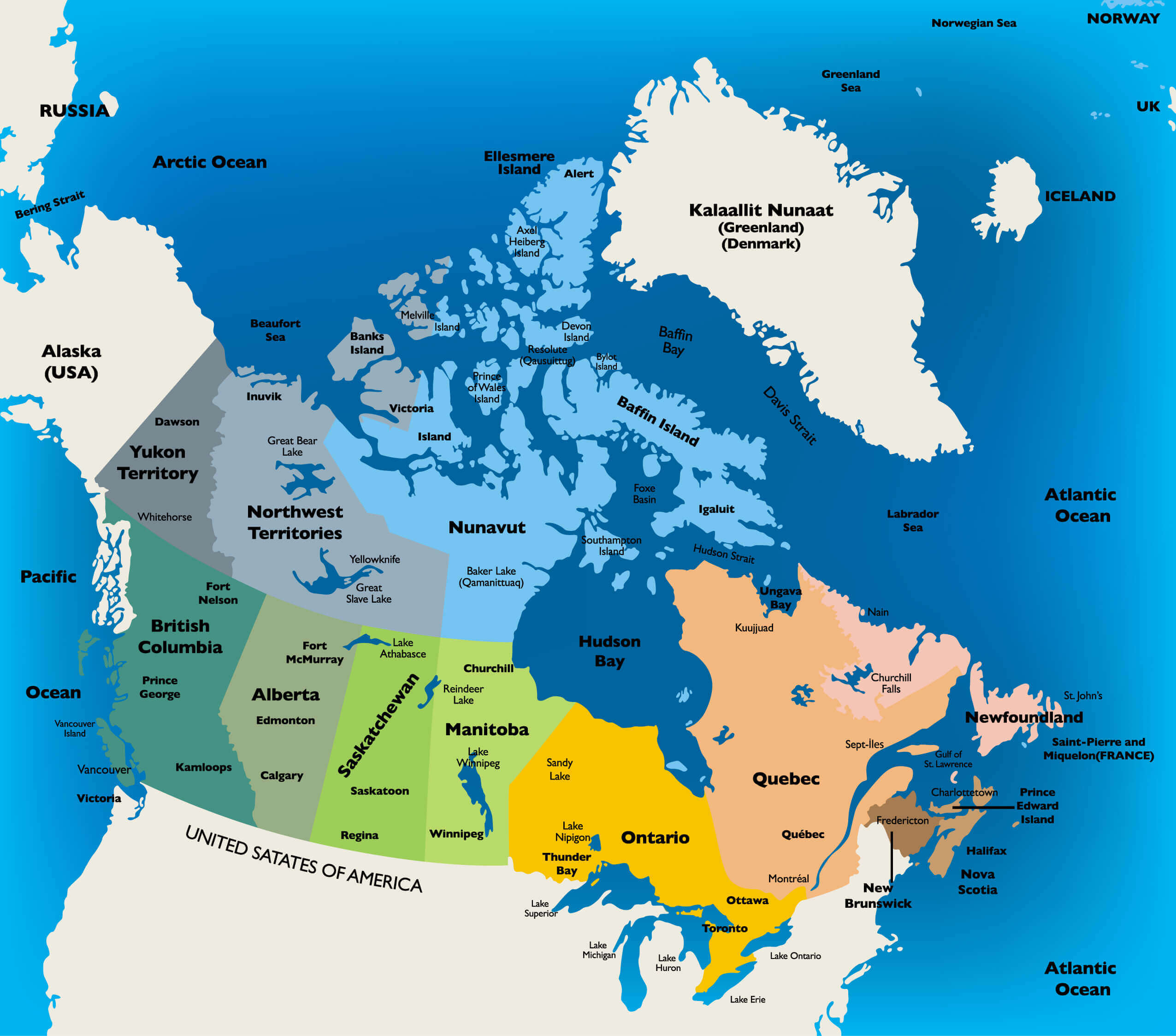
Printable Canadian Map With Cities
Canadas Geography: A Friendly Guide
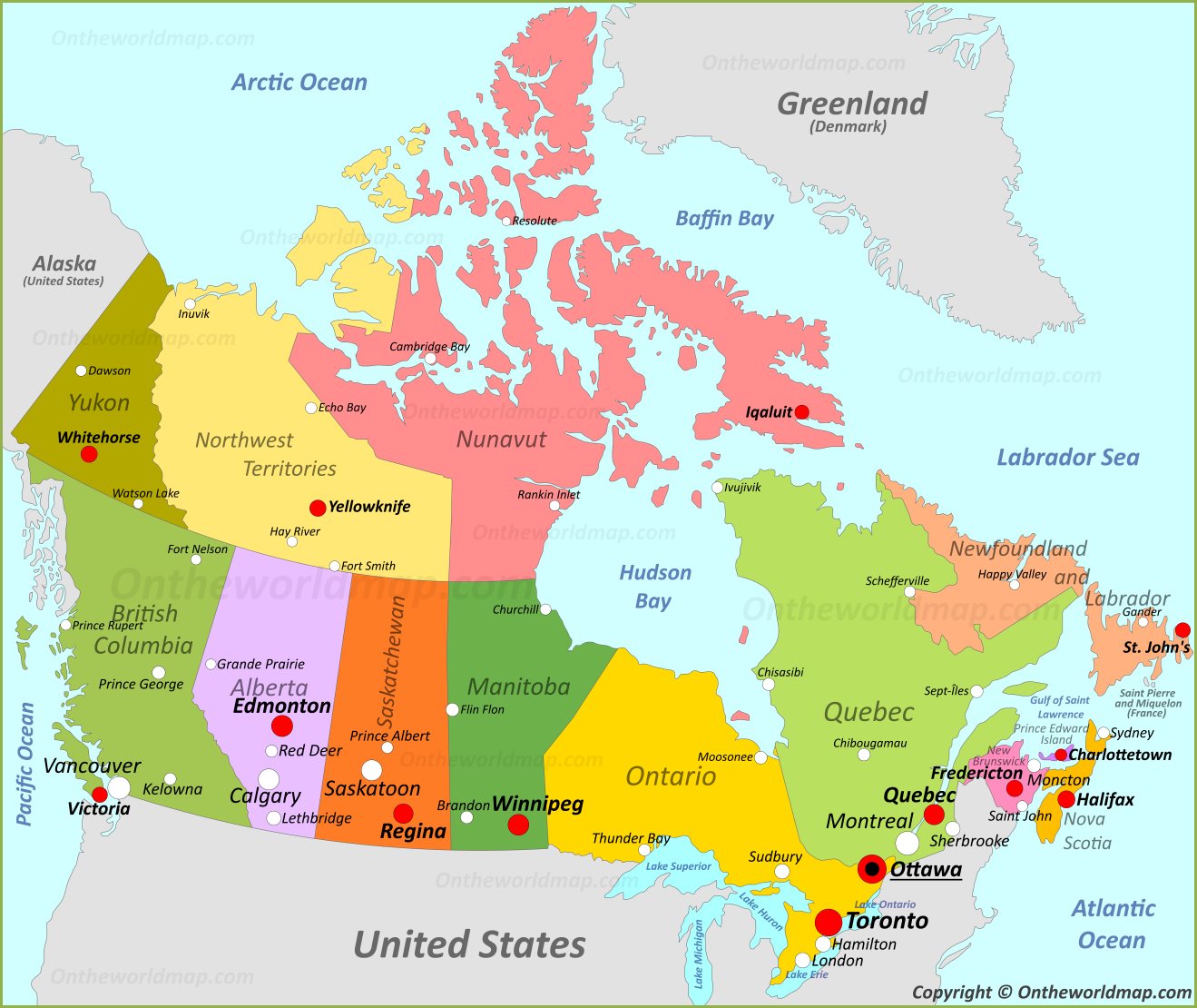
Canadas Geography: A Friendly Guide