← Exploring Italy Through Maps: A Visual Guide to the Boot-Shaped Peninsula Exploring Mexico: A Visual Journey Through Its Maps and Regions →
France is one of those countries that seems to have it all — sweeping mountain ranges, sun-drenched coastlines, dense forests, and some of the most iconic cities in the world. Whether you're planning a road trip through Provence, tracing the Loire Valley's château-dotted landscape, or simply satisfying a love of geography, a good map of France is your best companion. Maps don't just tell you where things are — they tell you a story about the land, its history, and its people. Let's take a closer look at what makes France's cartography so fascinating and useful.
Navigating France: Roads, Cities, and Airports at a Glance
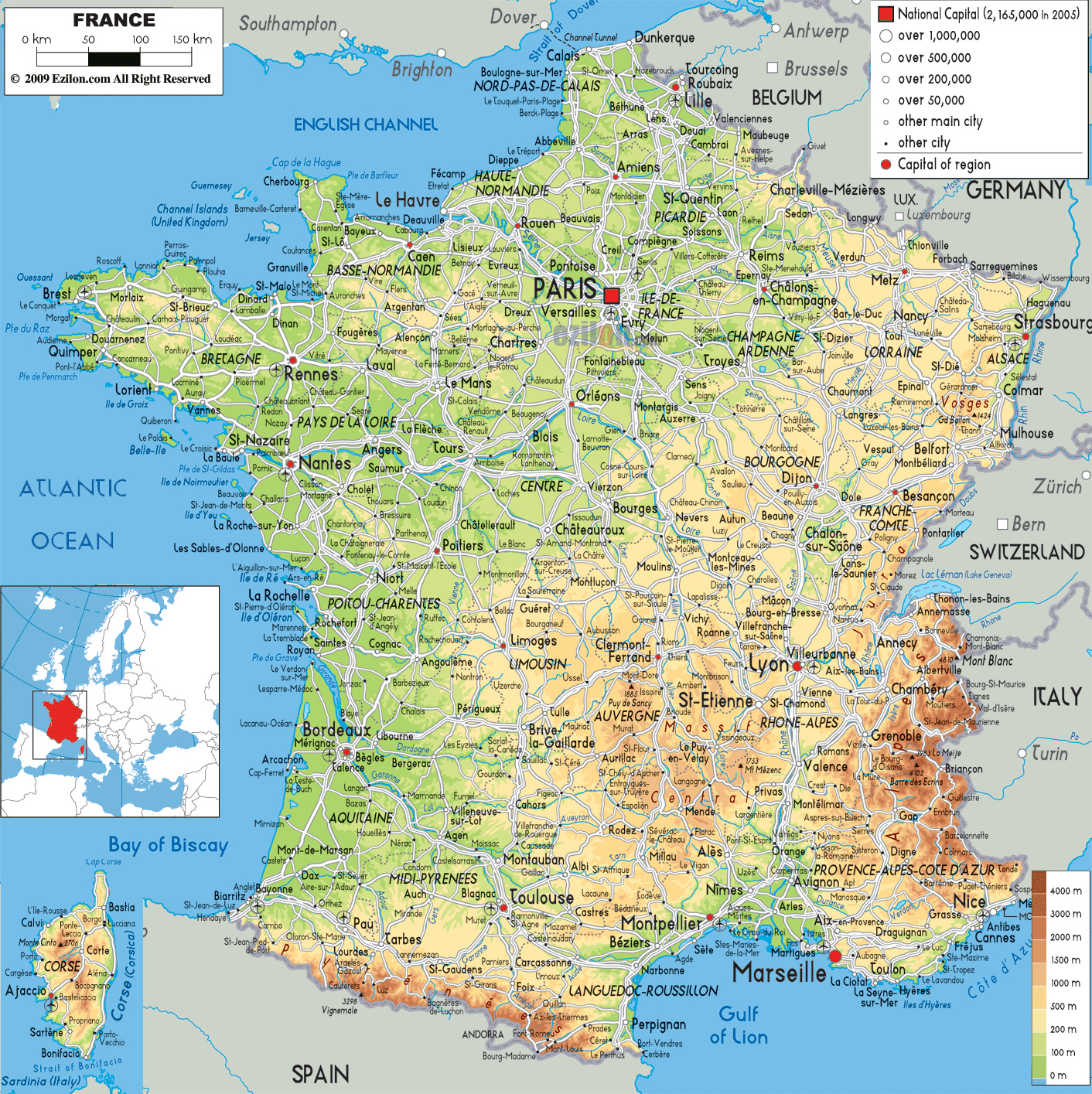
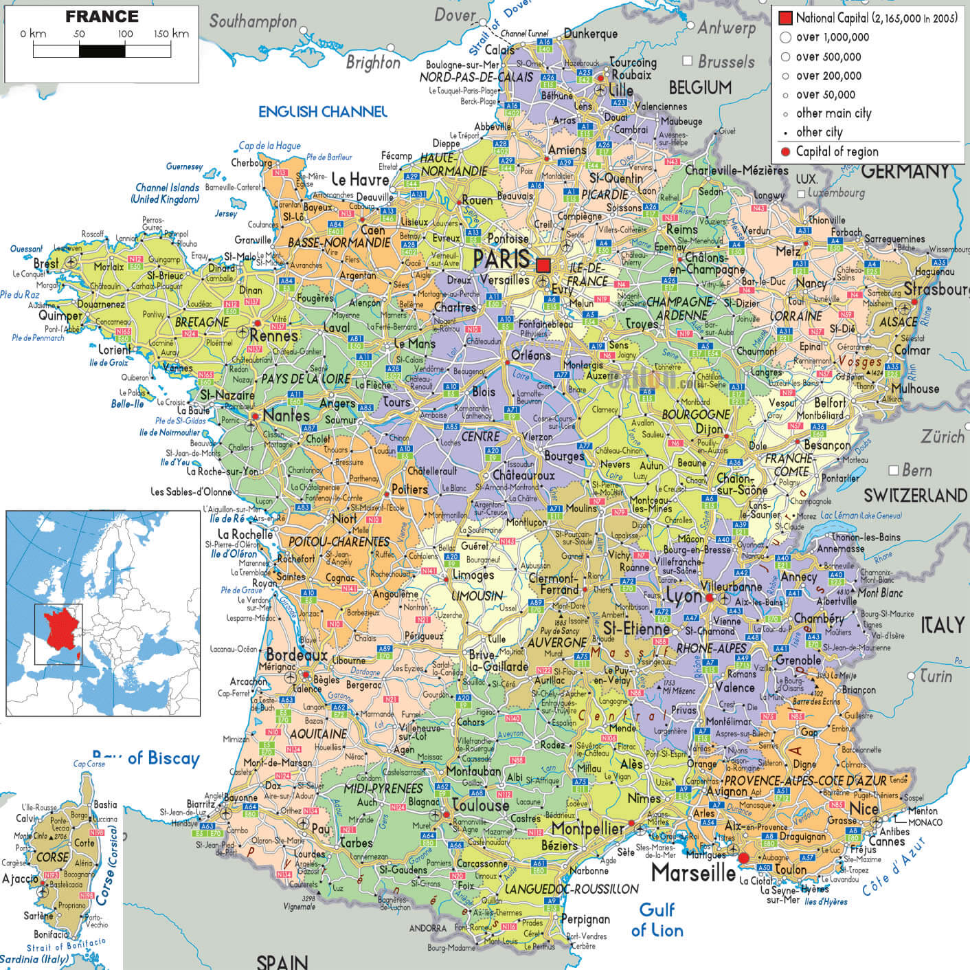
A detailed map of France that includes roads, cities, and airports is an incredibly practical tool for travelers and geography enthusiasts alike. France boasts an extensive and well-maintained transportation network — from the sprawling autoroute system that connects Paris to the far corners of the hexagon, to regional airports that make even remote destinations accessible. Cities like Lyon, Marseille, Bordeaux, and Toulouse each serve as major hubs, both culturally and logistically. Looking at a road map, you can trace the routes that wind through the Alps the Pyrenees, follow Rhône River southward toward the Mediterranean, or chart a course along the rugged Atlantic coastline. Physical maps also highlight's remarkable geographic diversity, showing the contrast between the flat plains of the north, the volcanic plateaus of the Massif Central, and the dramatic elevations of Mont Blanc in the east. For anyone planning a driving holiday or a multi-city itinerary, this kind of map is an indispensable starting point.
Understanding French Regions: The Administrative Breakdown
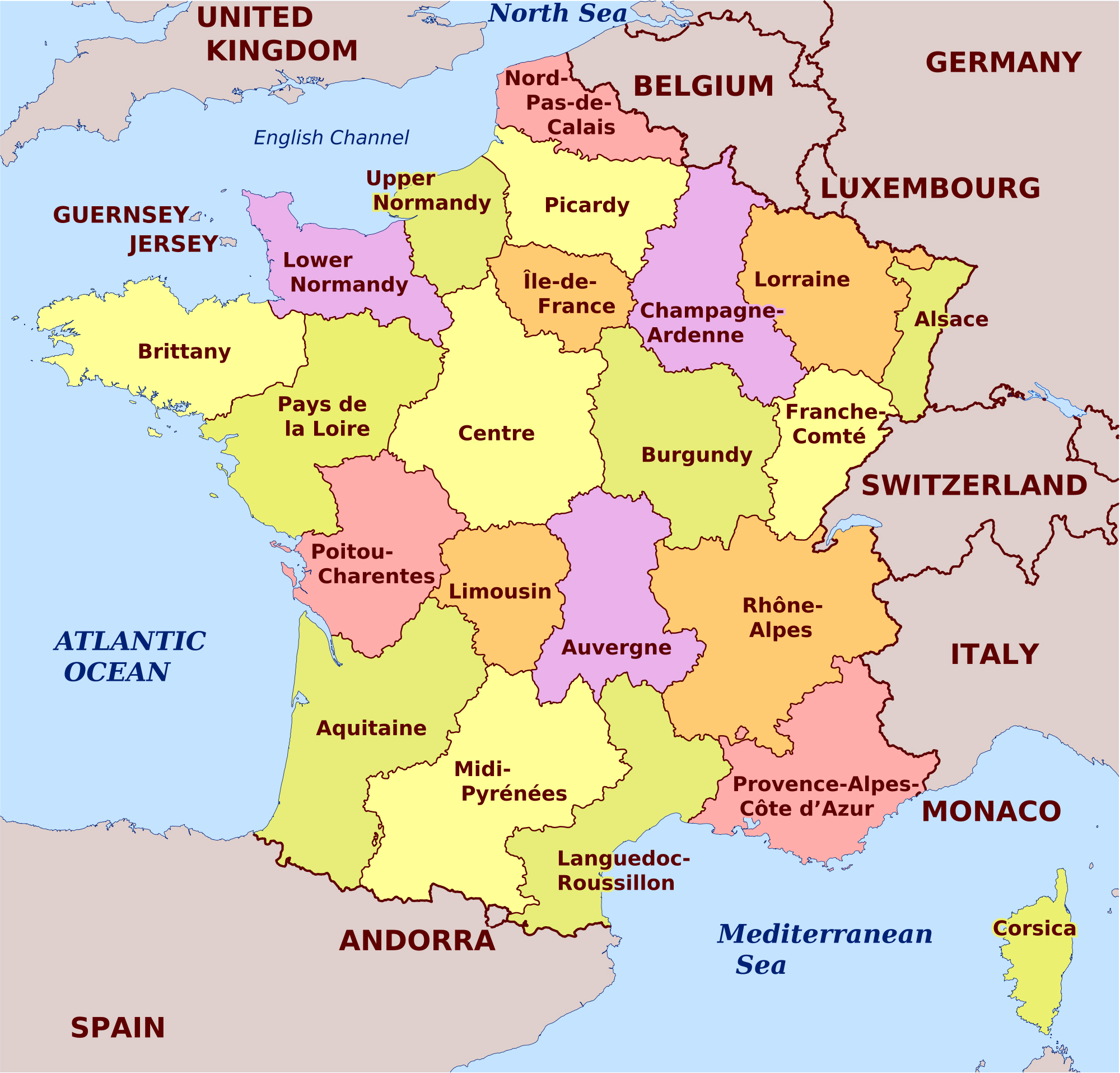
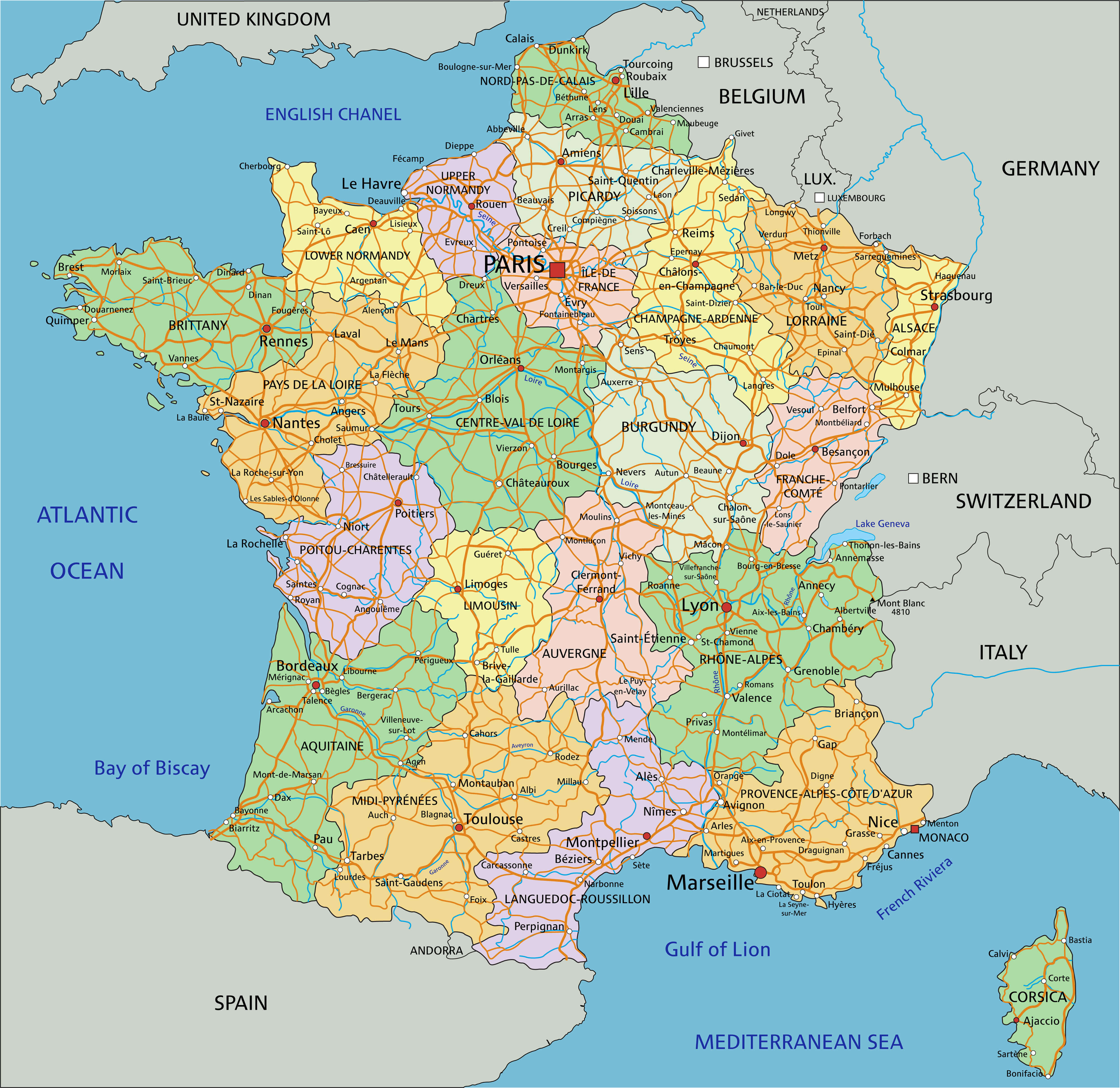
France's administrative map reveals a fascinating layer of organization beneath its physical landscape. The country is divided into 18 administrative regions — 13 in metropolitan France and 5 overseas — each with its own identity, culture, and local governance. These regions were significantly reorganized in 2016, merging many of the older smaller units into larger administrative zones. An map lets you appreciate just how vast some regions are: Grand Est the northeast covers huge swath of land with deep historical ties to Germany Luxembourg while Nouvelle-Aquitaine in the southwest is the largest region in metropolitan France by area. Understanding these boundaries essential not for political or purposes, but also for appreciating the cultural tapestry of the country. Wine lovers will immediately recognize the boundaries of Burgundy, Bordeaux, and Champagne. History buffs will trace the lines Normandy and Brittany. A-detailed administrative map bridges the gap between France's geographic reality and its rich regional identity making it a must-have resource for students, travelers, and researchers alike. Whether you're digging into French politics, planning a regional food tour, or studying European geography, this kind of map offers an endlessly rewarding reference point.
France Map - Guide Of The World
France Map - Guide of the World
Map Of France
Map of France
Map Of France
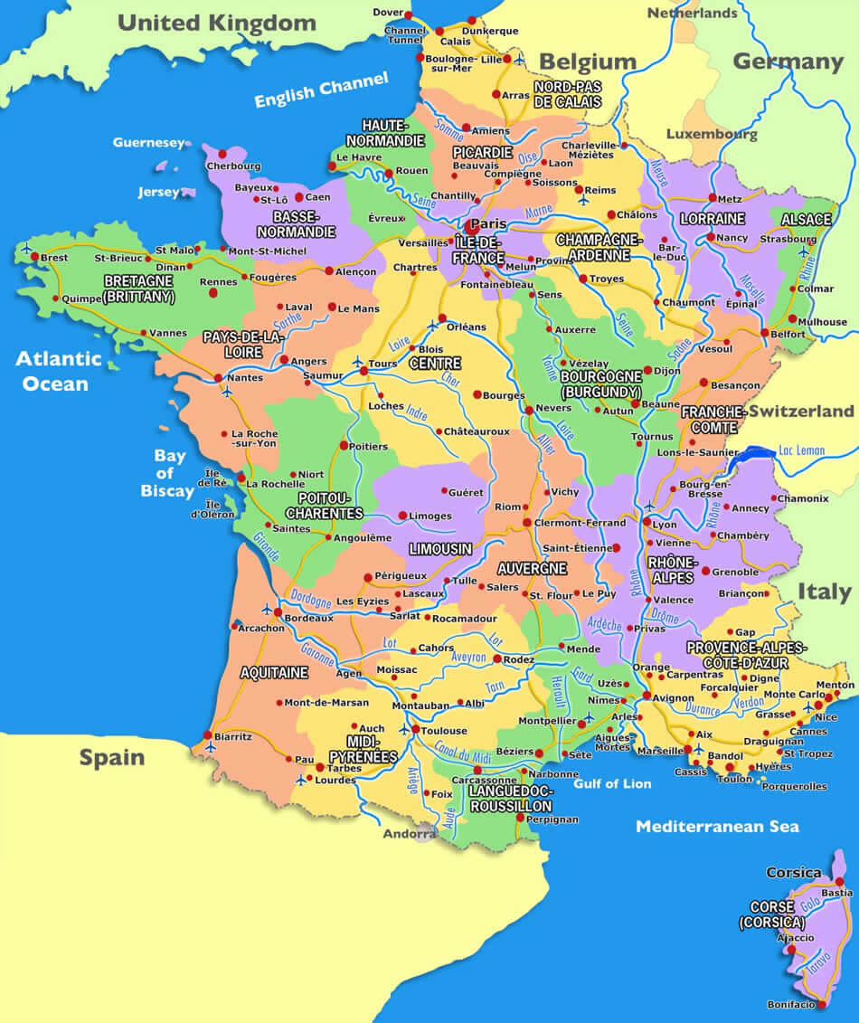
Map of France