← Exploring the Map of Wales: A Visual Guide to Its Regions and Heritage Exploring Portugal Through Maps: A Visual Journey Across This Stunning Country →
South Africa stands as one of the most geographically diverse and historically significant nations on the African continent. Stretching from the arid Karoo in the interior to the lush subtropical coastlines of KwaZulu-Natal, the country occupies the southernmost tip of Africa and covers an area of approximately 1.22 million square kilometers. Understanding the map of South Africa is essential for anyone looking to grasp the nation's complex regional identities, political boundaries, and natural landscapes. Whether you are a traveler planning a journey, a student of geography, or simply a curious mind, the map of South Africa tells a story far deeper than lines drawn on paper. It reflects centuries of history, cultural evolution, and the ongoing transformation of a nation that continues to define itself on the world stage.
Administrative Divisions of South Africa: A Closer Look at Its Provinces
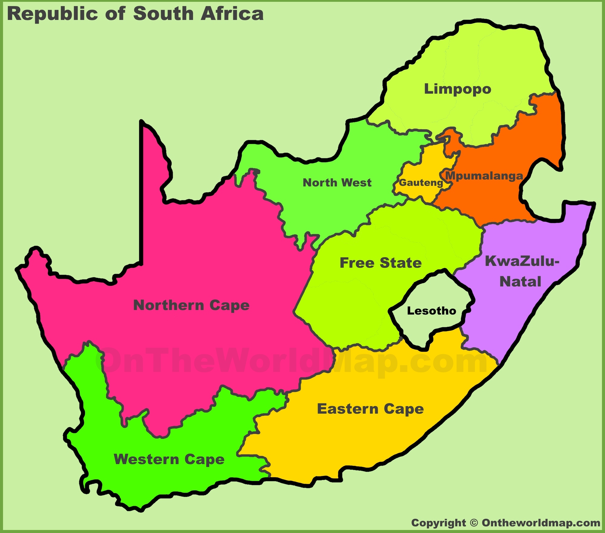
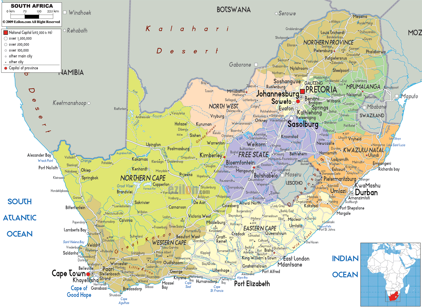
South Africa is divided into nine distinct provinces, each with its own capital government, and unique cultural character. These provinces include Gauteng, the economic heartland and most densely populated region; the Western Cape, known for Cape Town and its dramatic coastlines; KwaZulu-Natal, steeped in Zulu heritage and coastal beauty; and the sprawling Northern Cape, the largest province by land area yet one of the least populated. The remaining provinces — Eastern Cape, Free State, Limpopo, Mpumalanga, and North West — each contribute to the country's rich mosaic of languages, traditions, and landscapes The administrative divisions map reveals how South Africa reorganized its provincial structure after the end of apartheid in 1994, replacing the old homelands and with a new framework designed to promote equity and democratic governance. Studying these boundaries offers critical insight into how resources populations, and political power are distributed across the country today.
General Map of South Africa: Understanding the Country's Geographic Layout
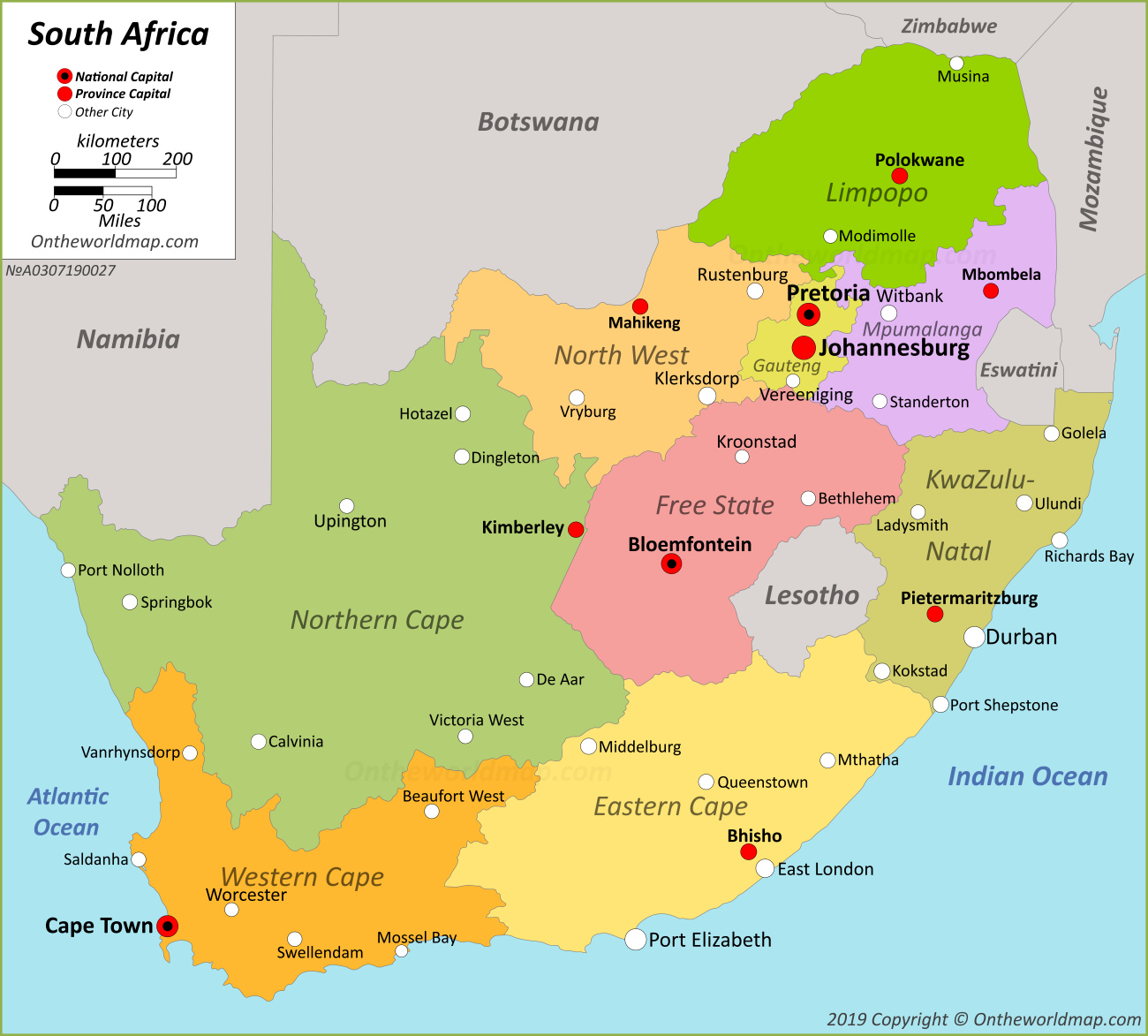
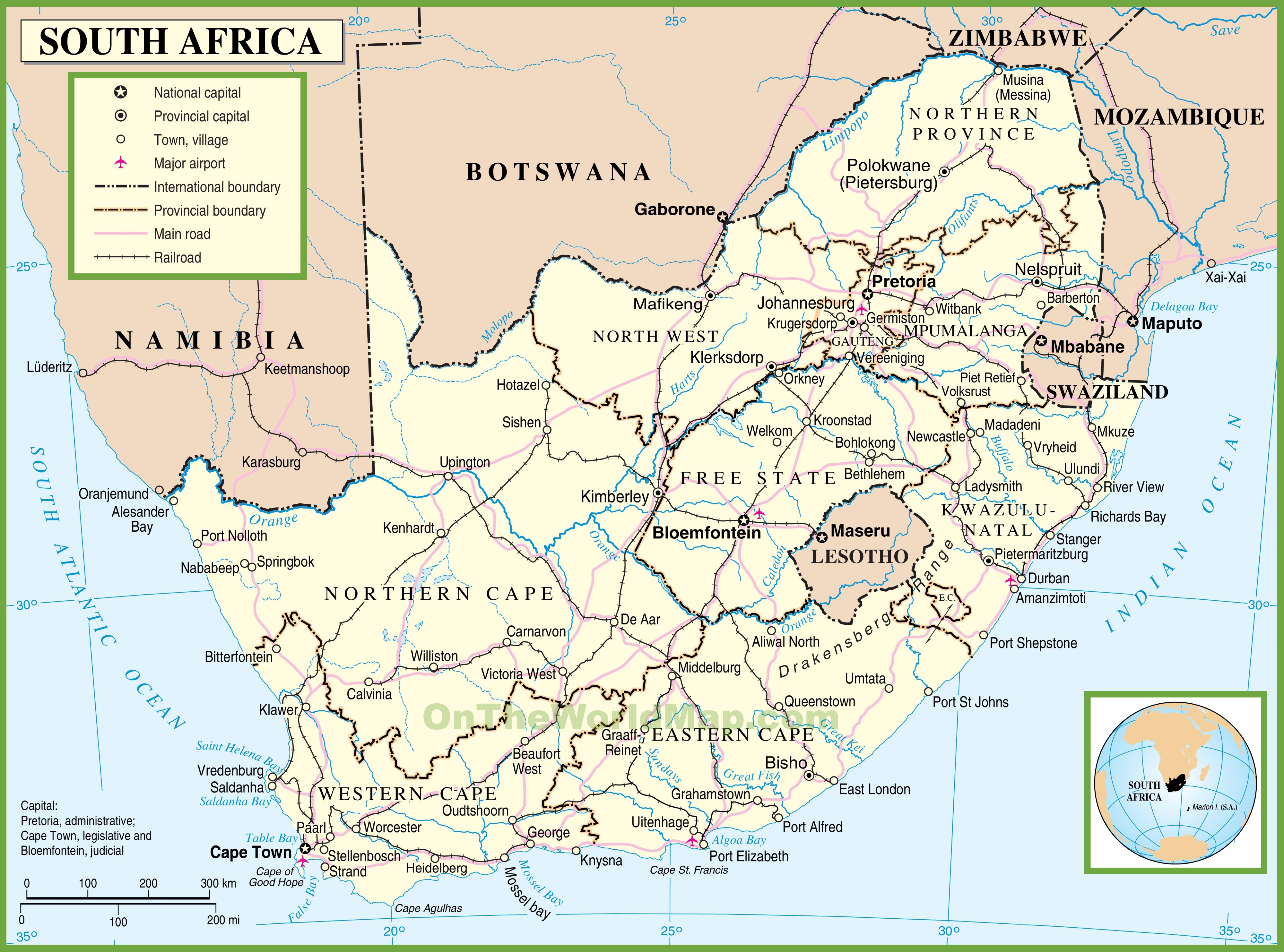
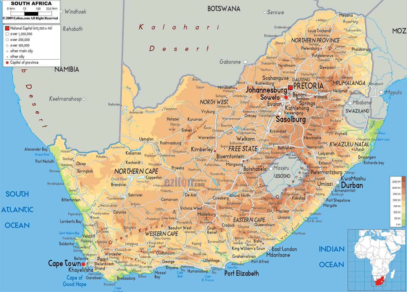
The general map of South Africa paints a vivid picture of a land shaped by dramatic contrasts. Bordering Namibia, Botswana, Zimbabwe, Mozambique, and Eswatini to the north, and entirely surrounding the landlocked kingdom of Lesotho within borders, South Africa holds a geopolitically unique position in the Southern African region. The country's topography ranges from the elevated Highveld plateau which sits at an average altitude of around 1,500 meters, to Drakensberg mountain range forming a towering escarpment along the eastern edge of the country Major cities such as Johannesburg, Pretoria, Cape Town, Durban, and Port Elizabeth are well distributed across the map, reflecting both historical settlement patterns and modern urban growth. Rivers like the Orange and the Limpopo carve through the interior, providing vital water resources in a country where rainfall can be unpredictable. The general map also highlights the country's two major coastlines — the Atlantic Ocean to the west and the Indian Ocean to the east — which together stretch for nearly 2,800 kilometers. These geographical features do not merely define the physical terrain; they shape the climate zones, agricultural regions, biodiversity hotspots, and economic corridors that make South Africa one of the most compelling and complex countries in the world to study explore.
South Africa Map Printable - Printable Free Templates
South Africa Map Printable - Printable Free Templates
Map Of South Africa: Offline Map And Detailed Map Of South Africa
Map of South Africa: offline map and detailed map of South Africa
South Africa Map
south africa map