← Exploring Mexico: A Visual Journey Through Its Maps and Regions Exploring the Florida Map: Cities, Roads, and Geographic Wonders of the Sunshine State →
Spain is one of Europe's most geographically diverse nations, occupying the majority of the Iberian Peninsula in southwestern Europe. From the snow-capped peaks of the Pyrenees in the north to the sun-drenched coastlines of Andalusia in the south, the country's physical and political landscape is remarkably varied. Understanding the map of Spain is essential for travelers, students, historians, and anyone with an interest in European geography. Whether you are planning a road trip through its autonomous communities or studying river systems and mountain ranges, a detailed map serves as an indispensable tool for navigating this culturally rich and geographically complex country.
Political Regional Overview Spain
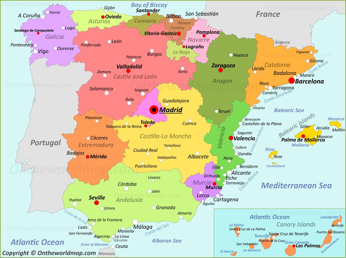
Spain divided into 17 autonomous communities, each with its own distinct identity, culture, and in some cases, language. A map of Spain reveals the boundaries of regions such as Catalonia in the northeast, the Basque Country in the north, Andalusia in the south, and the capital region of Madrid at the center of the peninsula. Major cities including Madrid, Barcelona, Valencia, Seville, and Bilbao are strategically distributed across the country, each serving as a hub for commerce, culture, and transportation. The Canary Islands off the coast of northwestern Africa the Balearic Islands in the Mediterranean Sea are also integral parts of Spanish territory, appearing as insets on most comprehensive maps. Understanding these regional divisions is crucial for grasping Spain's administrative structure, dynamics, and the deep-rooted sense of regional identity that defines the country's modern character.
Physical Geography and Natural Features of Spain
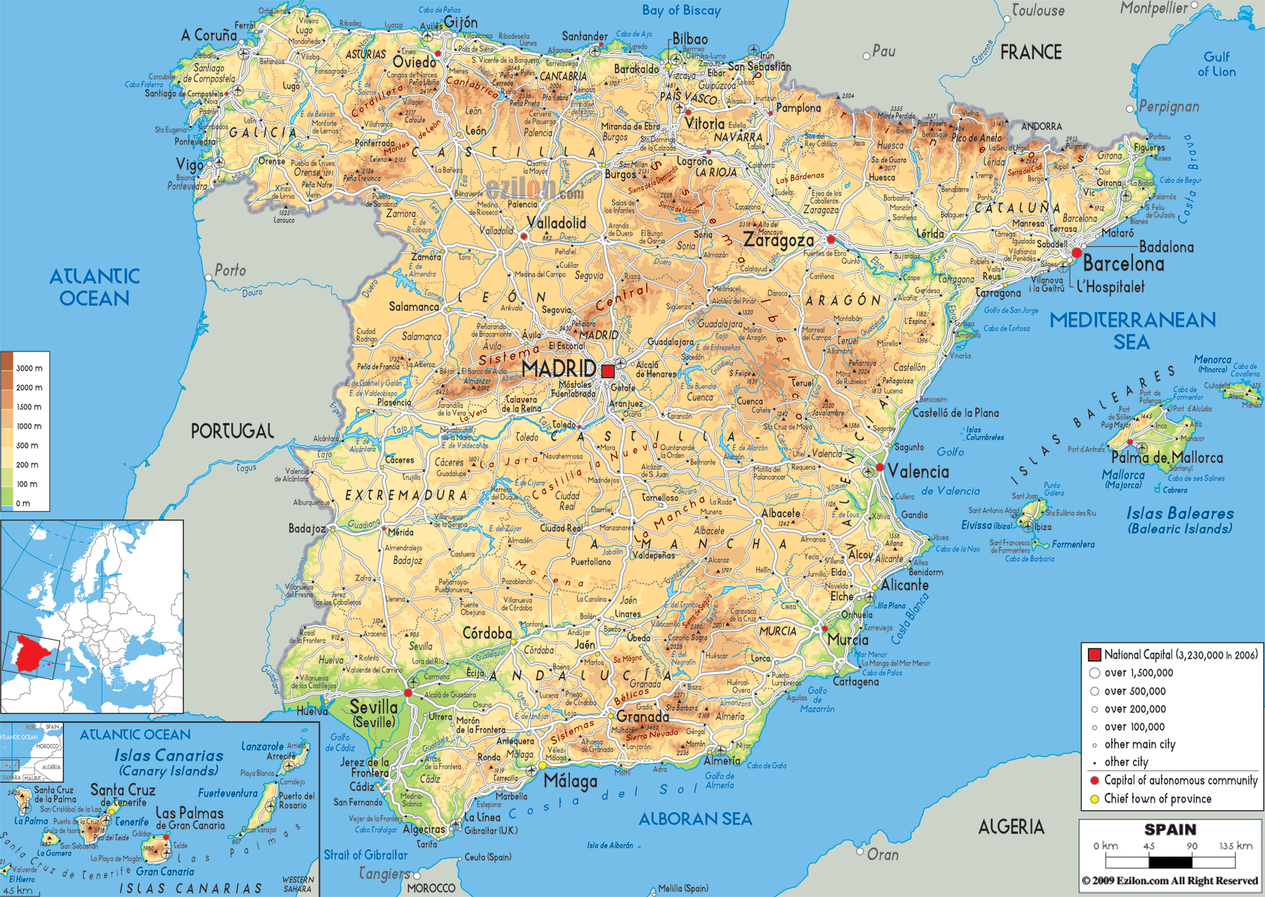
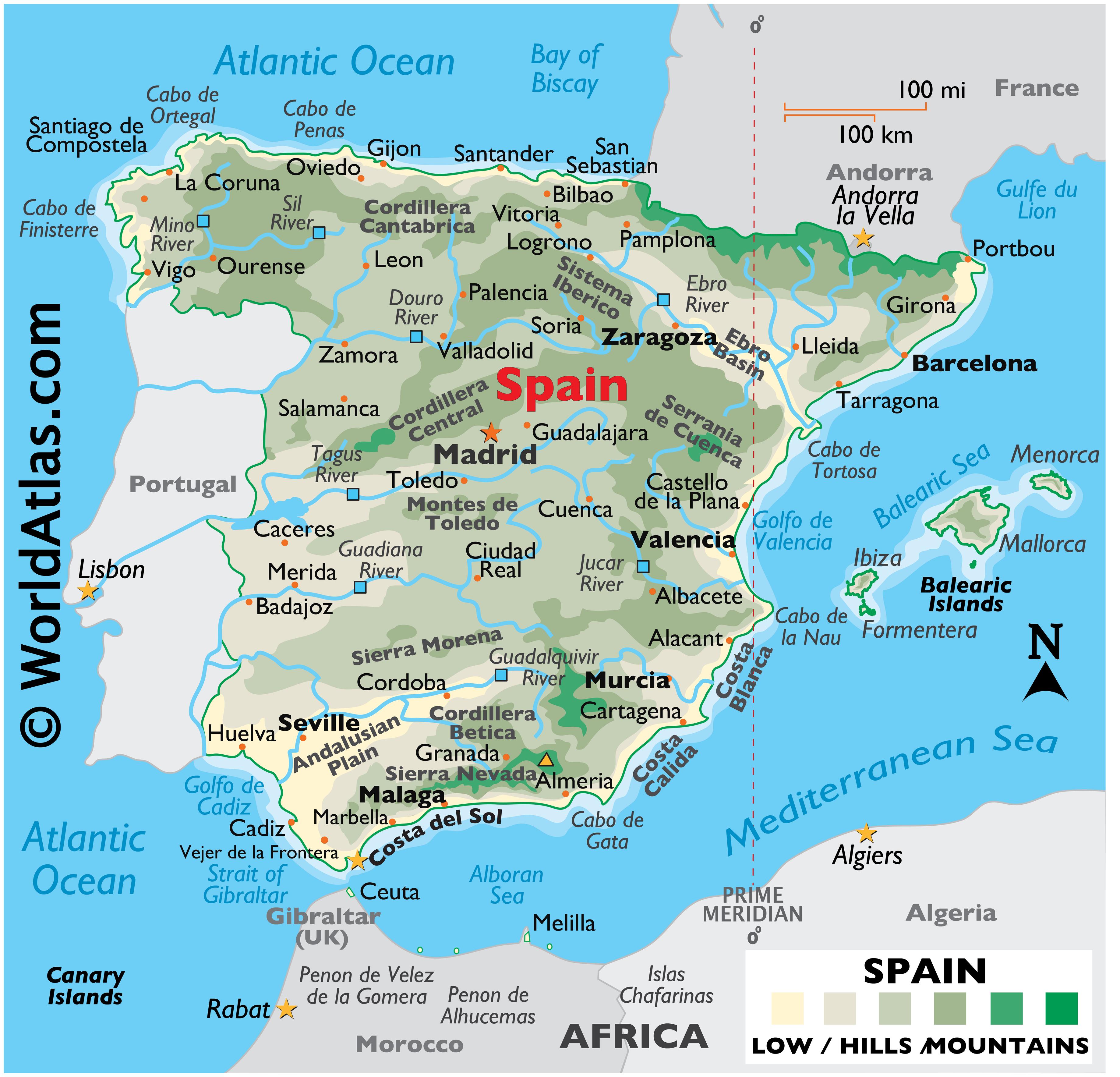
Spain's physical geography is among the most dramatic in all of Europe. A map of the clearly illustrates the Meseta Central, a vast elevated plateau that dominates the interior of the peninsula and sits at an average elevation of roughly 600 700 meters above sea level. Surrounding this plateau are several major mountain ranges, including the Cantabrian Mountains along the northern coast, the Iberian System the east, and the Sierra Nevada in the far south, which contains Mulhacén — the highest peak in mainland Spain at approximately 3,479 meters. The country's river systems are equally notable, with the Ebro, Tagus, Duero, Guadalquivir, and Guadiana rivers carving their way across the landscape and historically shaping settlement patterns and agricultural development. Coastal geography also plays a significant role, with Spain bordered by the Bay of Biscay to the north, the Atlantic Ocean to the west and southwest, and the Mediterranean Sea to the east southeast. This diverse contributes directly to Spain's wide range of climates, ecosystems, and agricultural zones, making a map an essential reference for understanding the country's natural heritage and environmental characteristics.
Large Scale Road Map Of Spain At James Loman Blog
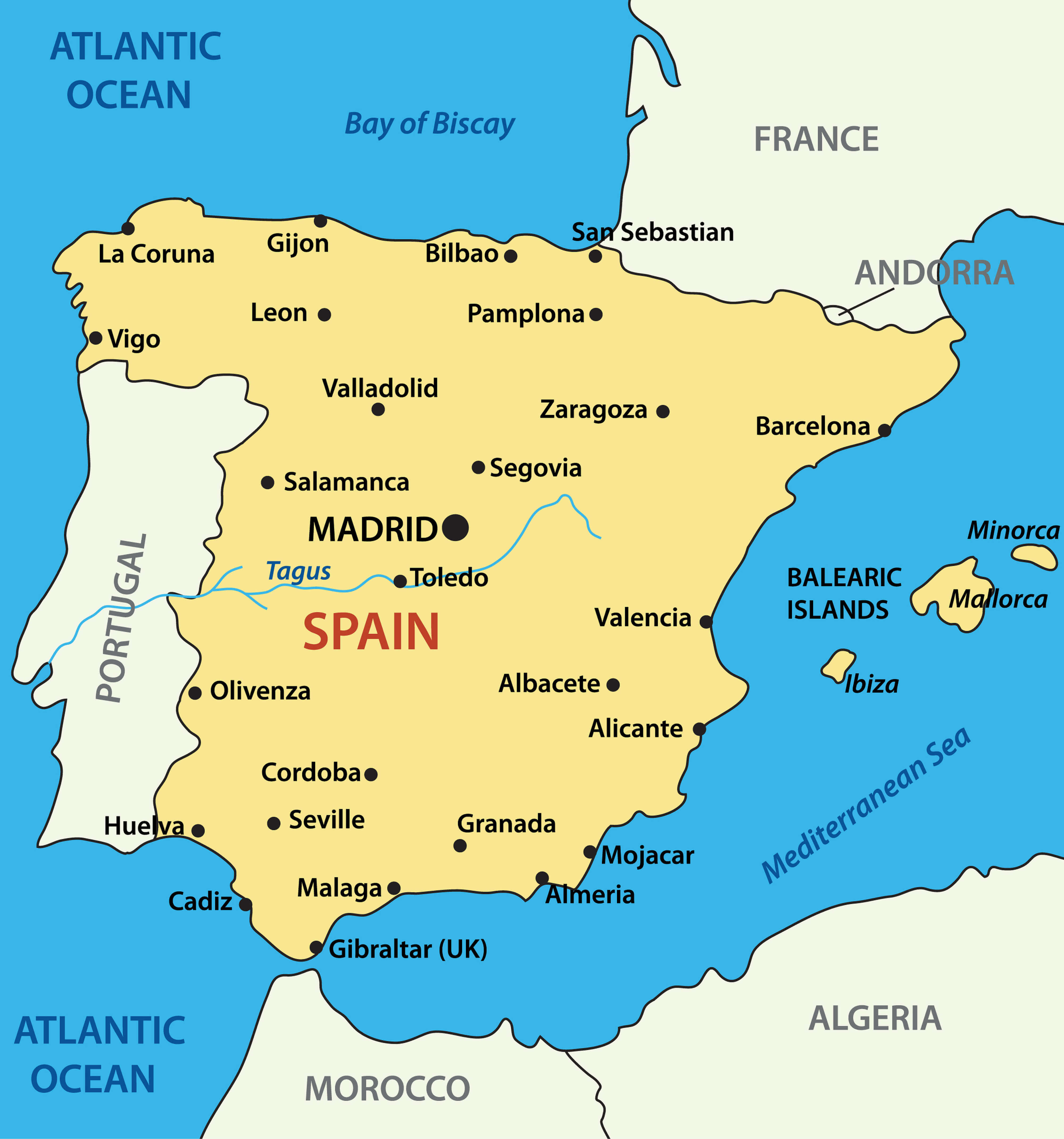
Large Scale Road Map Of Spain at James Loman blog
Spain Map Of Regions And Provinces - OrangeSmile.com
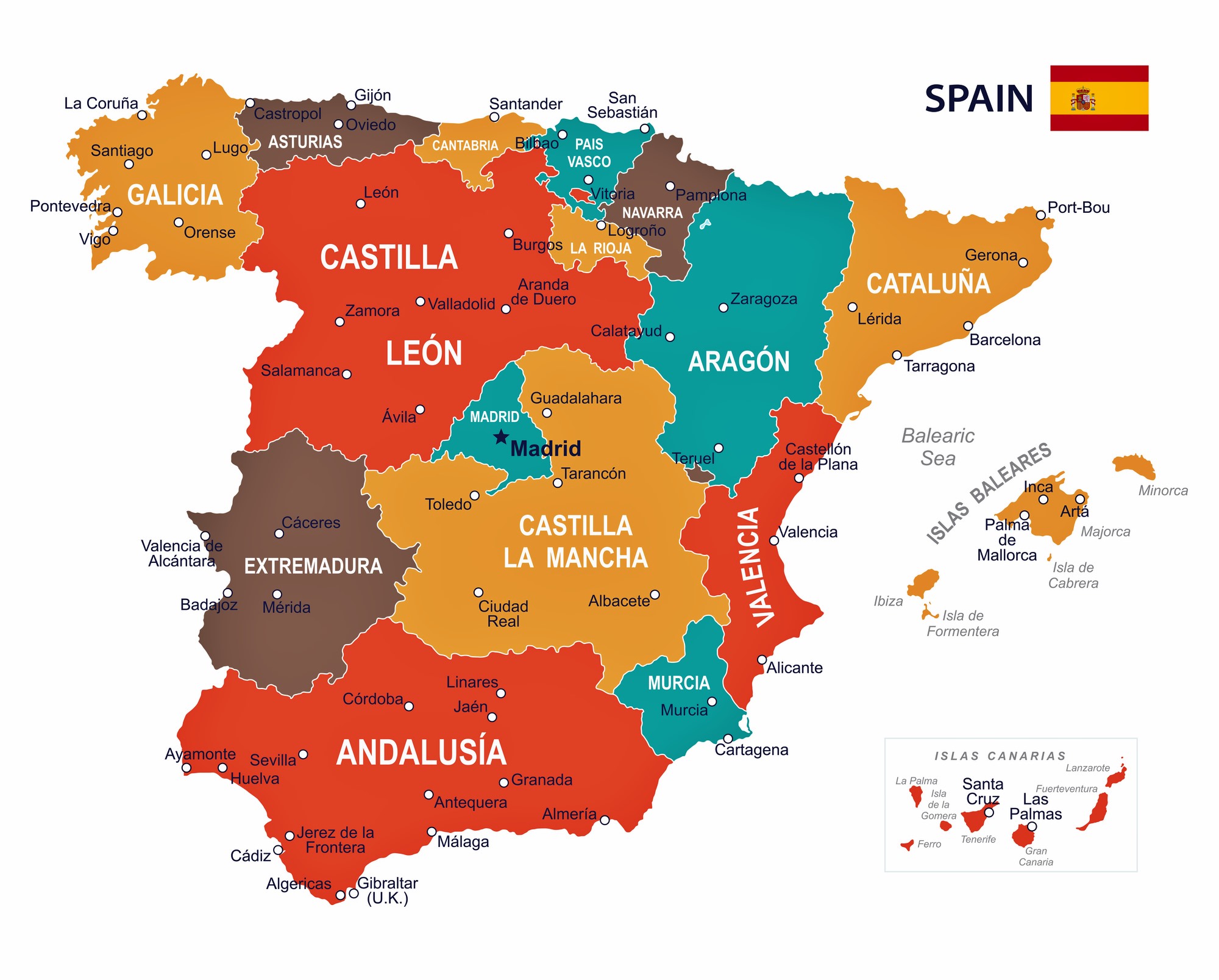
Spain Map of Regions and Provinces - OrangeSmile.com
Map Of Spain - Gifs
Map Of Spain - gifs