← Exploring Chicago Through Its Maps: A Street-Level Love Letter to the City Exploring Seattle's Neighborhoods: A Complete Guide to Seattle Maps →
Washington D.C. is one of the most visited cities in the United States, drawing millions of travelers each year who come to experience its iconic landmarks, world-class museums, and rich political history. Whether you're planning your first trip or returning to explore corners of the city you haven't yet discovered, having a reliable map of Washington D.C. is an essential part of making the most of your visit. Understanding the city's layout — from its grid-based street system to the distinct neighborhoods and corridors of power — can transform a overwhelming experience into a smooth, rewarding journey through the heart of American democracy.
Navigating Washington D.C. by Road: the City's Street Grid
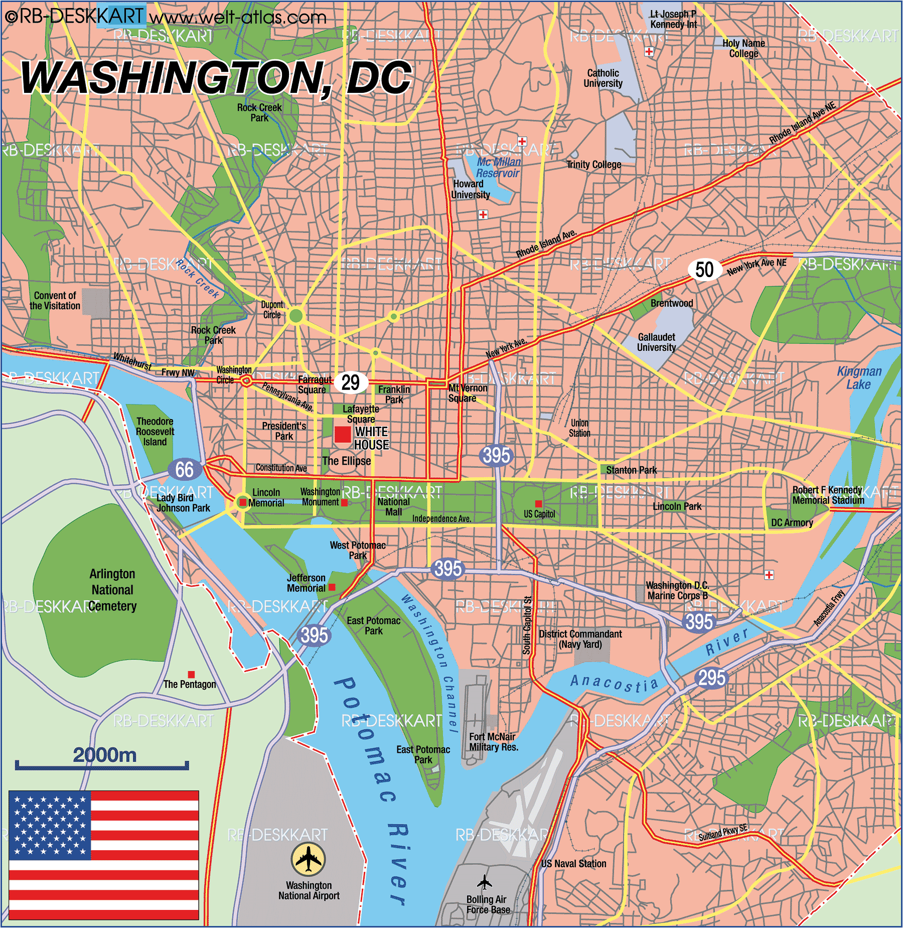
Washington D.C. was meticulously planned by Pierre Charles L'Enfant in the late 18th century, and that intentional design is immediately visible on any road the city. The street follows a grid pattern overlaid with diagonal avenues — most named after U.S. states — radiate outward from key focal points like the Capitol and the White House. This creates a series of traffic circles and squares such as Dupont Circle and Logan Circle, that serve as both navigational landmarks and vibrant community hubs. how the quadrant system works — with the city divided into Northwest, Northeast, Southwest, and Southeast — is critical for anyone driving through D.C. A map makes it clear why the Northwest quadrant is the largest and most densely packed with attractions, government buildings, and commercialors. For visitors renting cars or relying on rideshare services, familiarizing yourself with major arteries like Constitution Avenue, Pennsylvania Avenue, and Massachusetts Avenue will help you move between neighborhoods with far greater confidence.
Biking the National Mall: A Cyclist's Map to.C.'s Most Iconic Corridor
/national-mall-bike-map-02fed56c87d9410ab9d1ce1768cf62e7.jpg)
For many visitors, the National Mall represents the very soul of Washington D.C. Stretching approximately two miles from the Lincoln Memorial on the west to the U.S. Capitol on the east, the Mall is flanked by some of the most recognizable institutions in the world including the Smithsonian museums, the Washington Monument, and the Reflecting Pool. A dedicated bike map the National Mall reveals just how accessible this sprawling green space truly is. The Mall features clearly designated cycling paths that allow visitors to cover significant ground without fatigue of walking entire corridor foot. Bikesharing programs like Capital Bikeshare have made two-wheeled exploration more accessible than ever, with multiple docking stations positioned conveniently near major entry points. A good cycling will also highlight connections surrounding neighborhoods, including Georgetown the northwest and Capitol Hill to the east, allowing adventurous cyclists to extend their journeys well beyond the Mall itself. Whether you're a seasoned urban cyclist or a casual rider looking to see the monuments at a relaxed pace, a bike map is an indispensable tool for planning your route through this historic landscape.
No matter you choose to explore Washington D.C. by car, bike, foot, or the's efficient Metro system — having right map in hand makes all the difference. The city rewards those who take the time to understand its layout, because so much of what makes D.C. extraordinary lies not just at the famous landmarks themselves, but in the connections between them. From the planned grandeur of the National Mall to the intricate web of roads linking.C.'s diverse neighborhoods, a well-studied map is your most reliable companion for uncovering everything this remarkable capital has to offer.
Street Map Of Washington Dc
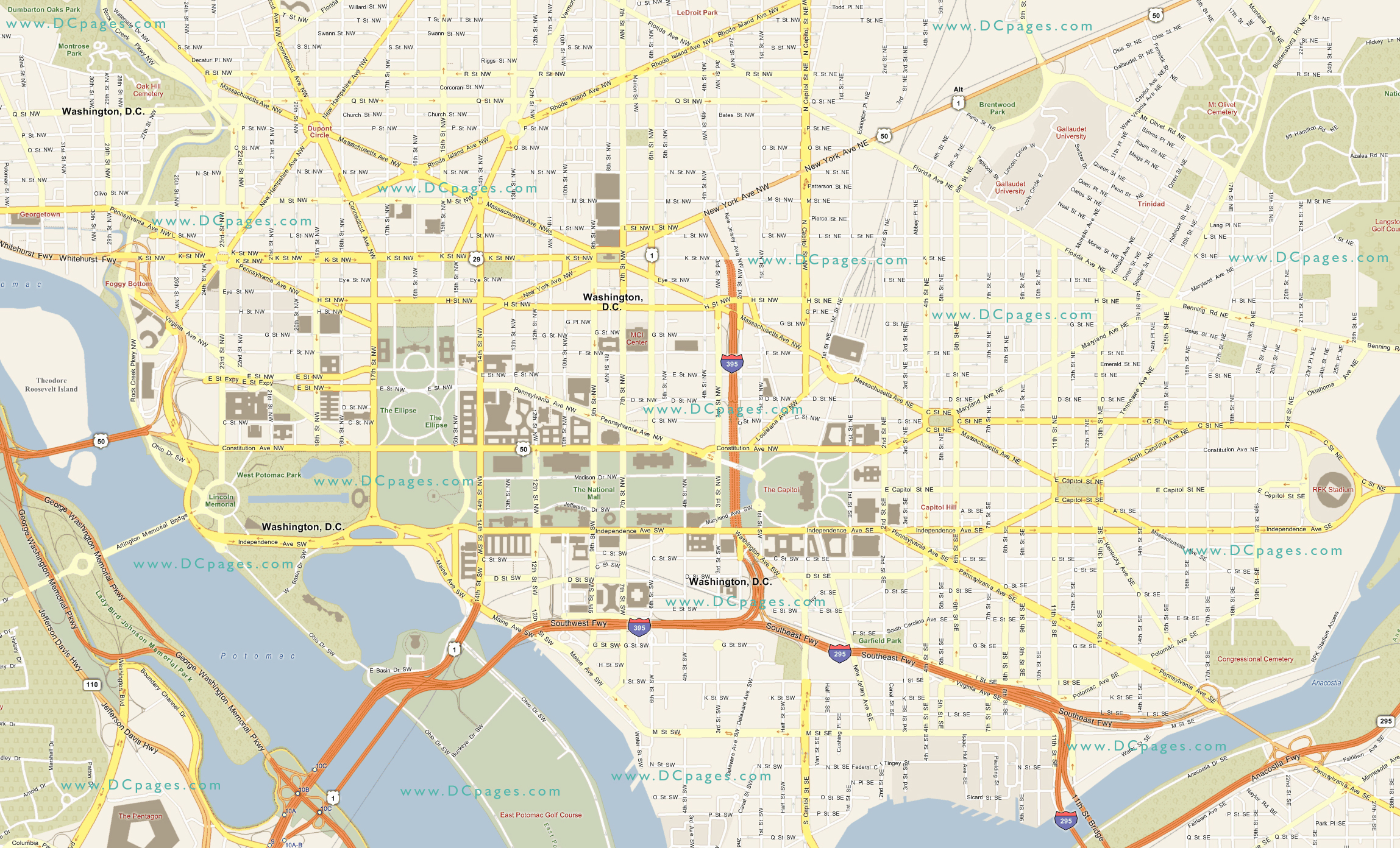
Street Map Of Washington Dc
Washington Dc Map Washington D.C. Map Card — Little Desk Drawer

Washington Dc Map Washington D.C. Map Card — Little Desk Drawer
Washington Dc Map At Amber Warren Blog

Washington Dc Map at Amber Warren blog