← Exploring India Through Maps: A Visual Journey Across the Subcontinent Exploring the Middle East Map: Countries, Regions, and Geographic Insights →
China is one of the largest and most geographically diverse countries in the world, spanning approximately 9.6 million square kilometers across East Asia. Understanding its geography through maps is essential for travelers, students, researchers, and anyone with a curiosity about this vast nation. From the sweeping plains of the north to the rugged terrain of the west the bustling coastal cities of the east, a map of China tells a story of immense scale, cultural depth, and administrative complexity. Whether you are studying political boundaries, planning trip, or simply exploring the world from your screen detailed map of China is an invaluable tool that brings clarity to an otherwise overwhelming landscape.
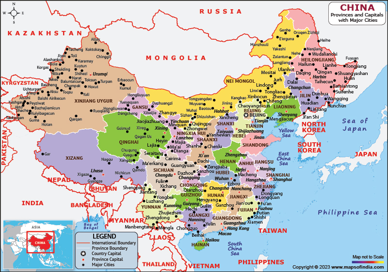
China is divided into 23 provinces, 5 autonomous regions, 4 direct-controlled municipalities, and 2 special administrative regions. Each of these administrative divisions has its own capital city, local governance structure, and distinct cultural identity. A map of China highlights these clearly, allowing viewers to understand how the country is organized at a regional level. Major provincial capitals such as Beijing, Shanghai, Guangzhou, Chengdu, and Wuhan serve as economic and cultural hubs within their respective regions. Understanding the political layout of China is particularly important for those engaged in business, academic research, or international relations, as policies and regulations can vary significantly from one province to another. The sheer number of provinces and the diversity among them reflect the richness of Chinese civilization, which has developed over thousands of years across distinctly different geographic and climatic zones.
Major Cities Across China: Urban Centers on
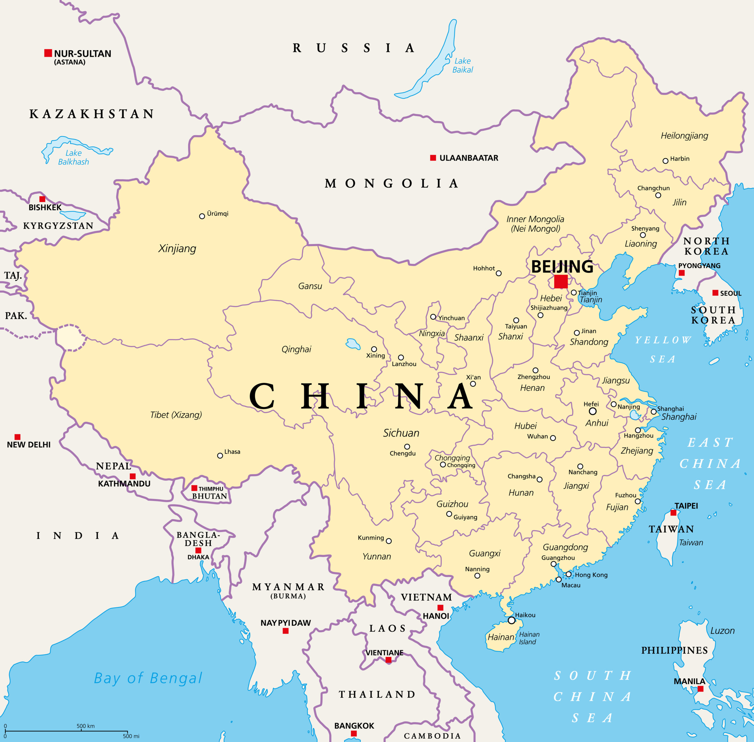
A printable map of China with cities offers a detailed look at the country's urban landscape, revealing just how densely populated and widely distributed its metropolitan areas are. China is home to some of the world's largest cities by population, including Shanghai, Beijing, Shenzhen, Chongqing, and Tianjin. These cities are not only population centers but also engines of economic growth, innovation, and cultural exchange Coastal cities tend to be among the most developed benefiting from centuries of trade and modern industrial expansion Inland cities, particularly those along the Yangtze River corridor, have also grown rapidly in recent decades thanks to government investment and migration from rural areas. A city map of China also helps illustrate the country's extensive transportation network, including high-speed rail lines major highways that connect its far-flung regions you are planning a visit to the ancient walls of Xi'an, the modern skyline of Shenzhen, or the natural beauty surrounding Guilin, having a reliable map ensures you can navigate China's remarkable with confidence and ease.
China Map - Guide Of The World - All For One
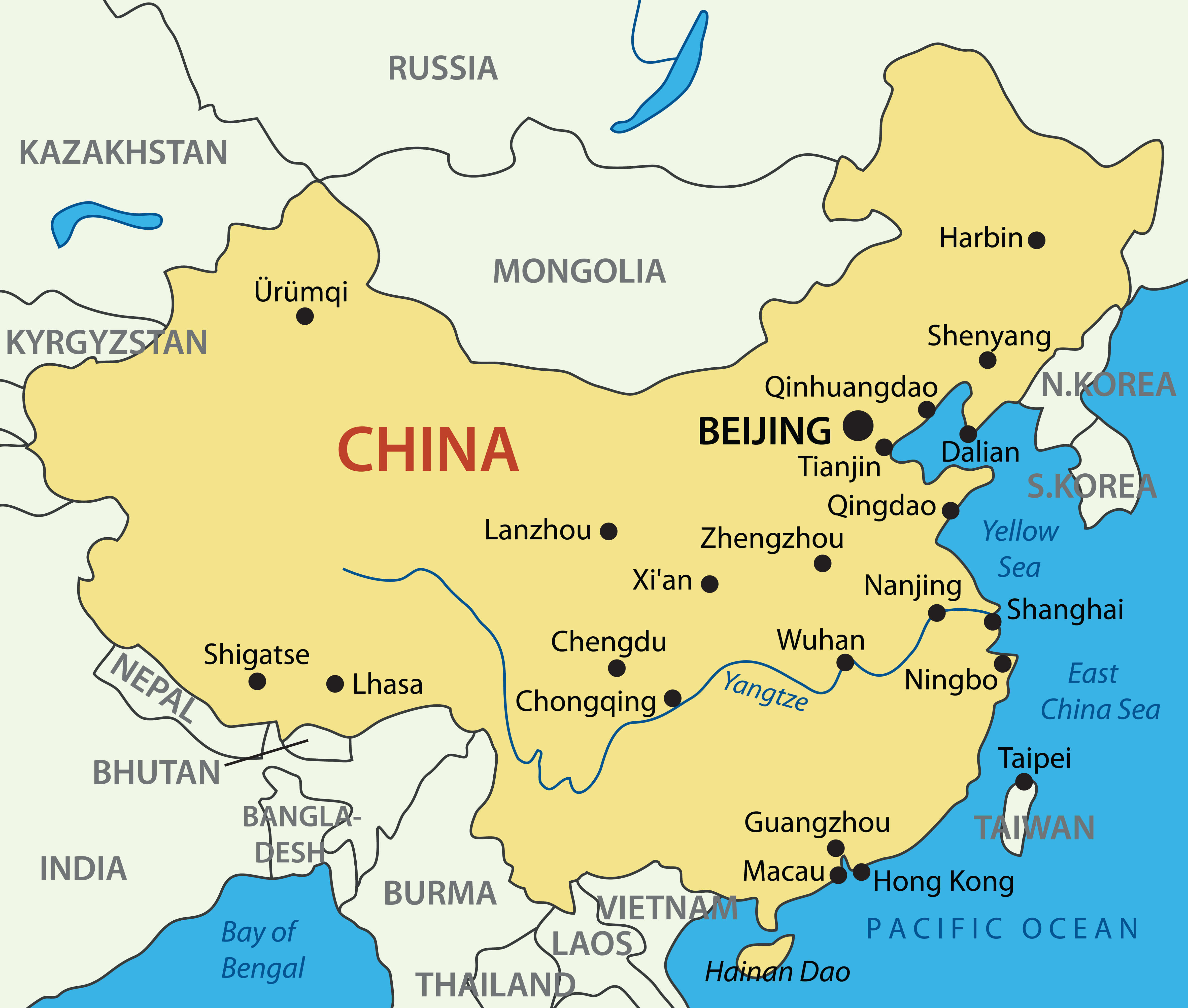
China Map - Guide of the World - All For One
Map Of China With Provinces
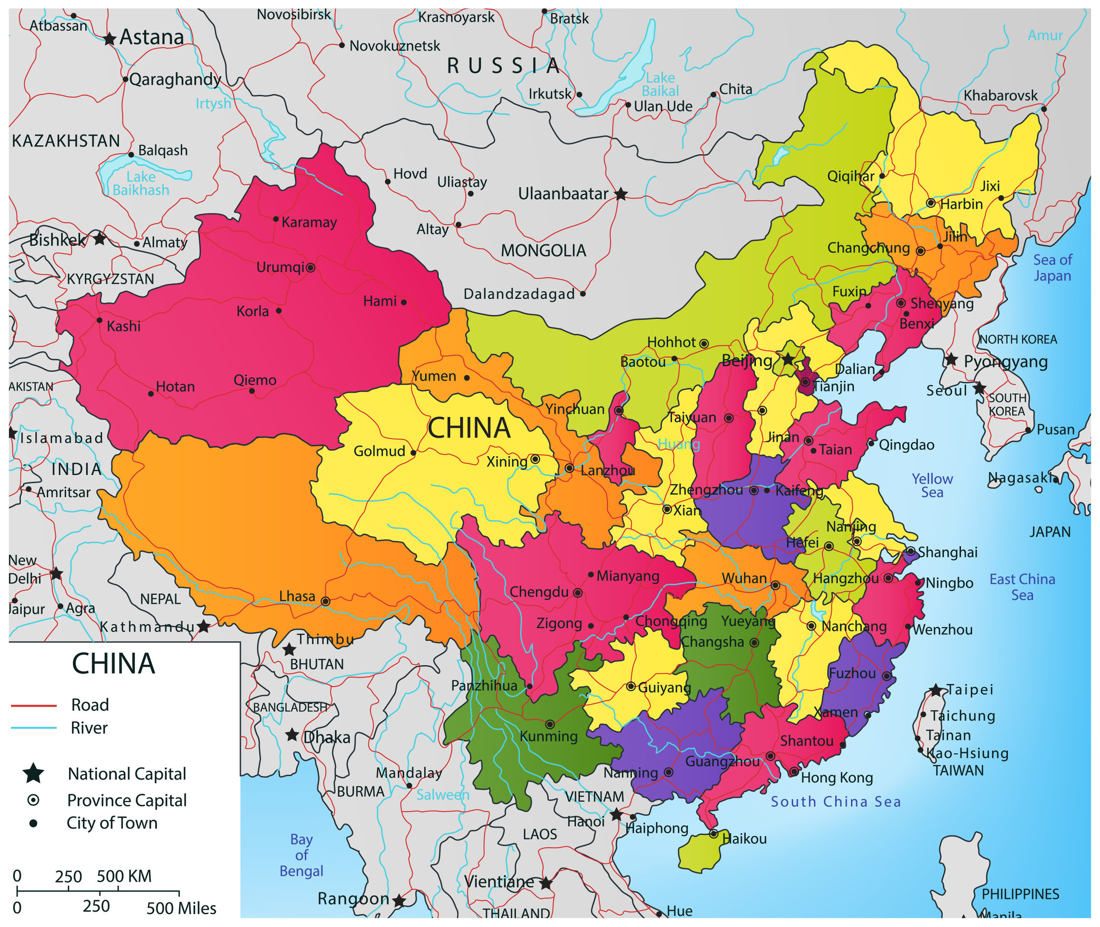
Map Of China With Provinces
Political Map Of China
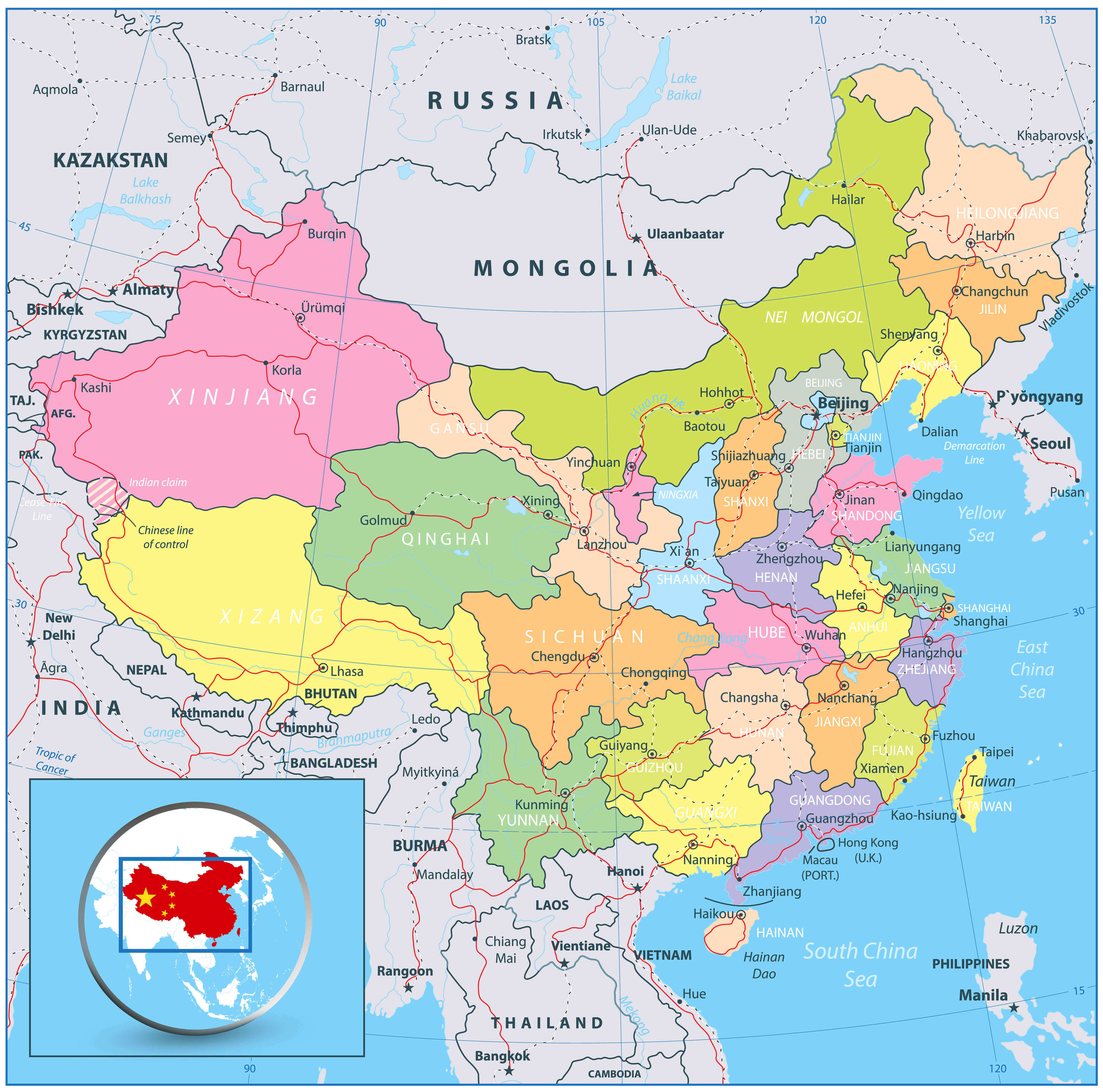
Political Map Of China