← Exploring the Map of Africa: Geography, Politics, and Regional Diversity Exploring the Map of China: Provinces, Capitals, and Major Cities →
India is one of the most geographically diverse and culturally rich countries on Earth. Spanning over 3.2 million square kilometers, it stretches from the snow-capped peaks of the Himalayas in the north to the sun-soaked beaches of Kerala in the south, and from the vast Thar Desert in the west to the lush green hills of the northeast. Understanding this incredible land becomes so much easier — and more fascinating — when you have a detailed map in hand. Whether you're planning trip, studying geography, or simply curious about the lay of the land, maps of India open up a world of discovery.
A Detailed Tourist Map of India: Navigate the Land of Wonders
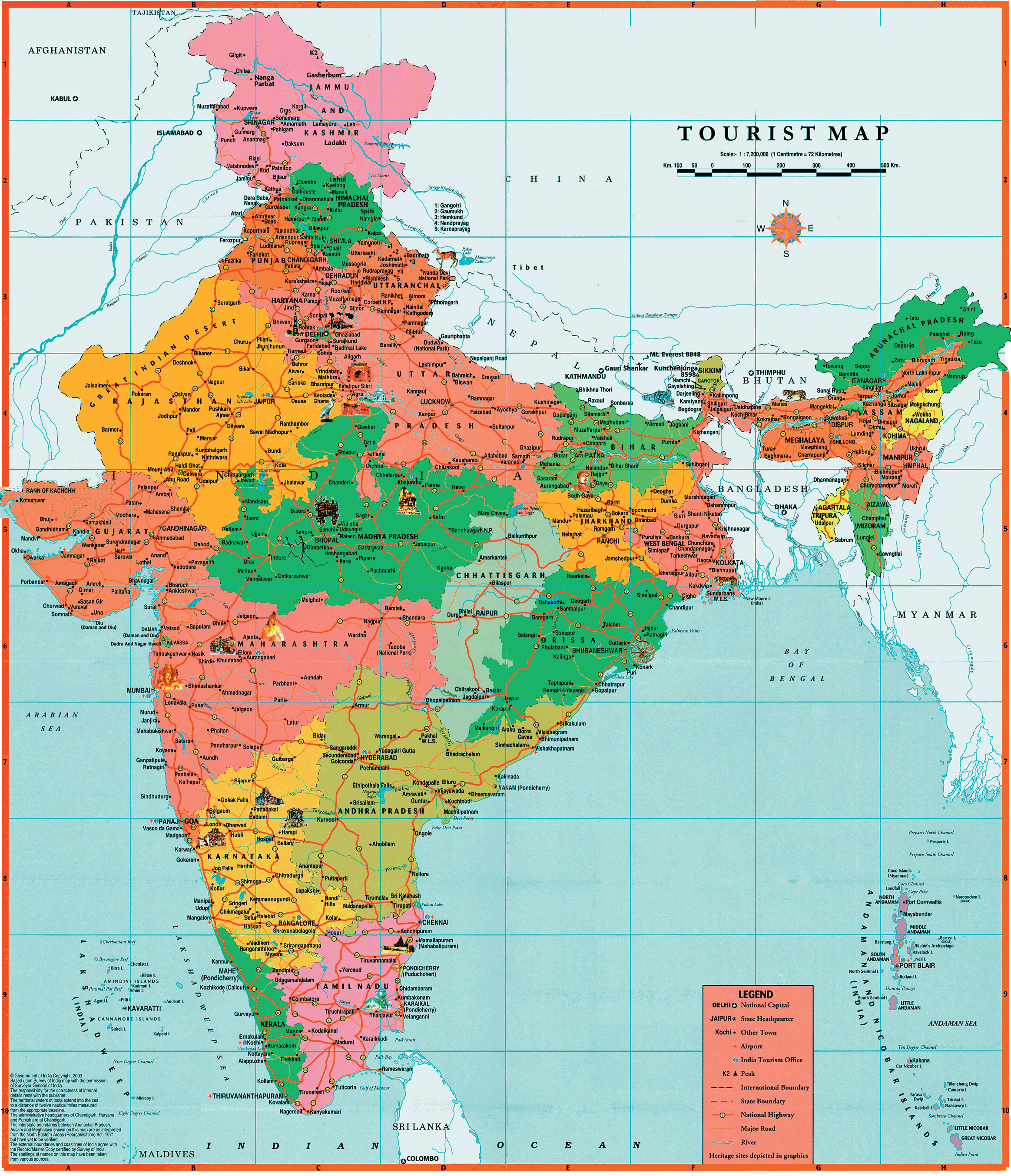
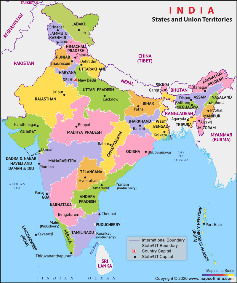
A large, detailed tourist map of India is an essential companion for anyone looking to explore this magnificent country. Such maps highlight the country's 28 states and 8 union territories, pinpointing major cities like Delhi, Mumbai, Kolkata, Chennai, and Bengaluru. Beyond the urban hubs, tourist maps also chart the routes to iconic landmarks from the Taj Mahal in Agra and forts of Rajasthan to the backwaters of Kerala and the ancient temples of Tamil Nadu. The road networks national highways, and rail corridors visible on a map give travelers a true sense of the scale and connectivity of the Indian subcontinent. Trekkers heading Ladakh, pilgrims bound for Varanasi, or beach lovers making their way to Goa all benefit from understanding the geography that ties these diverse destinations together. A well-crafted tourist map doesn't just show where places are — it tells the story of how they connect.
India Map: Discovering the Full Scope of the Subcontinent
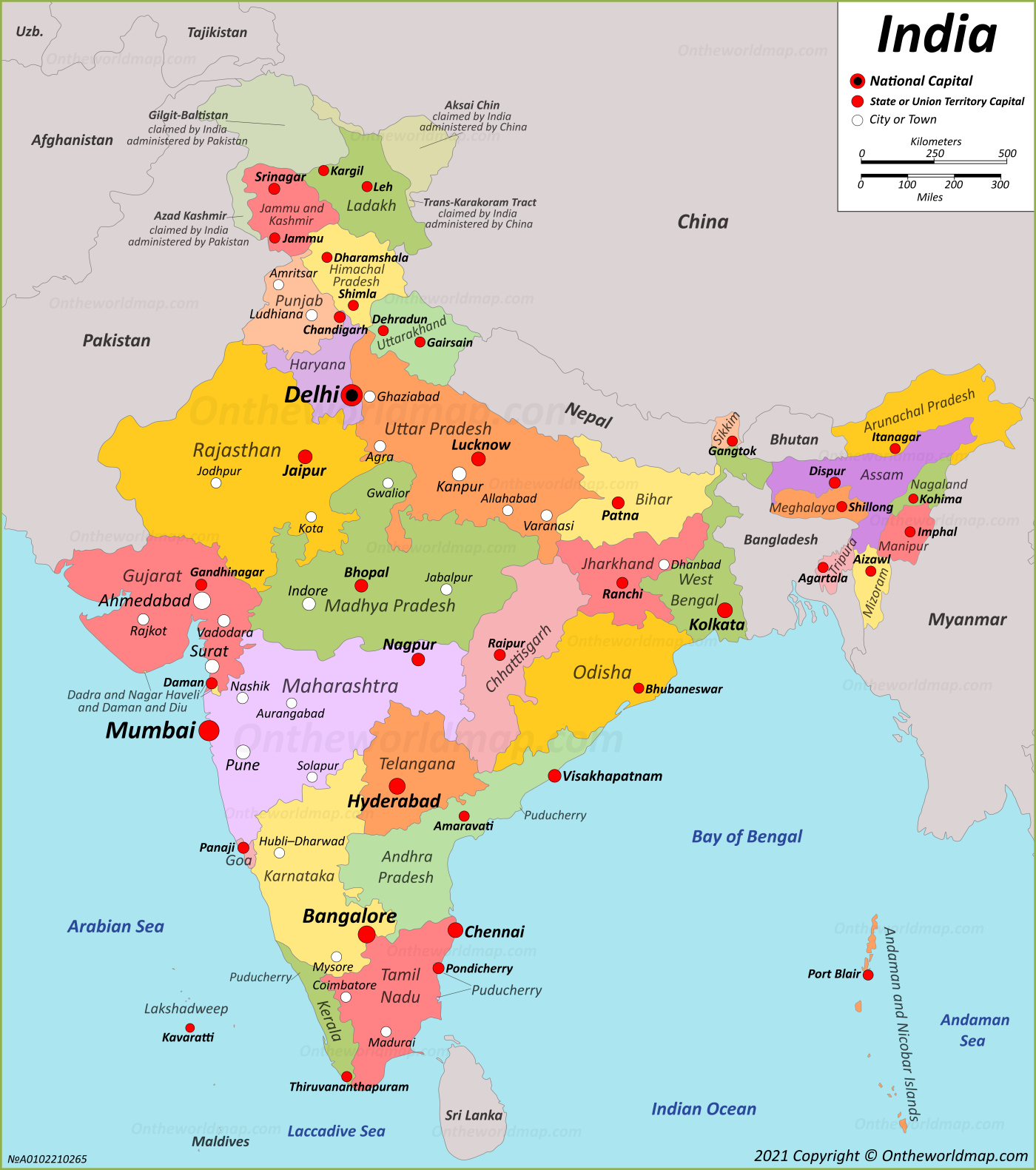
A comprehensive map of India reveals just how vast and varied the country truly is. The northern region is dominated by the great Indo-Gangetic Plain, one fertile and densely populated areas in the world, flanked by the towering Himalayan range Moving south, the Deccan Plateau rises between the Eastern and Western Ghats, shaping the climate and culture of peninsular India. The coastline stretches for nearly 7,500 kilometers, bordering the Arabian Sea to the west the Bay of Bengal to the east, and the Indian Ocean to the south. River systems like the Ganges, Brahmaputra, Godavari, and Krishna carve through the landscape, sustaining agriculture and civilization for thousands of years. A good map also illustrates India's neighboring countries — Pakistan, China, Nepal, Bhutan, Bangladesh, and Myanmar — helping to place the nation within its broader regional context. For students, researchers, and curious minds alike, a detailed map of India is not just a navigation tool but a gateway to understanding one of humanity's oldest and most enduring civilizations. Every contour line, city marker, and regional boundary carries with it centuries of history, making the map itself a fascinating document of human geography.
Maps Of India | Detailed Map Of India In English | Tourist Map Of India
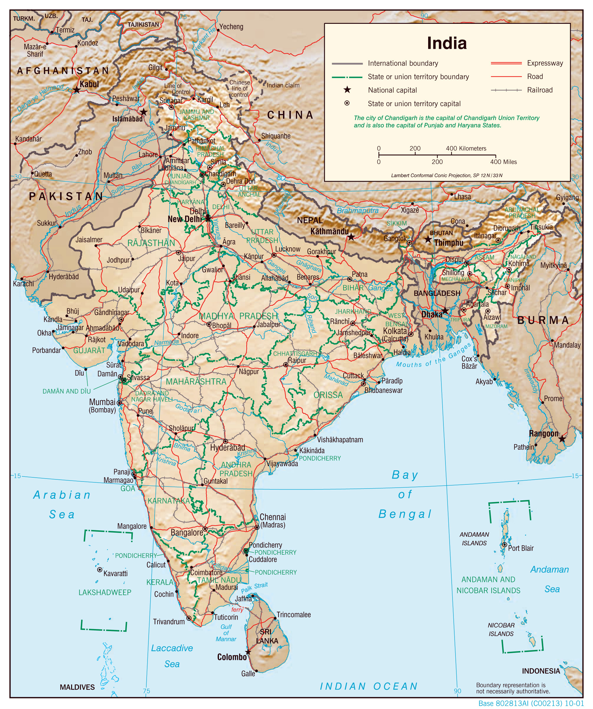
india map detailed political large administrative maps relief physical road world 2001 asia
Political Map Of India With States - Nations Online Project
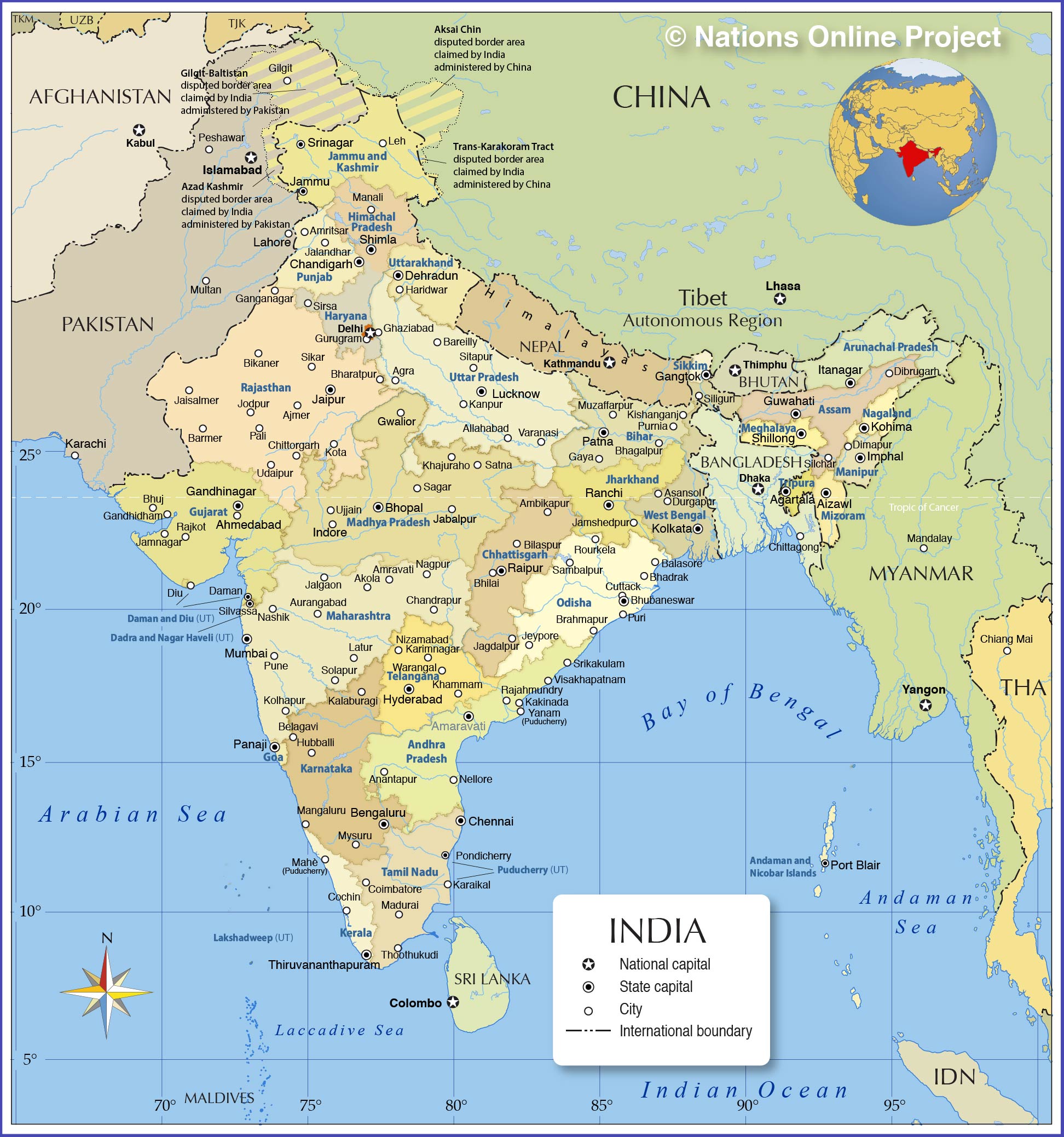
india map states cities major administrative state union territories political countries borders capitals maps online showing capital international boundaries new
List Of Indian States, Union Territories And Capitals In India Map
states map indian union territories india maps list capitals political larger view