← Exploring the Map of Sweden: A Journey Through Scandinavia's Crown Jewel Exploring Finland Through Maps: A Complete Geographic Overview →
Denmark might be one of Europe's smaller countries, but don't let its size fool you. Packed into a compact peninsula an archipelago of over 400 islands, this Scandinavian gem offers a fascinating geography that rewards anyone who takes the time to study it on a map. From the rolling heathlands of Jutland to the charming cobblestone streets of Copenhagen, understanding Denmark's layout is the first step to truly appreciating everything this country has to offer. Whether you're a traveler plotting your next adventure, a geography enthusiast, or simply someone curious about this Nordic nation, a good map of Denmark is your best companion.
Navigating Denmark: A Detailed Road Map of Cities and Airports
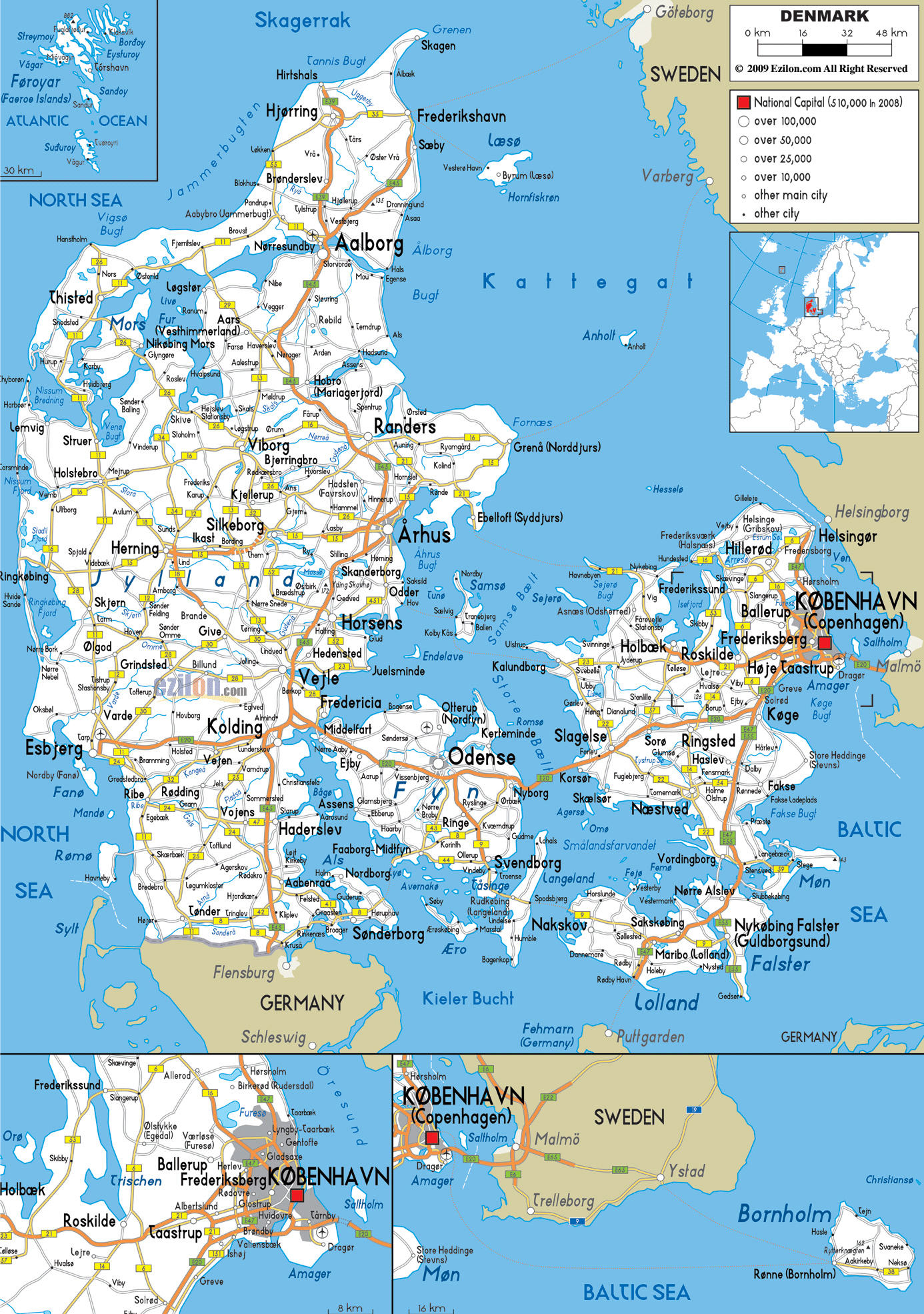
A detailed road map of Denmark reveals just how well-connected this country truly is. The road network stretches across the Jutland Peninsula and bridges the gaps between major islands, with iconic crossings like the Øresund Bridge linking Denmark to Sweden and the Great Belt Bridge connecting Funen to Zealand. Major cities like Copenhagen, Aarhus, Odense, and Aalborg anchor the map, each serving as a regional hub of culture commerce. For travelers, the map also highlights's impressive network of airports Copenhagen Airport (Kastrup) standing as the busiest in Scandinavia. Regional airports in Billund, Aarhus, and Aalborg make the entire country accessible with ease. What stands out most when studying Danish road map is the sheer efficiency of the infrastructure — distances are short, roads are well-maintained, and no corner of the country feels out of reach.
Denmark at a Glance: Facts Borders, and Geographic Highlights
src="https://www.worldatlas.com/upload/4c/60/dd/dk-01.jpg" alt="World Atlas map of Denmark showing geographic regions, borders, and major cities" />Zoom little and the broader map of Denmark tells equally compelling story. Bordered by Germany to the south its only land neighbor — and surrounded by the North Sea to the west Baltic Sea to the east, Denmark occupies a strategically important position in northern Europe. The country's geography is predominantly flat and low-lying, with its highest natural point, Møllehøj, reaching a modest 170 meters above sea level. The map also showcases the Faroe Islands and Greenland, both autonomous territories that fall under Danish realm adding a surprisingly global dimension to this small nation. Key waterways like the Kattegat and the Little Belt are clearly visible, underscoring Denmark's historic relationship with the sea. For centuries shaped Danish culture, trade, and even its Viking legacy a seafaring people who used these very waters as to explore settle distant lands.
Whether you're tracing road trips through the countryside, planning a city hop between Copenhagen and Odense, or simply satisfying a curiosity about Scandinavian geography, maps of Denmark offer a window into a country that is remarkably layered for its size. The blend of modern infrastructure natural beauty, and historical depth makes every inch of the worth exploring. So unfold the trace the coastlines, and let surprise you — because this is a destination that consistently delivers far more than its modest footprint might suggest.
Denmark Map
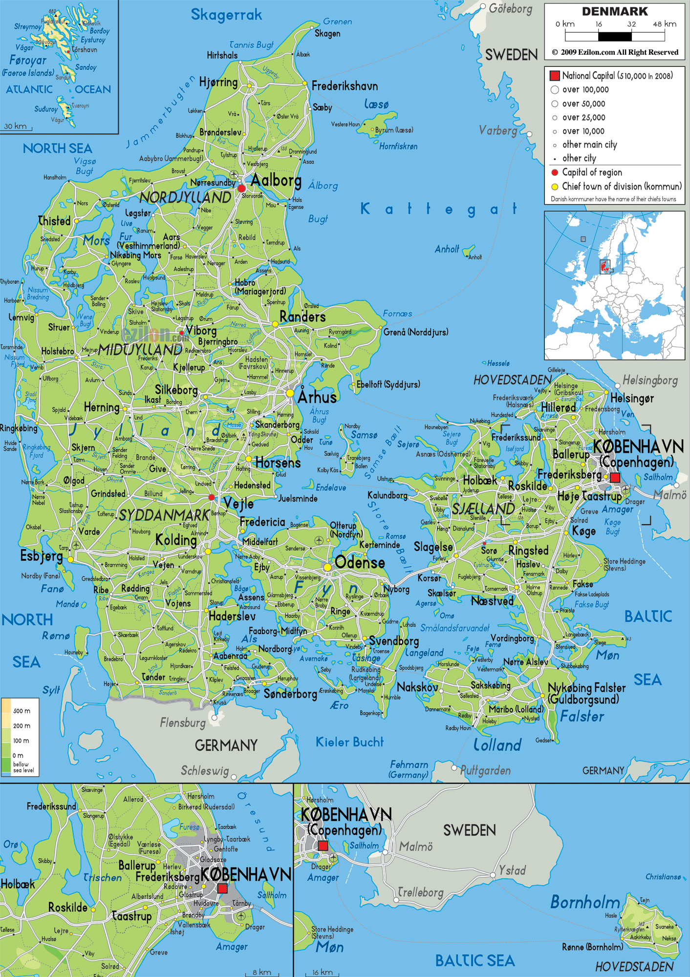
Denmark Map
Political Map Of Denmark - Nations Online Project
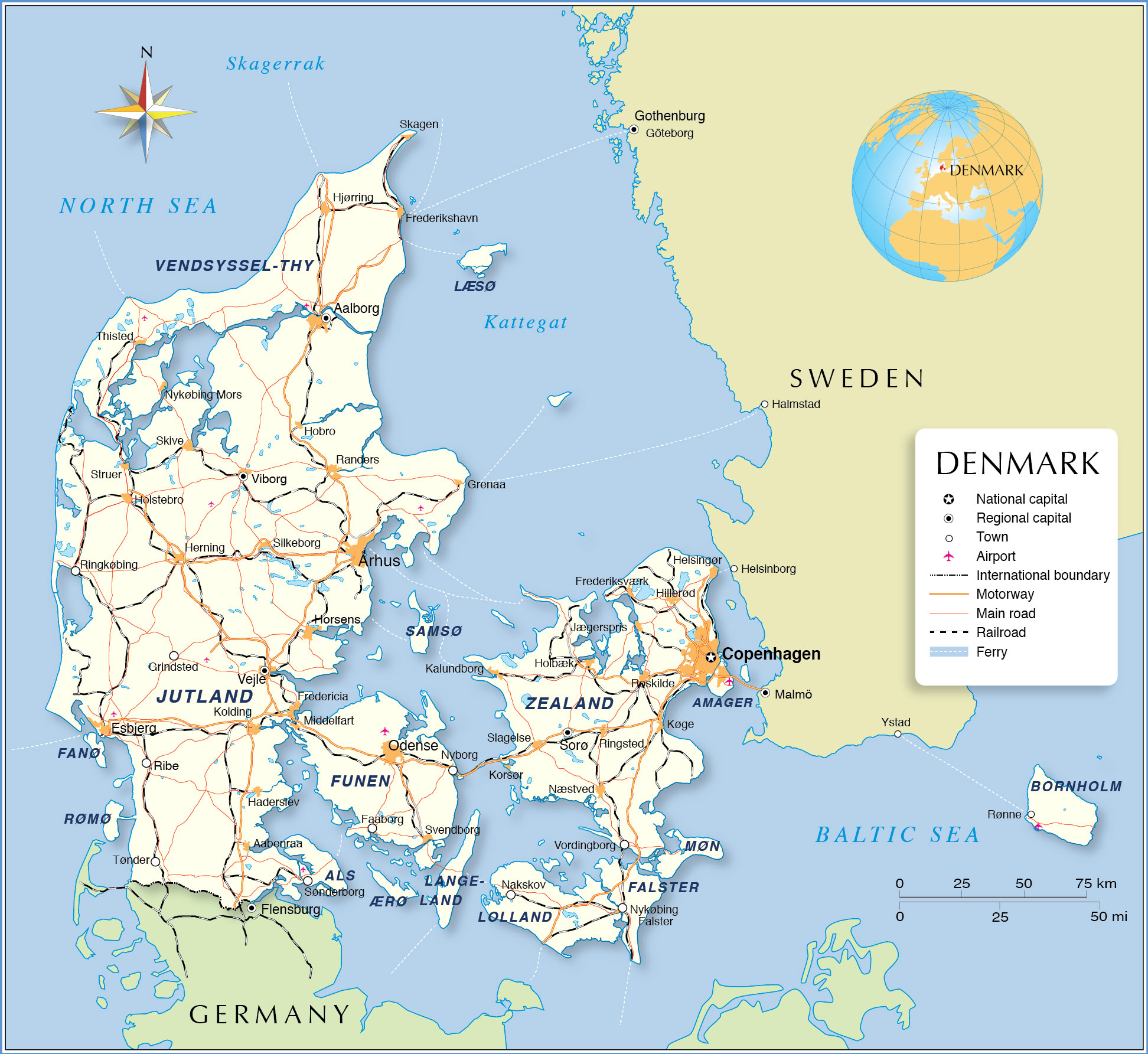
Political Map of Denmark - Nations Online Project
Denmark Area Map _ Political Map Of Denmark – FYCB
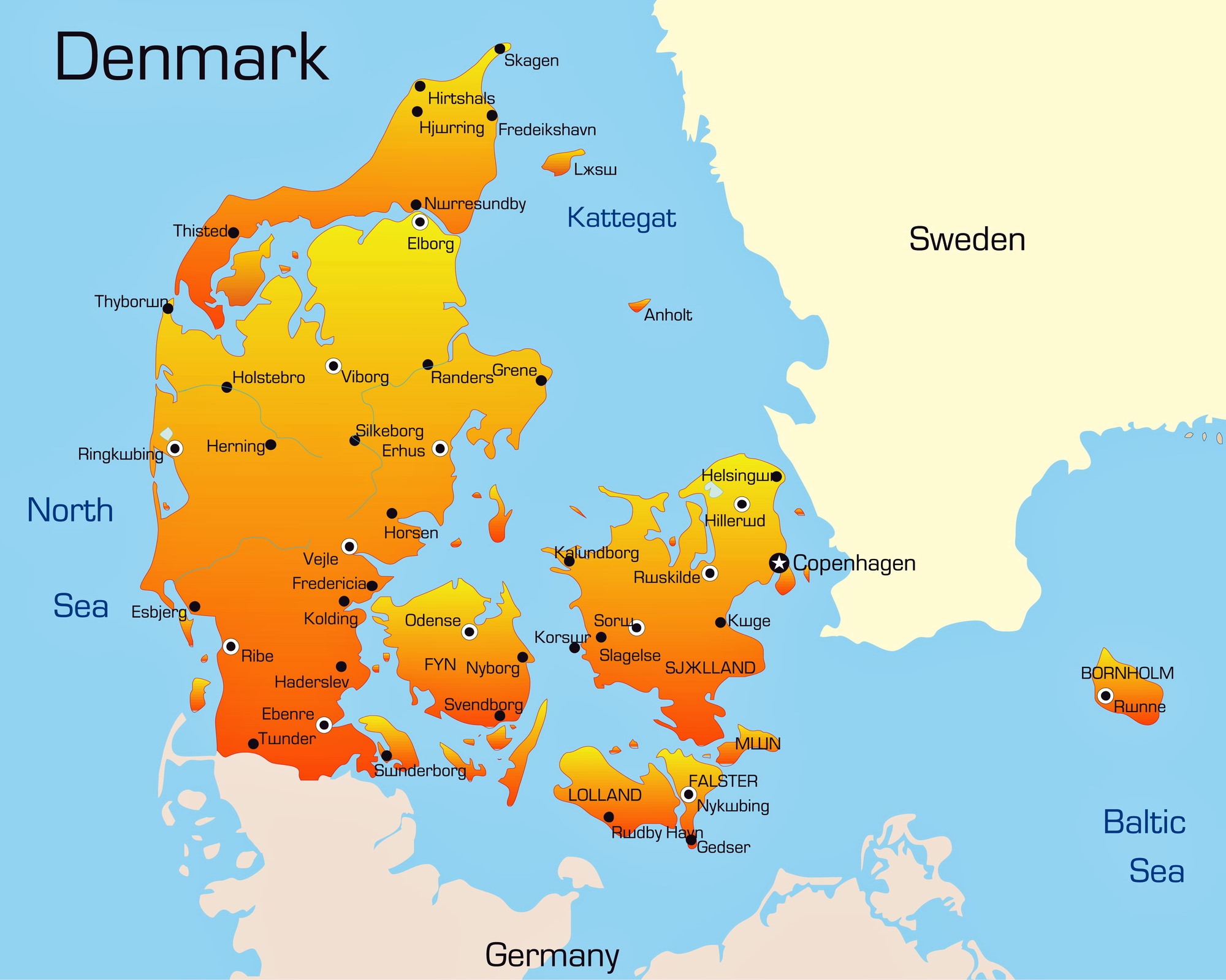
Denmark Area Map _ Political Map of Denmark – FYCB