← Exploring Denmark Through Maps: A Visual Guide to the Land of Vikings and Fairy Tales Exploring Poland Through Maps: A Personal Journey Across a Fascinating Country →
Finland, officially known as the Republic of Finland, is a Nordic country situated in Northern Europe, bordered by Sweden to the west, Norway to the north, and Russia to the east. With a total area of approximately 338,000 square kilometers, Finland is the eighth-largest country in Europe by land area. Understanding the geography of Finland through detailed maps reveals a fascinating landscape defined by thousands of lakes, vast boreal forests, and a lengthy coastline along the Baltic Sea. Whether you are planning a trip, conducting research, or simply exploring the world from your desk, a good map of Finland is an invaluable tool for comprehending the country's spatial layout, infrastructure, and regional diversity.
Road Network and Transportation Infrastructure of Finland
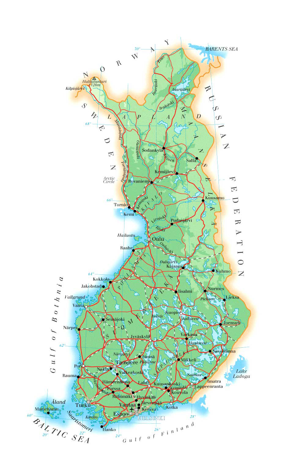
Finland's road network is one of the most extensive in the Nordic region, stretching across more than 450,000 kilometers of roads that connect remote northern territories to the densely populated southern cities. A road map of Finland highlights the well-maintained highway system linking key urban centers such as Helsinki, Tampere, Turku, and Oulu. The country's E-roads and national highways ensure efficient transit between regions, while secondary roads branch into rural areas and wilderness zones. The road also reflects Finland's commitment to connectivity despite its challenging geography, including frozen terrain in Lapland during winter months. For travelers and logistics professionals alike, studying Finland's road map offers critical insights into travel times, route planning, and the distribution of services across the countryCountry Overview and Major Cities on the Finland Map
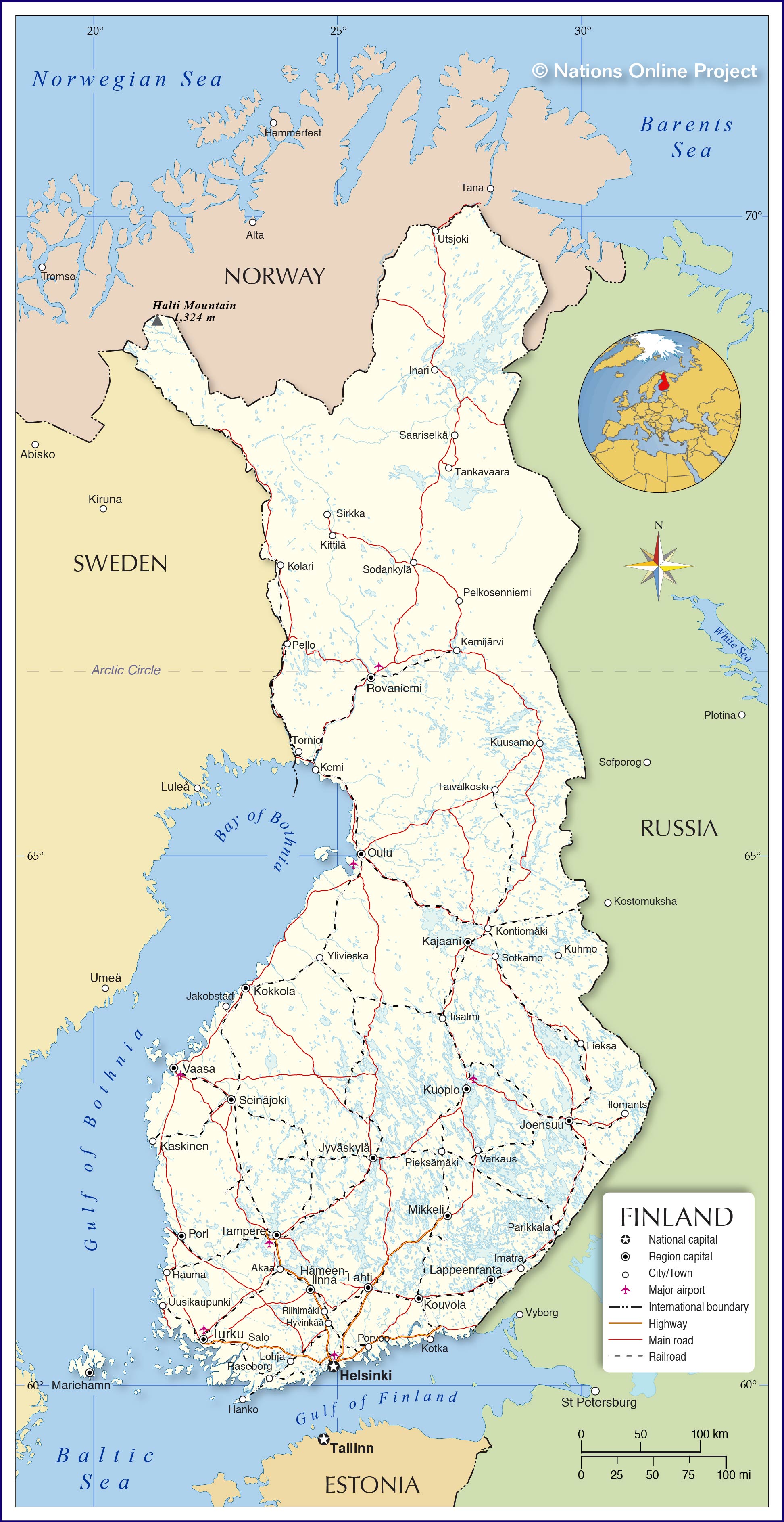
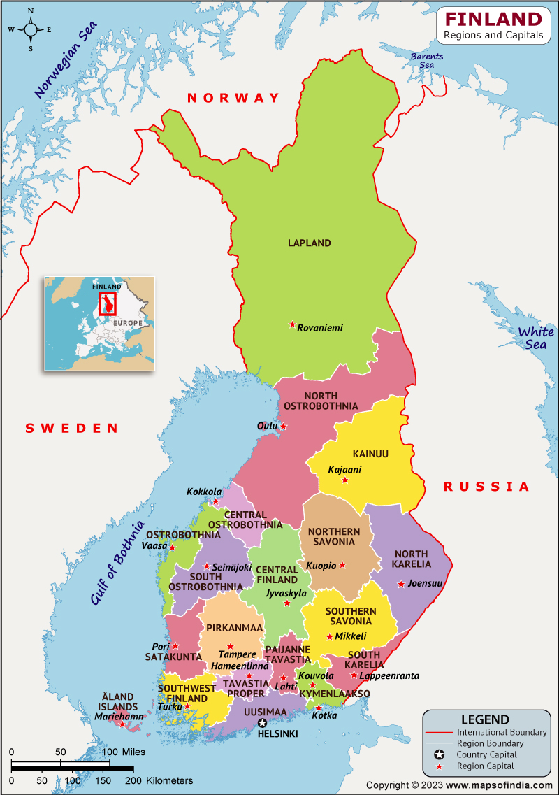
A comprehensive country map of Finland provides a broad view of the nation's administrative divisions cities, and physical geography. Helsinki, the capital city, is located in the far south on the coast of the Gulf of Finland and serves as the country's political, economic, and cultural hub. Other significant cities include Espoo, Vantaa, Tampere, and Oulu, each playing a vital role in Finland's regional development. The map also reveals the country's extraordinary lake district the central regions, an area known as the Finnish Lakeland, which contains tens of thousands of lakes formed by glacial activity. Finland's northern territory Lapland, covers roughly-third of the country's total area is sparsely populated, representing stark contrast to the urban. The Åland Islands, an autonomous region in the southwest, are also notable feature on any map of Finland. the country's geographic layout through well-annotated map enables travelers, students, and researchers to better appreciate the natural human-made features that define this remarkable Nordic nation.
Printable Map Of Finland
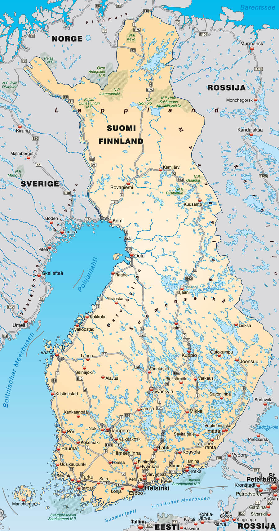
Printable Map Of Finland
Finland Maps & Facts - World Atlas
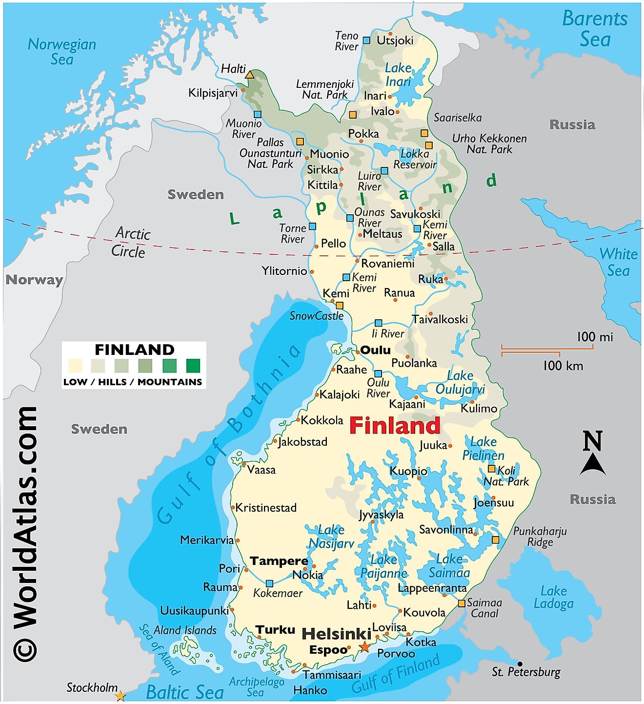
Finland Maps & Facts - World Atlas
Finland Map Finland Political Map, Red Country Shape, Borders Stock
Finland Map Finland Political Map, Red Country Shape, Borders Stock