← Exploring the Map of Las Vegas: Your Ultimate Guide to Navigating the Entertainment Capital Exploring the Map of Africa: Geography, Politics, and Regional Diversity →
Hawaii stands as one of the most geographically fascinating states in the United States. Situated in the central Pacific Ocean, this archipelago stretches across more than 1,500 miles and is composed of 137 islands, atolls, and seamounts. Understanding the map of Hawaii is essential for anyone planning to visit, study, or simply appreciate the unique layout of this island chain. Each island carries its own distinct character, terrain, and identity, yet together they form a unified state unlike any other in the nation From the volcanic peaks of the Big Island to the lush valleys of Kauai, the geography of Hawaii tells a story millions of years in the making. Studying a detailed map reveals not only the physical distances between islands but also the remarkable diversity packed into a relatively compact region of Pacific.
A Visual Overview of the Hawaiian Islands

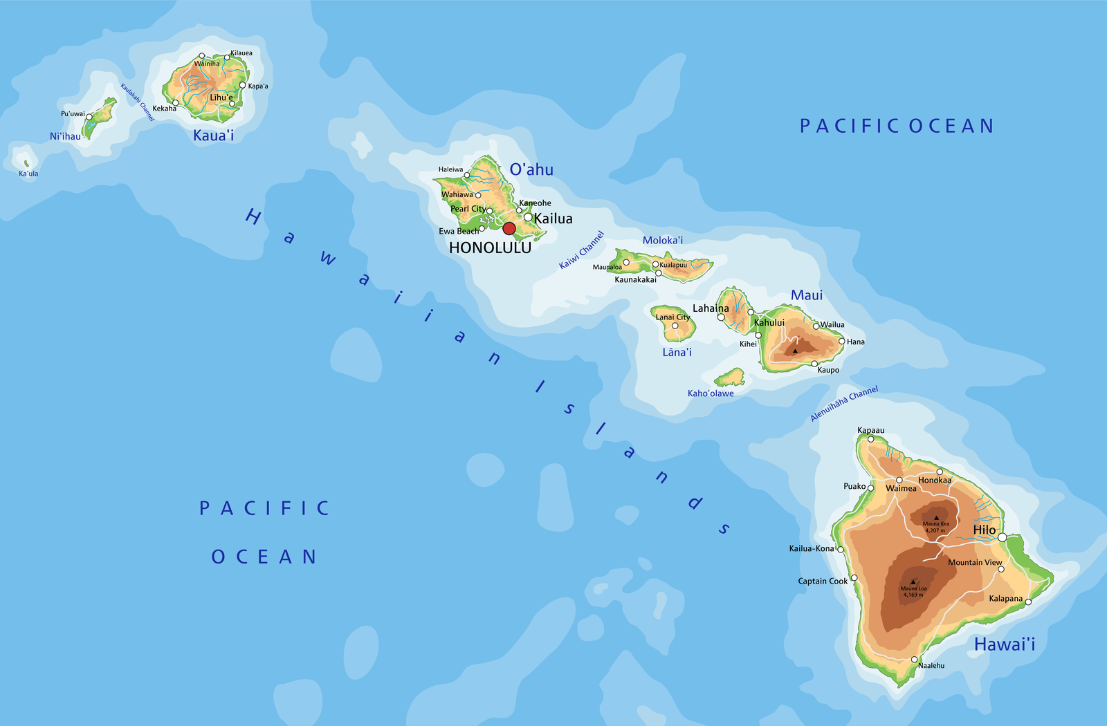
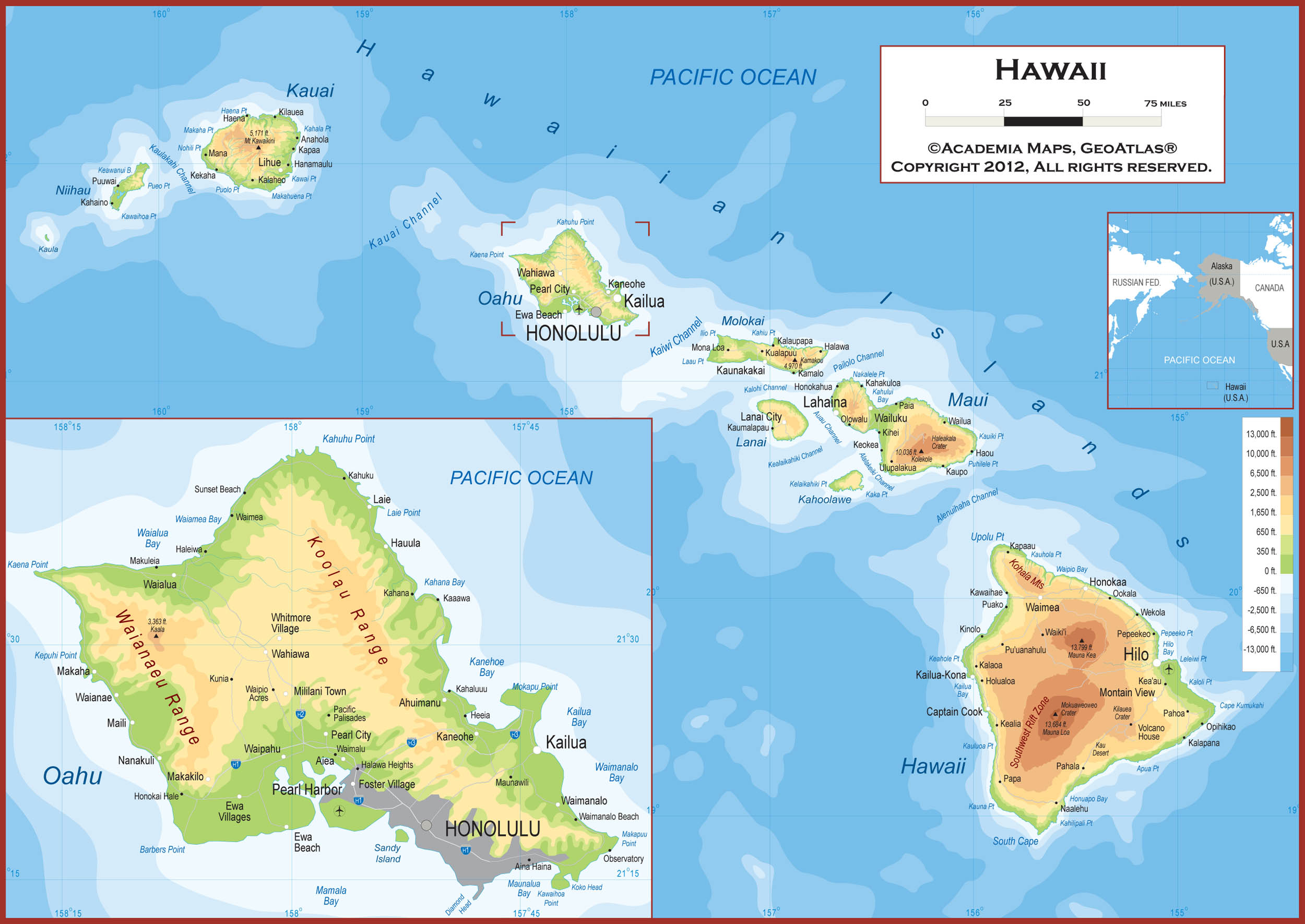
A color map of Hawaii provides an immediate sense of the state's sweeping geography. The main islands — Hawaii, Maui, Oahu, Kauai, Molokai, Lanai, Niihau, and Kahoolawe — are clearly visible, each separated by stretches of deep Pacific water Oahu, home to the state capital Honolulu and the historic Pearl Harbor, sits near the center of the main island group and remains the most densely populated. The Big Island, officially named, dominates the southeastern end of the chain and is the largest island by land area by significant margin. Maui draws attention for its dramatic geography, including the massive Haleakala crater A-coded map helps distinguish elevation changes, land features, and political boundaries that simple outline cannot capture. For travelers researchers alike, this visual tool serves as an indispensable starting point for understanding how the islands relate to one another across open ocean.
Detailed Map of Hawaii and Hawaiian Island Chain
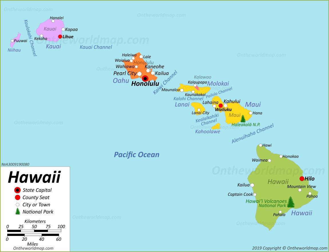
A detailed cartographic view of Hawaii reveals the precise relationships between the major islands and surrounding ocean. The chain follows northwest to southeast orientation, a pattern directly linked to the movement of the Pacific Plate over volcanic hotspot deep beneath the ocean floor. As the plate shifts, new activity builds islands over the hotspot while older islands continue moving away, gradually eroding geological time. This explains why the northwestern islands are older lower and more worn than the younger taller southeastern. On map, you can also identify key bodies of water such as the Alenuihaha Channel between Big Island and Maui, one of the roughest ocean channels in the world. Roads cities, and natural landmarks become visible on largescale maps, offering practical value anyone navigating the islands. Understanding full extent of the Hawaiian archipelago, from the main down to the remote Northwestern Islands, paints a complete picture of this remarkable Pacific its extraordinary place in both American and global geography.
🗺️ Hawaiian Islands Guide: Which Island Is Right For You?
🗺️ Hawaiian Islands Guide: Which Island Is Right for You?
Printable Hawaiian Islands Map - Printable Free Templates
Printable Hawaiian Islands Map - Printable Free Templates
Hawaii Travel Maps | Downloadable & Printable Hawaiian Islands Map

Hawaii Travel Maps | Downloadable & Printable Hawaiian Islands Map