← Exploring the Map of Hawaii: A Complete Guide to the Hawaiian Islands Exploring India Through Maps: A Visual Journey Across the Subcontinent →
Africa is the world's second-largest continent, covering approximately 30.3 million square kilometers and home to 54 recognized sovereign nations. Understanding its geography requires more than memorizing borders — it means appreciating the extraordinary diversity of landscapes, cultures, and political histories that shape this vast landmass. Maps of Africa serve as essential tools for students, researchers, travelers, and policymakers alike, offering a visual framework for interpreting everything from regional conflicts to trade routes and ecological zones. Whether you are studying physical geography or tracking geopolitical developments, a well-detailed map of Africa provides invaluable context.
A Comprehensive Visual Reference for Africa's Geography

A general reference map of Africa gives viewers a broad overview of the continent's structure, highlighting sweeping coastlines along the Atlantic and Indian Oceans, major river systems such as the Nile, Congo, and Niger, and the vast Sahara Desert that dominates the northern third of the continent. These maps are particularly useful for educational purposes, allowing students and educators to locate individual countries, identify capital cities, and understand the spatial relationships between regions. Africa's geography is remarkably varied — from the lush rainforests of Central Africa and the Great Rift Valley in the east, to the Kalahari and Namib deserts in the south. Printable and downloadable map formats make this information accessible for classroom use, research projects, and travel planning, providing a reliable foundation for geographic study at any level.
Understanding Africa Through Its Political Boundaries
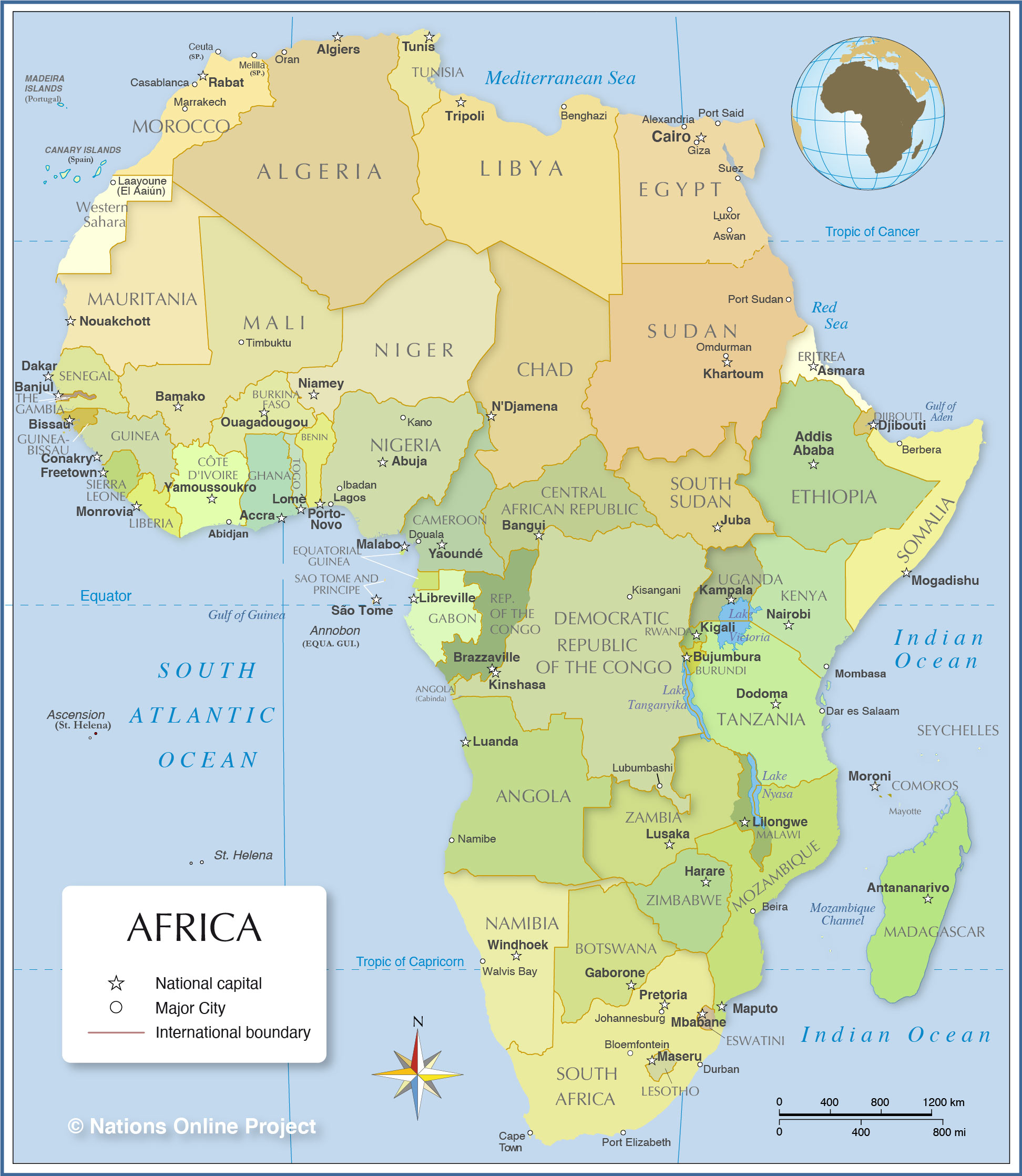
A political map of Africa focuses specifically on the human-drawn boundaries that define each the continent's 54 countries along with their capital cities and major urban centers. These boundaries carry significant historical weight, as many were established during the colonial era — often cutting across ethnic linguistic, and tribal lines with little regard for pre-existing communities. This legacy continues to influence contemporary governance, regional cooperation, and conflict resolution across the continent. Political maps are indispensable for understanding international relations, tracking membership in regional bodies such as the African Union, and monitoring territorial disputes. Countries range dramatically in size, from the sprawling Democratic Republic of the Congo and Algeria to smaller nations like Djibouti and Eswatini. Examining Africa's political geography alongside its physical terrain reveals why certain regions face distinct developmental challenges, and why cooperation borders remains both critically important and genuinely complex For anyone engaged in African studies, diplomacy, development work, or business, a current accurate political map is an essential reference point.
Political Africa Wall Map
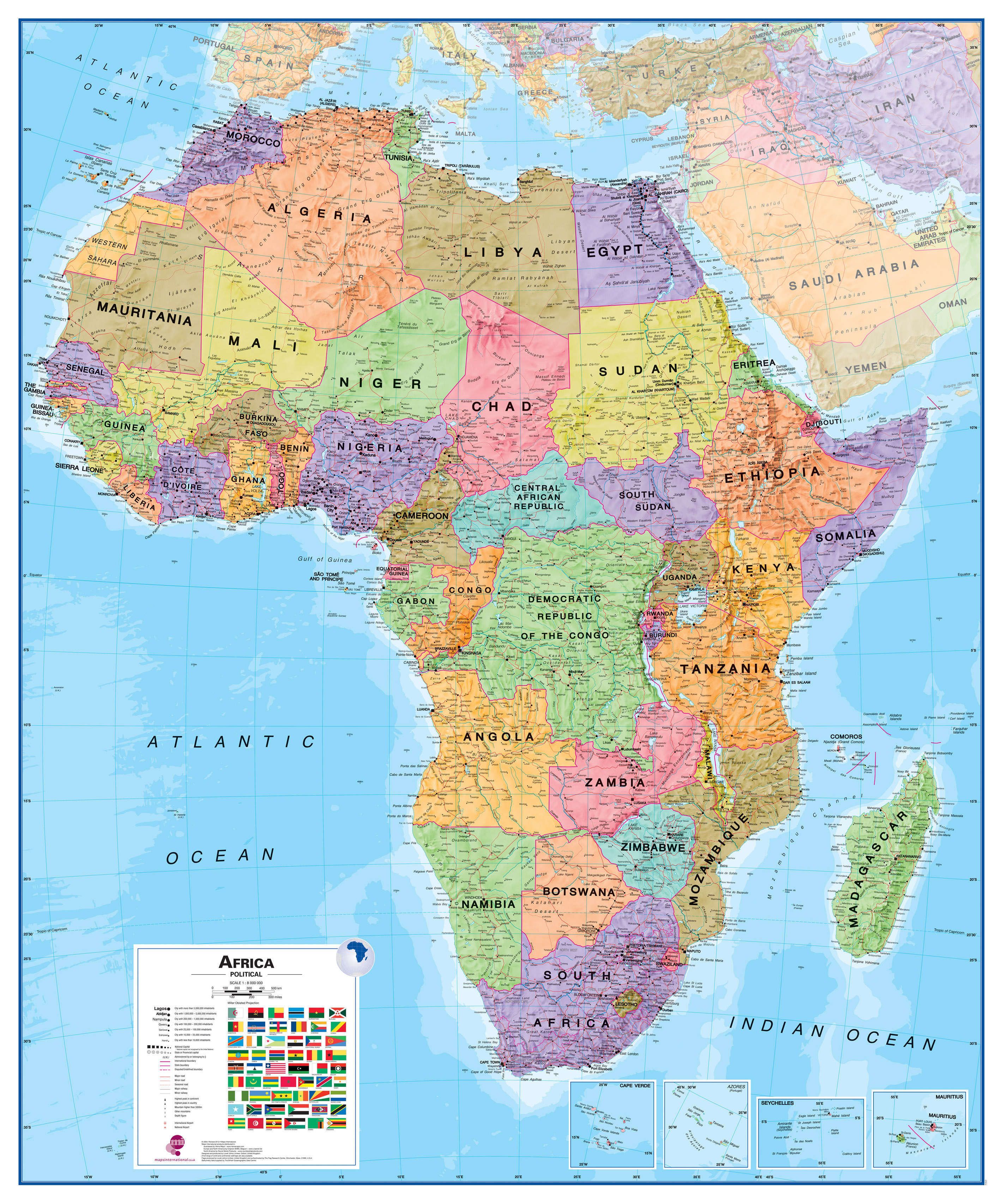
Political Africa Wall Map
Large Detailed Political Map Of Africa With All Capitals – 1982
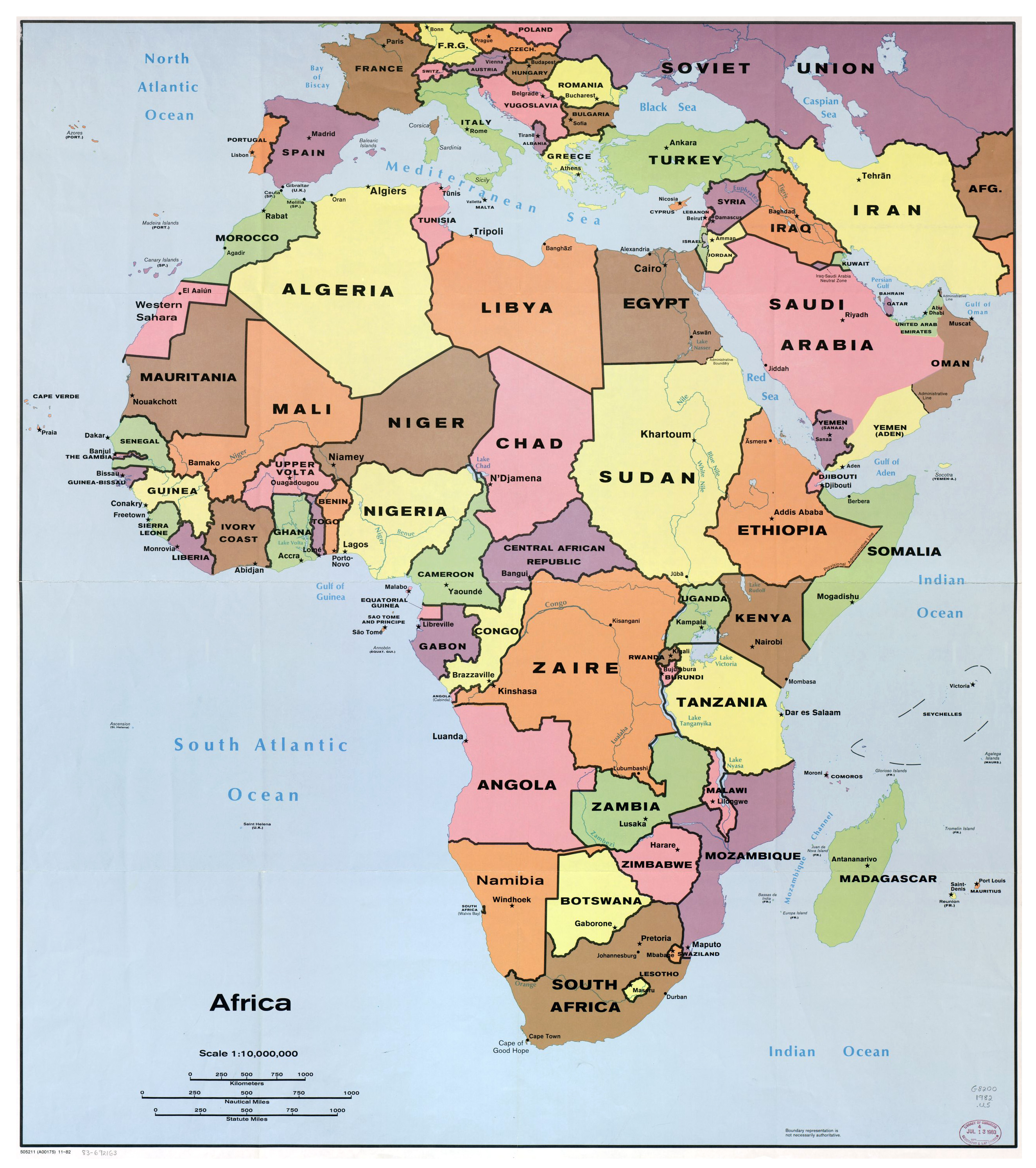
Large detailed political map of Africa with all capitals – 1982 ...
Large Detailed Political Map Of Africa With Major Cities And Capitals
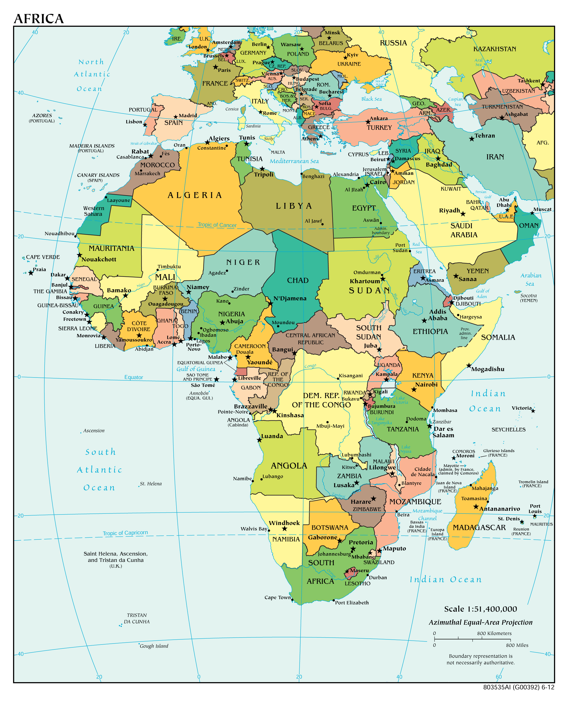
Large detailed political map of Africa with major cities and capitals ...