← Exploring the Map of England: A Journey Through Its Regions, Cities, and Rich History Exploring Scotland Through Maps: A Guide to Its Roads, Cities, and Landscapes →
Ireland, often called the Emerald Isle, is a land of rolling green hills, dramatic coastlines, and rich cultural heritage. Understanding its geography through maps offers a fascinating window into how this island nation is organized — from its bustling cities and provincial boundaries to its rivers, mountain ranges, and coastal features. Whether you are planning a trip, studying Irish history, or simply satisfying your curiosity, exploring the map of Ireland is a rewarding journey in itself. The island is divided into four provinces — Leinster, Munster, Connacht, and Ulster — and contains two distinct political entities: the Republic of Ireland and Northern Ireland. Getting familiar with these divisions helps paint a clearer picture of the island's complex and layered identity.
A Detailed Look at Ireland's Political Boundaries
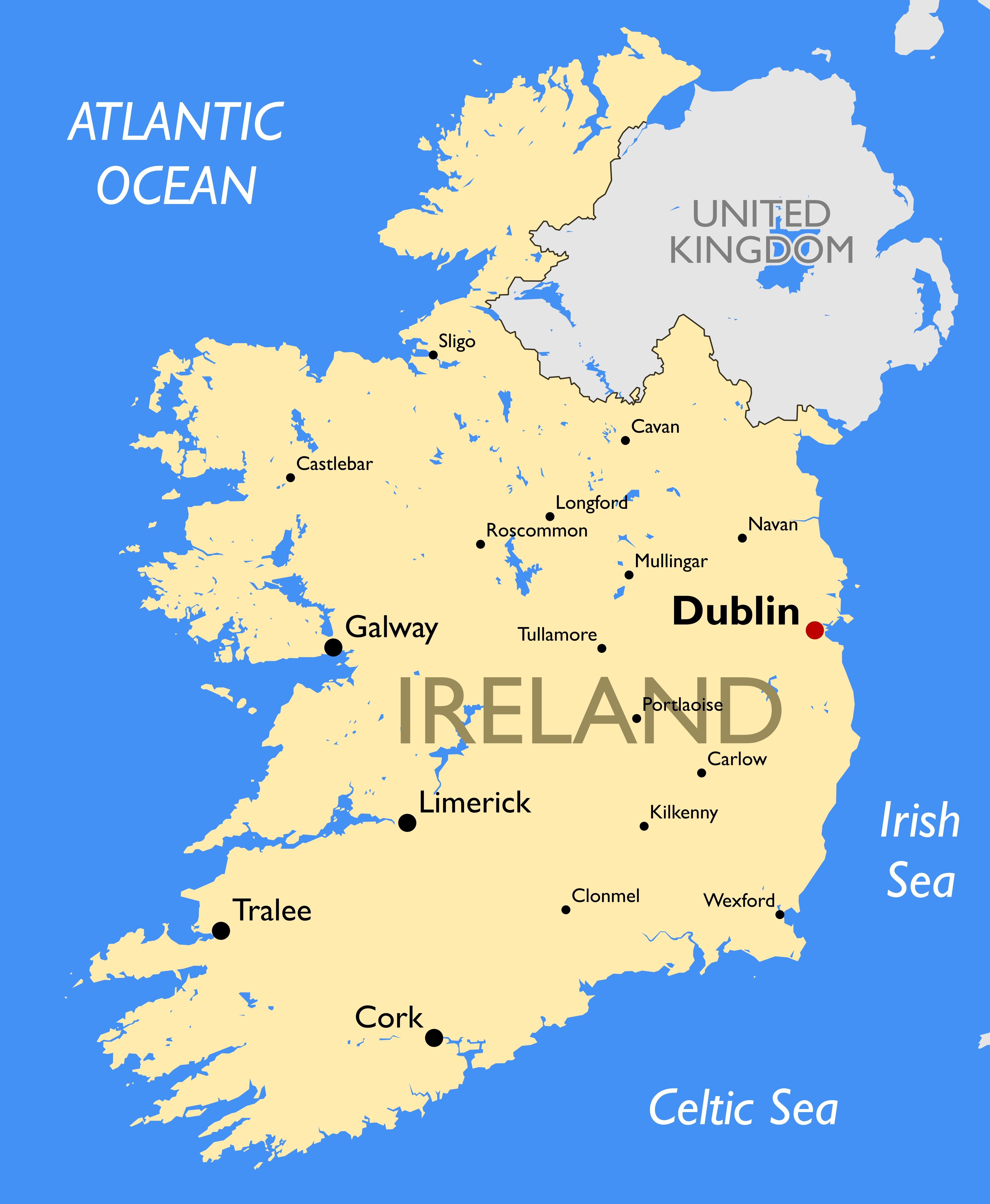
Ireland's political map reveals a carefully structured network of counties each with its own unique character history. The Republic of Ireland comprises 26 counties, while Northern Ireland which remains part of the United Kingdom, is made up of 6 counties. Major cities like Dublin, Cork, Galway, and Limerick are clearly marked as key urban centers across. Dublin, located on the east coast, serves as the capital largest city of the Republic, functioning as the country's political, economic, and cultural hub. A large printable version of this political map is particularly useful for educators, students, and travelers who want a comprehensive overview of how Ireland is administratively organized. The borders county lines, and city placements all tell a story of centuries of settlement, governance, and community identity that continues to shape modern Ireland.
Understanding Ireland's Natural Landscape Through Its Physical Map
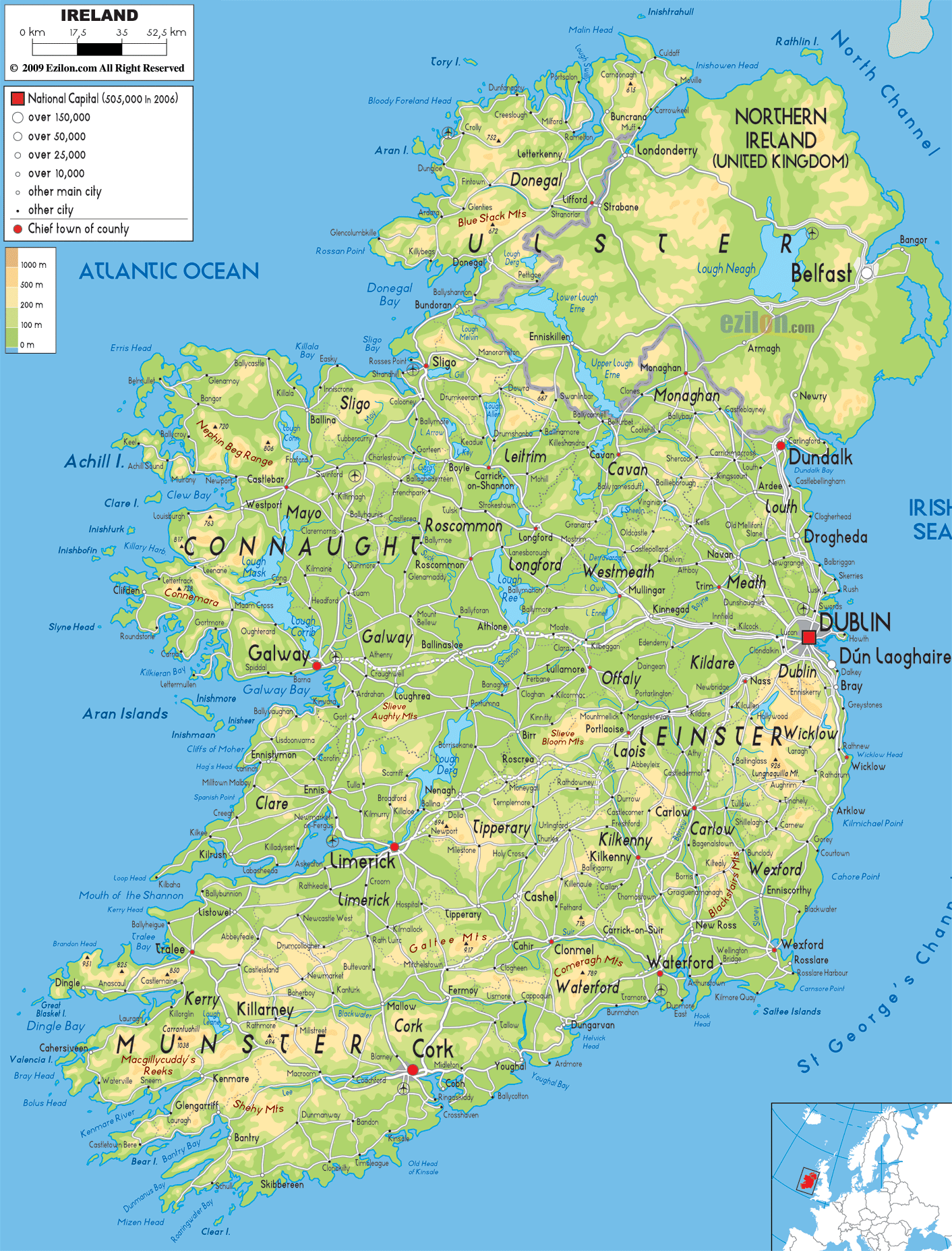
Ireland's physical map uncovers the stunning natural features that define its landscape. The island is characterized by a central limestone plain surrounded by coastal ranges, including the Wicklow Mountains in the MacGillycuddy's Reeks in the southwest, and the Twelve Bens in Connacht. Carrauntoohil, standing at 1,041 meters, is the highest peak in all of Ireland and is prominently featured on any detailed physical map. The River Shannon, the longest river in Ireland British Isles, stretches over 360 kilometers and drains much of the central lowlands before flowing into the Atlantic Ocean. Numerous lakes, known locally as loughs, dot the landscape — Lough Corrib, Lough Derg, and Lough Neagh being among the most significant. The physical map also highlights the rugged western coastline along the Wild Atlantic Way, one of the world's longest defined coastal routes. These natural features have not only shaped the climate and ecology of Ireland but have also deeply influenced its agriculture, settlement patterns, and cultural traditions throughout history From fertile river valleys to windswept mountain passes, the physical geography of Ireland is varied as it is beautiful, making it a fascinating subject for geographers, nature lovers, and curious travelers alike.
Printable Tourist Map Of Ireland - Ireland Physical Map Map Of Ireland
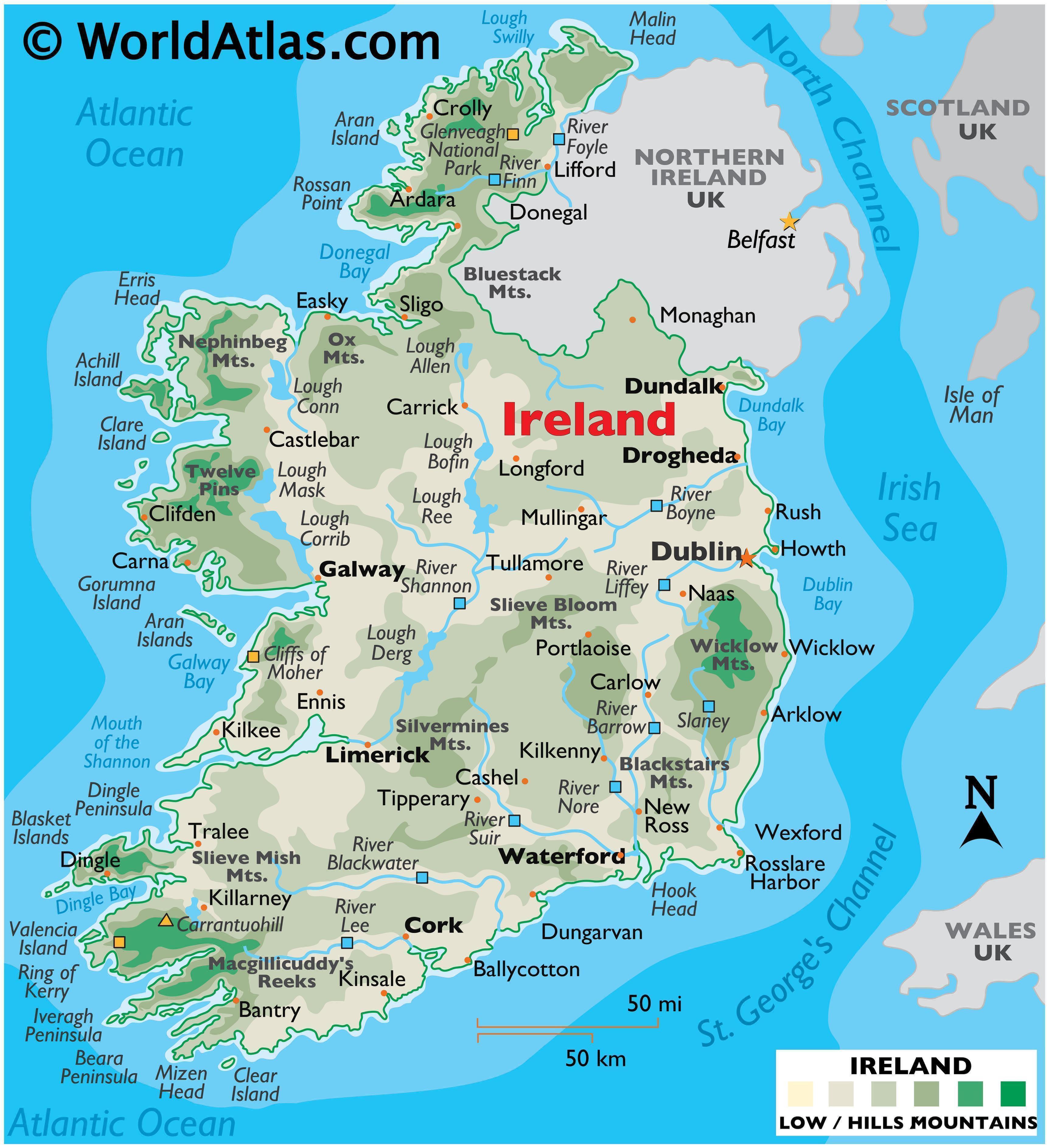
Printable Tourist Map Of Ireland - Ireland Physical Map map of ireland ...
Road Map Of Ireland Printable - Free Printables Templates
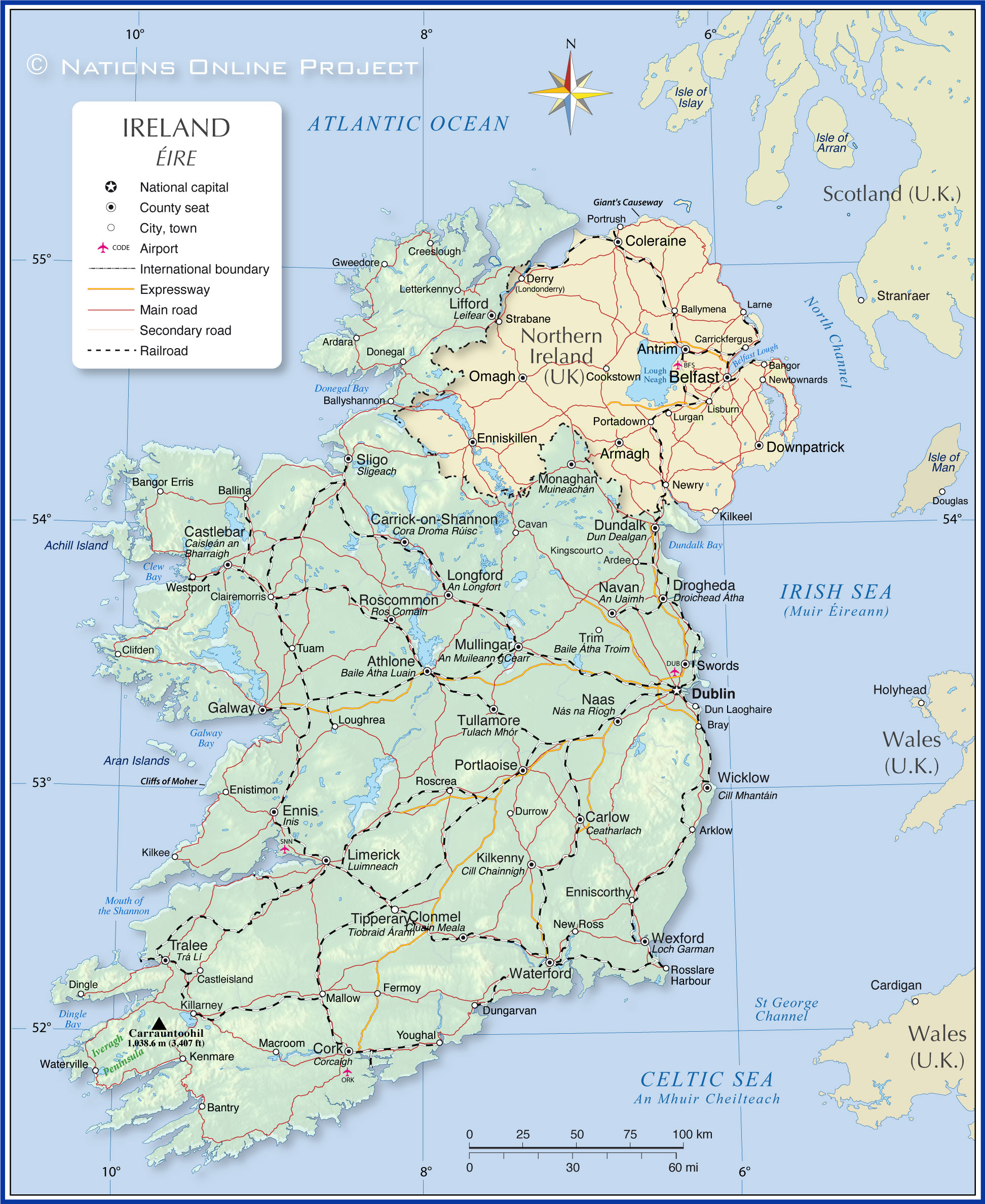
Road Map Of Ireland Printable - Free Printables Templates
Map Of Ireland Counties Printable
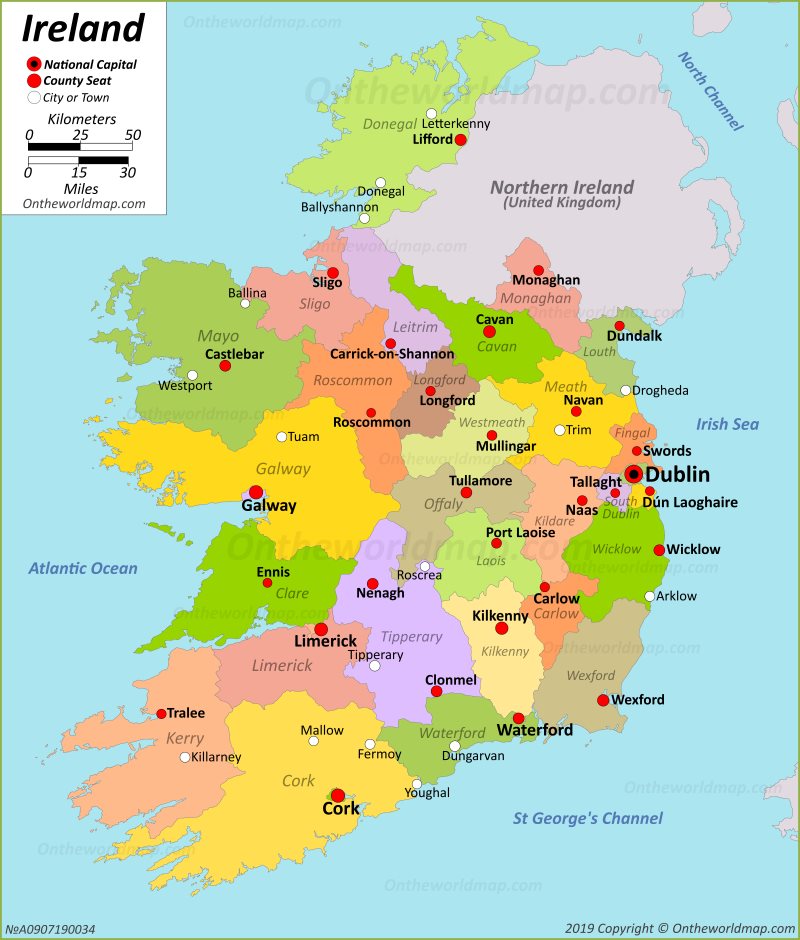
Map Of Ireland Counties Printable