← Map of Malaysia: A Comprehensive Geographic Overview Exploring the Map of Nigeria: A Personal Journey Through Africa's Most Populous Nation →
Kenya is one of Africa's most geographically diverse and culturally rich nations. Nestled in East Africa along the Indian Ocean coastline, the country spans a remarkable range of landscapes — from the snow-capped peaks of Mount to the sweeping savannahs of the Maasai Mara. Understanding Kenya through its maps offers a fascinating window into how this vibrant nation is organized, connected, and alive with movement Whether you're a traveler planning your next adventure, a student diving into African geography, or simply a curious mind's maps tell a story that words alone can't fully capture.
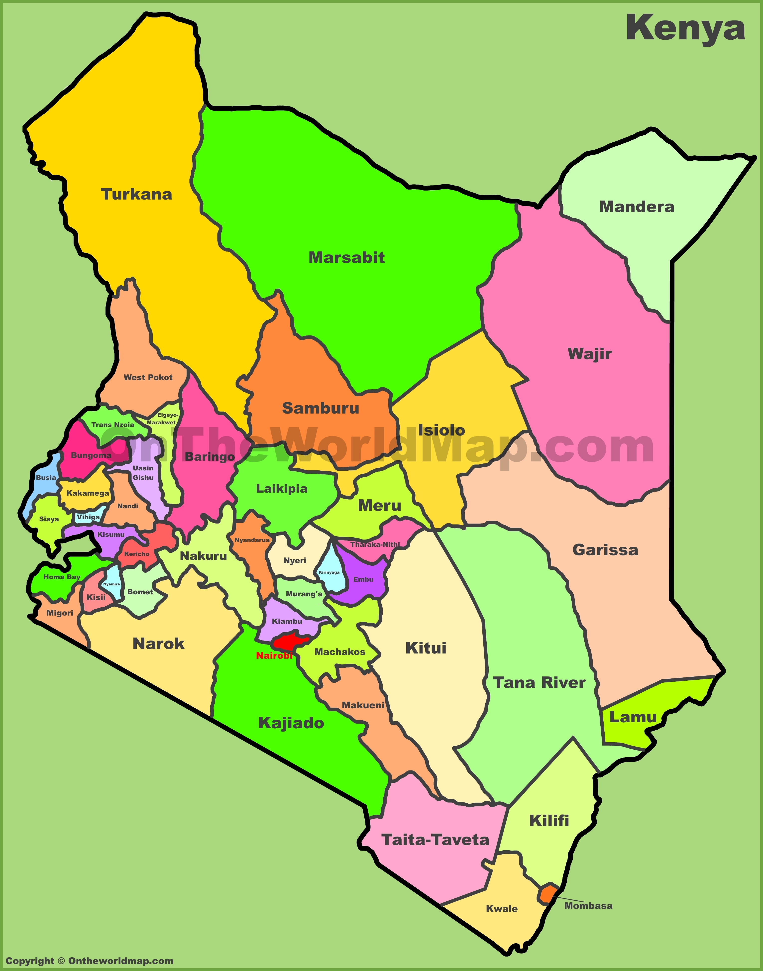
Kenya divided into 47 counties, each serving as a distinct administrative unit with its own local government. This devolved structure established under the 2010 Constitution, was designed to bring governance closer to the people and ensure more equitable distribution of resources across the country. The administrative map of Kenya paints a vivid picture of this structure, showing how the country is carved into regions range from the densely populated Nairobi County in the center to the vastrid expanse of Turkana County in the northwest Counties like Mombasa along the coast bring together a rich Swahili heritage while highland counties such as Nyeri and Kirinyaga are known for their fertile tea and coffee plantations. Studying this map helps reveal not just political boundaries, but the cultural and ecological variety that defines Kenya as a whole.
Navigating Kenya:, Cities, and Airports Across the Nation
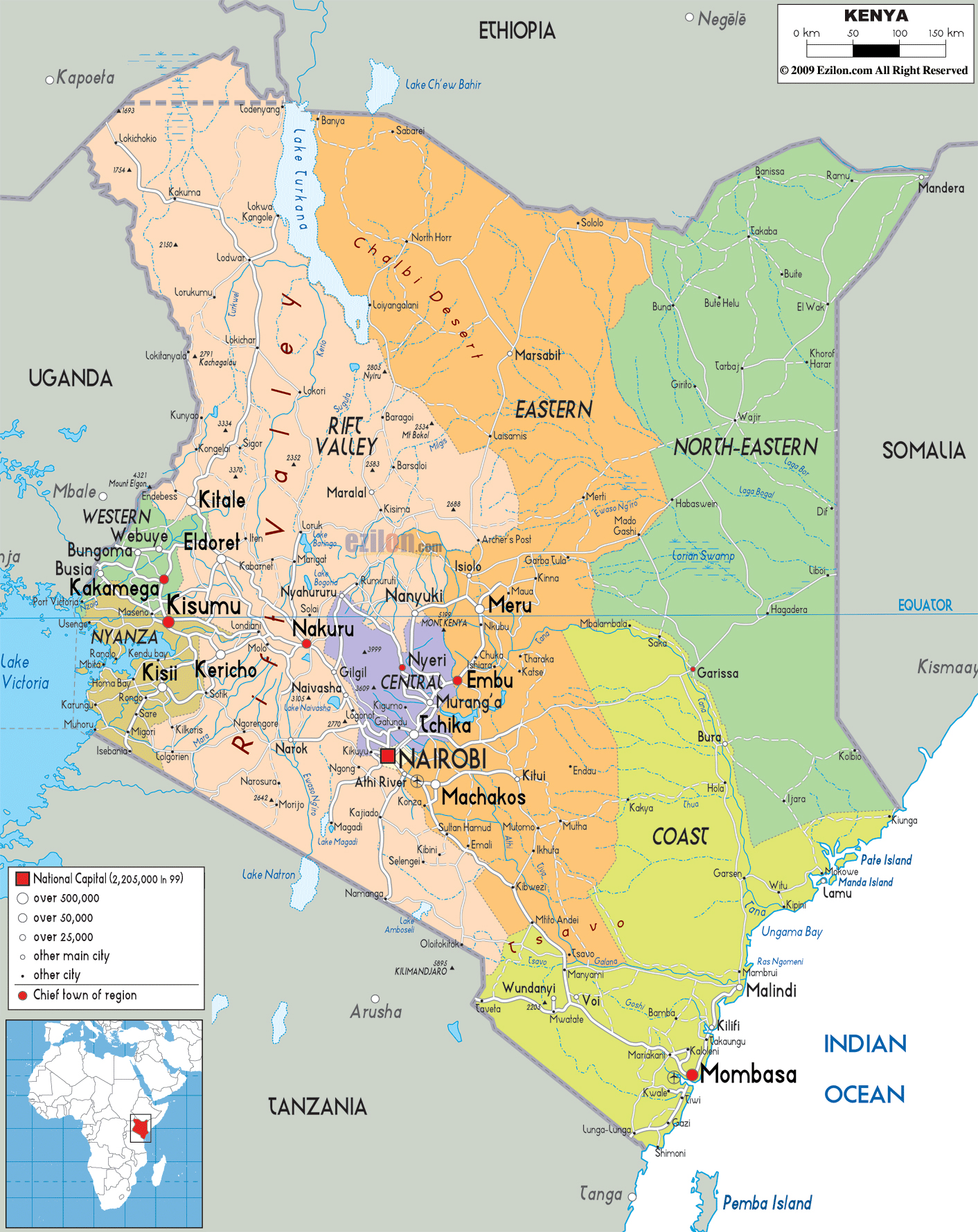
Getting around Kenya is an adventure in itself, and detailed political and road map makes journey far easier to visualize. The country's road network stretches from the bustling capital of Nairobi, weaving through highland towns coastal cities, and remote northern territories. Major highways connect key urban centers like Mombasa, Kisumu, Nakuru, and Eldoret, each city pulsing with its own distinct energy economic significance Airports dotted across the map — including Jomo Kenyatta International Airport in Nairobi and Moi International Airport in Mombasa — highlight's role as a major hub for travel and trade within East Africa and beyond. Smaller airstrips scattered near wildlife reserves make it possible to reach remote safari destinations with ease, a testament to how infrastructure and nature coexist in this remarkable country Together, the roads, cities, and airports shown on this map trace the arteries of a nation constantly on the move, connecting millions of people across breathtaking and diverse landscape.
Whether you're exploring's geography for academic purposes, trip planning, or pure curiosity, its maps offer an endlessly rewarding perspective Each county boundary road line, and city marker represents communities, histories, and ecosystems that together make Kenya of the most compelling countries African continent. Dive these maps, and you'll find yourself drawn deeper into the story of a nation that truly has it all.
Political Map Of Kenya - Nations Online Project
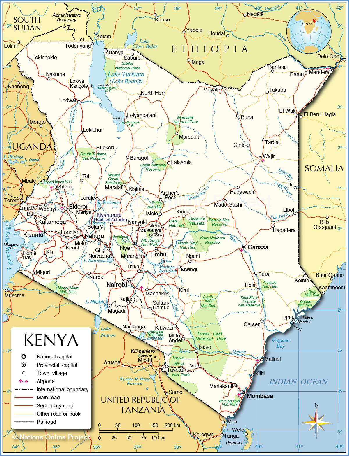
Political Map of Kenya - Nations Online Project
Political Map Of Kenya | Kenya Counties Map

Political Map of Kenya | Kenya Counties Map
Map Of Africa Kenya Political Map Of Kenya Nations
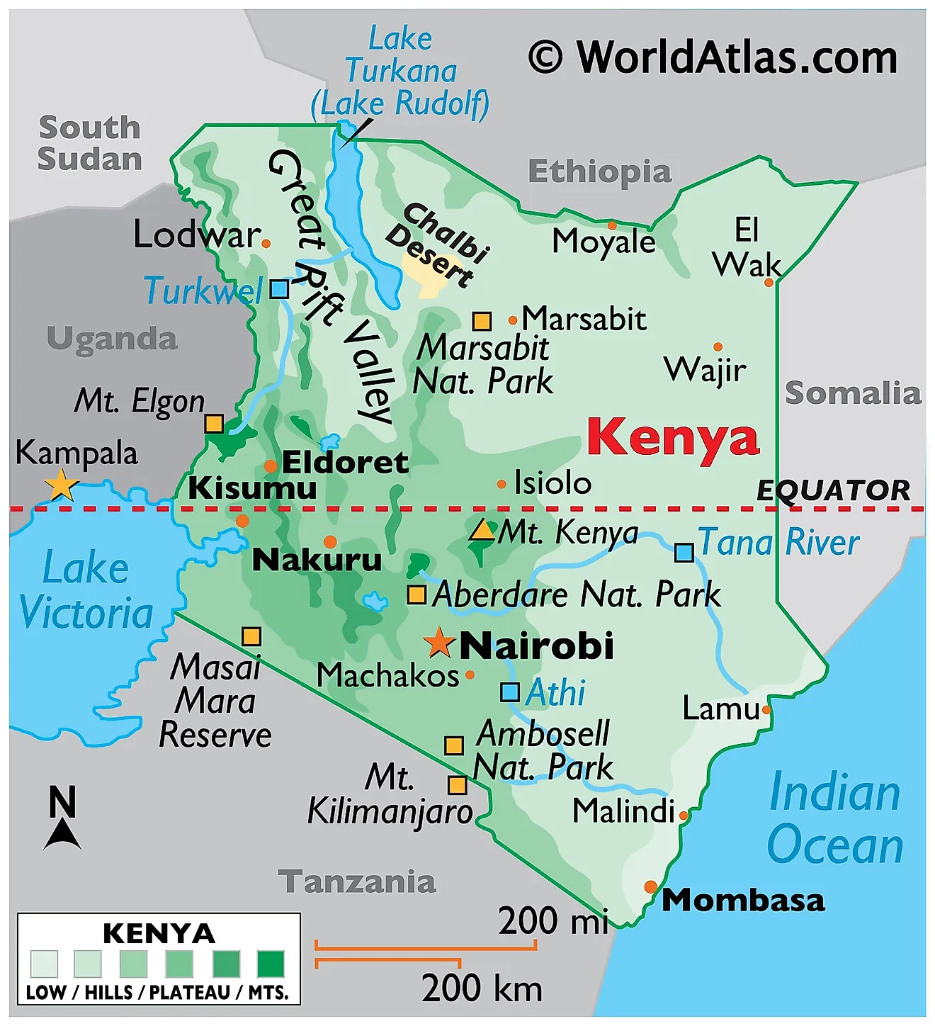
Map Of Africa Kenya Political Map Of Kenya Nations