← Exploring the Philippines: A Visual Guide to Its Regions and Geography Exploring Kenya's Map: A Visual Guide to Counties, Roads, and Major Cities →
Malaysia is a Southeast Asian nation divided into two distinct regions — Peninsular Malaysia and Malaysian Borneo — separated by the South China Sea. Understanding the geography of Malaysia through its maps reveals a country of remarkable diversity, from dense tropical rainforests and towering mountain ranges to bustling urban centers and pristine coastlines. Whether you are a traveler planning a visit, a student studying regional geography, or a professional conducting research, a detailed map of Malaysia serves as an essential tool for navigating this complex and fascinating nation.
Political and Administrative Map of Malaysia

Malaysia is composed of 13 states and 3 federal territories, each with its own administrative identity cultural character. On the peninsula, states such as Selangor, Johor, Penang, and Perak are home to major population centers and economic activity, with the federal capital Kuala Lumpur standing as the nation's political commercial heart. Across the South China Sea, the of Sabah and Sarawak on the island of Borneo represent a significant portion of Malaysia's total land area, offering a stark contrast to the more urbanized west. A map of Malaysia clearly delineates these boundaries, making it easier to understand how the country is governed and how its regions relate to one another. The administrative map also highlights key cities such as George Town, Kota Kinabalu, and Kuching, each which plays a vital role in regional commerce, tourism, and governancePhysical Topographic Geography Malaysia
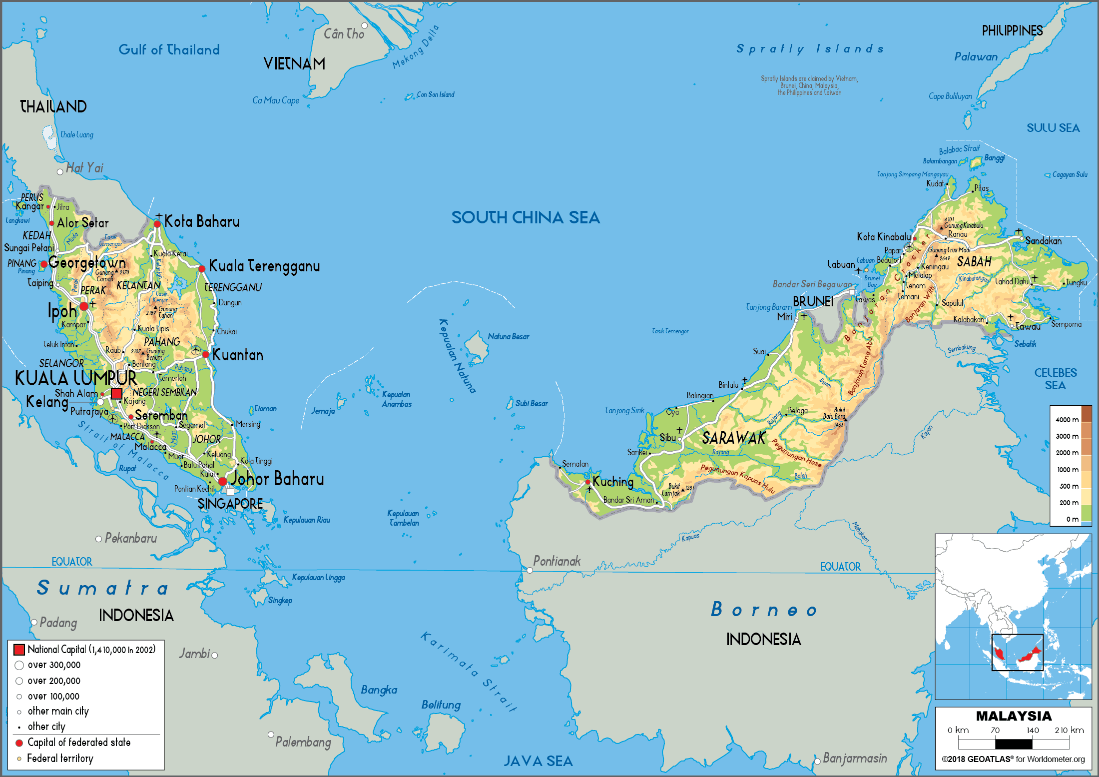
The physical geography of Malaysia is as varied as it is dramatic The Titiwangsa Mountain Range forms the backbone of Peninsular Malaysia, running north to south and separating the eastern and western coastal plains. Mount Kinabalu in Sabah, standing at approximately 4,095 meters, is the highest peak in Malaysia and one of the tallest mountains in Southeast Asia. River systems such as the Pahang, Perak, and Rajang rivers are critical both the ecology and the economy of the country, supporting agriculture, transportation, and biodiversity. The physical map also reveals Malaysia's extensive coastline along the Strait of Malacca, the South China Sea, and the Celebes Sea, which have historically made the nation a vital maritime trade hub. Lowland areas, particularly along the western coast of, support dense populations and intensive agricultural production, including palm oil and rubber plantations that remain central to the Malaysian economy. Understanding physical landscape through topographic map provides invaluable context for appreciating Malaysia's natural resources environmental challenges, and regional development patterns.
Together, the and physical maps of Malaysia paint a comprehensive picture of a nation uniquely positioned at the crossroads of Asia. Its strategic location, diverse terrain, and multi-state structure make it one of the most geographically interesting countries in the region. Whether analyzed from a political, economic, or environmental perspective, the maps Malaysia offer critical insights into why this country continues to be a focal point for trade, tourism, and geopolitical significance in Southeast Asia.
Cities Map Of Malaysia - OrangeSmile.com
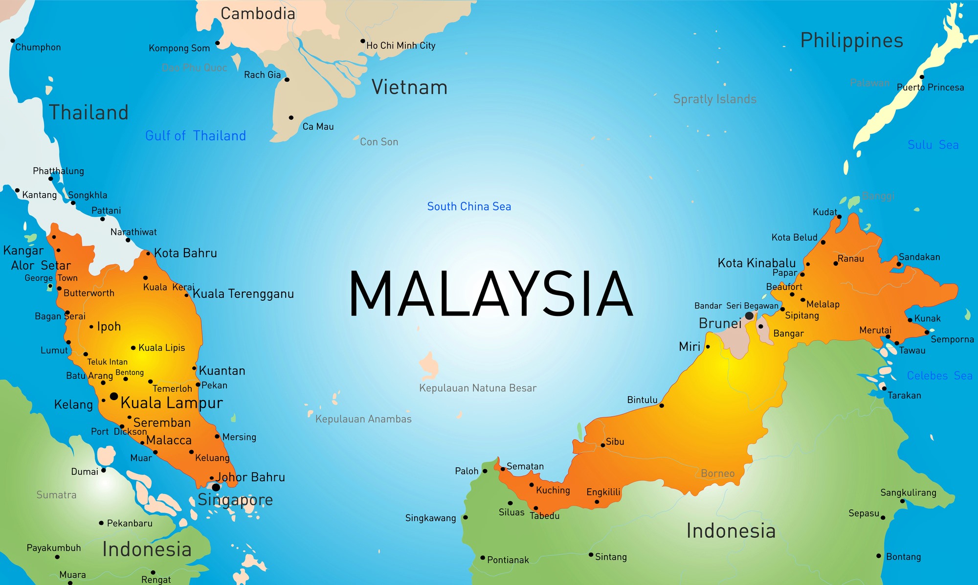
Cities map of Malaysia - OrangeSmile.com
Malaysia Maps | Printable Maps Of Malaysia For Download
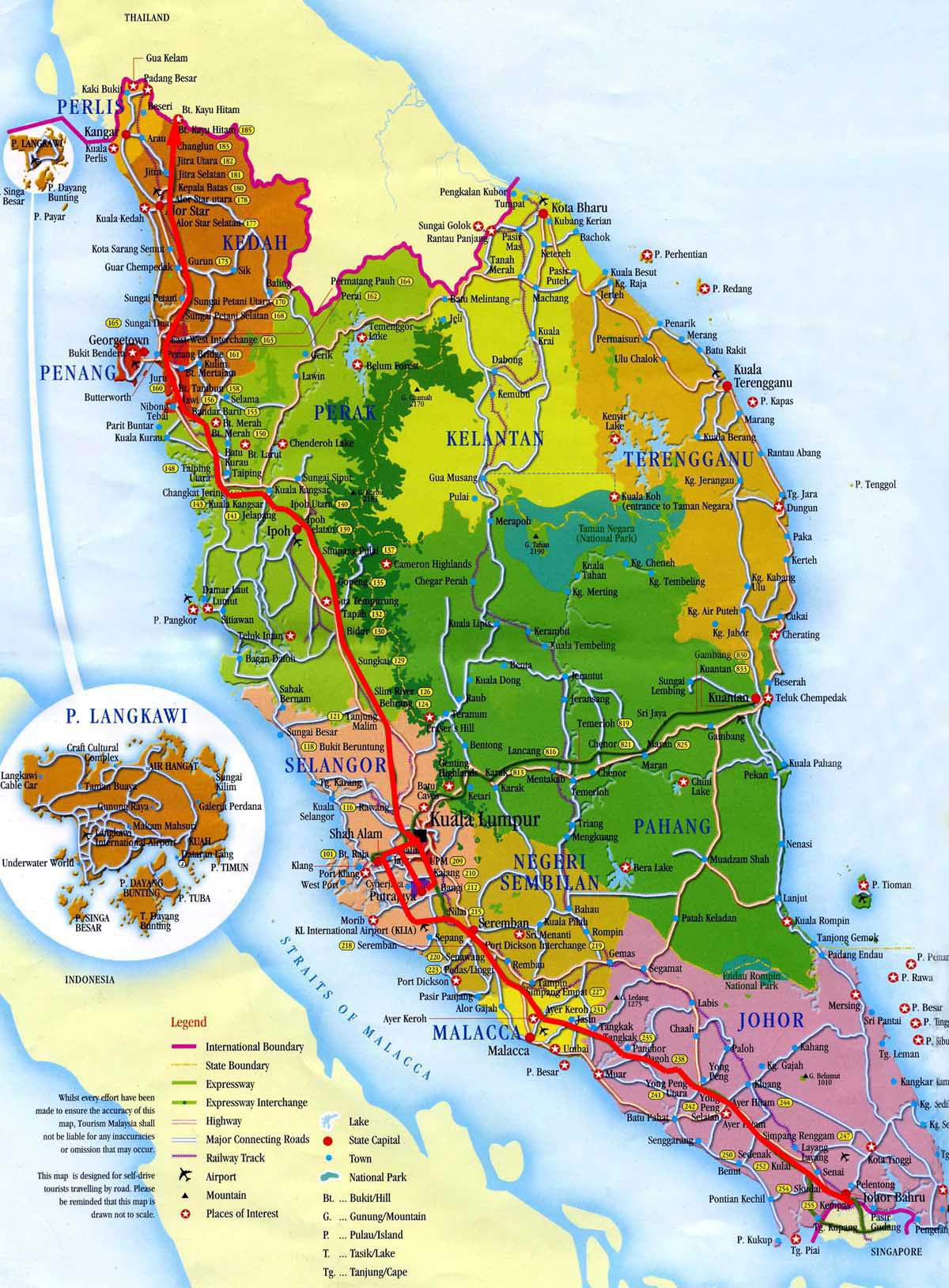
Malaysia Maps | Printable Maps of Malaysia for Download
Map Of Malaya : Malaysia Maps & Facts – MEGZZ
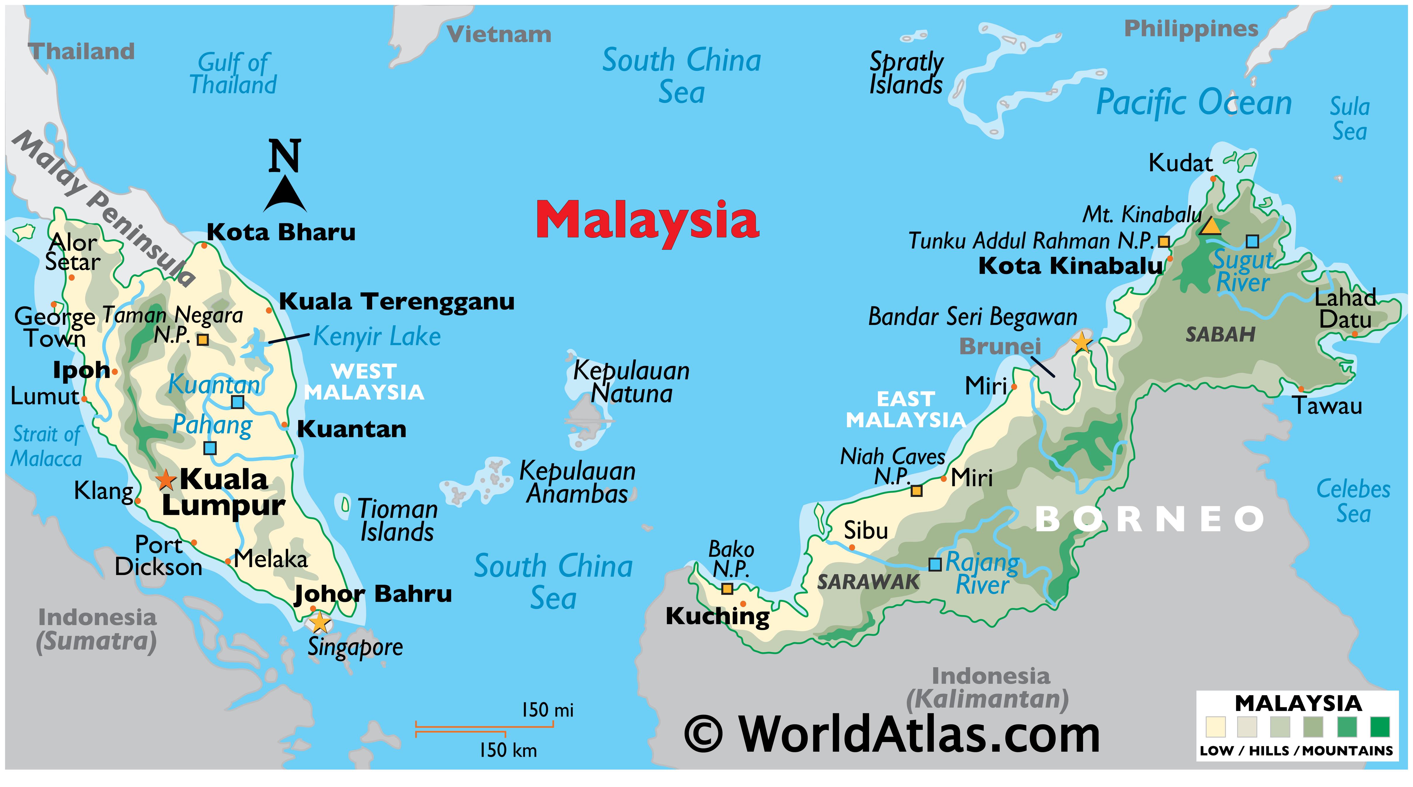
Map Of Malaya : Malaysia Maps & Facts – MEGZZ