← Exploring Scotland Through Maps: A Guide to Its Roads, Cities, and Landscapes Exploring the Map of Wales: A Visual Guide to Its Regions and Heritage →
New Zealand is one of the most geographically fascinating nations on Earth. Situated in the southwestern Pacific Ocean, this island country is composed of two main landmasses — the North Island and the South Island — along with hundreds of smaller islands scattered across the surrounding waters. Understanding the geography of New Zealand through its maps reveals a land of dramatic contrasts: volcanic plateaus, alpine mountain ranges, deep fiords, fertile plains, and rugged coastlines that stretch for thousands of kilometers. Whether you are a traveler planning a journey, a student conducting research, or simply a geography enthusiast, studying detailed map of New Zealand opens window into the country's rich physical and cultural landscape.
A High-Definition Look at New Zealand's Geographic Layout
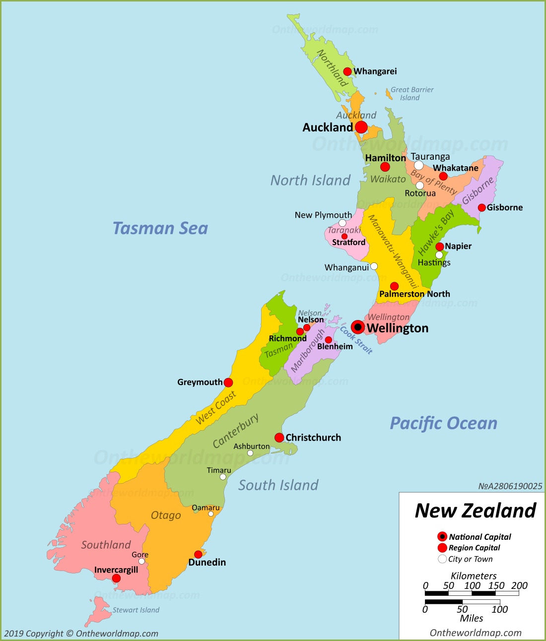
A high-definition map of New Zealand captures the country's defining characteristics with remarkable clarity. The North Island is home to the nation's capital, Wellington, as well as its largest city, Auckland, both of which serve as major economic and cultural hubs. The island's interior marked by the Central Plateau, a region defined by active volcanoes including Ruapehu, Ngauruhoe, and Tongariro. The South Island, by contrast, is dominated by the Southern Alps — a formidable mountain chain running along much of the island's length, with Aoraki/Mount Cook standing as the highest peak at 3,724 meters. The fertile Canterbury Plains spread out to the east of this range, while the dramatic Fiordland region carves the southwestern coastline into labyrinth of deep glacier-carved inlets. detailed HD map allows observers to trace the country's river systems, lake formations, and coastal boundaries with precision providing an indispensable geographic reference for anyone seeking a thorough understanding of New Zealand's physical structure
New Zealand's Political Geography: Roads Railroads, and Urban Centers
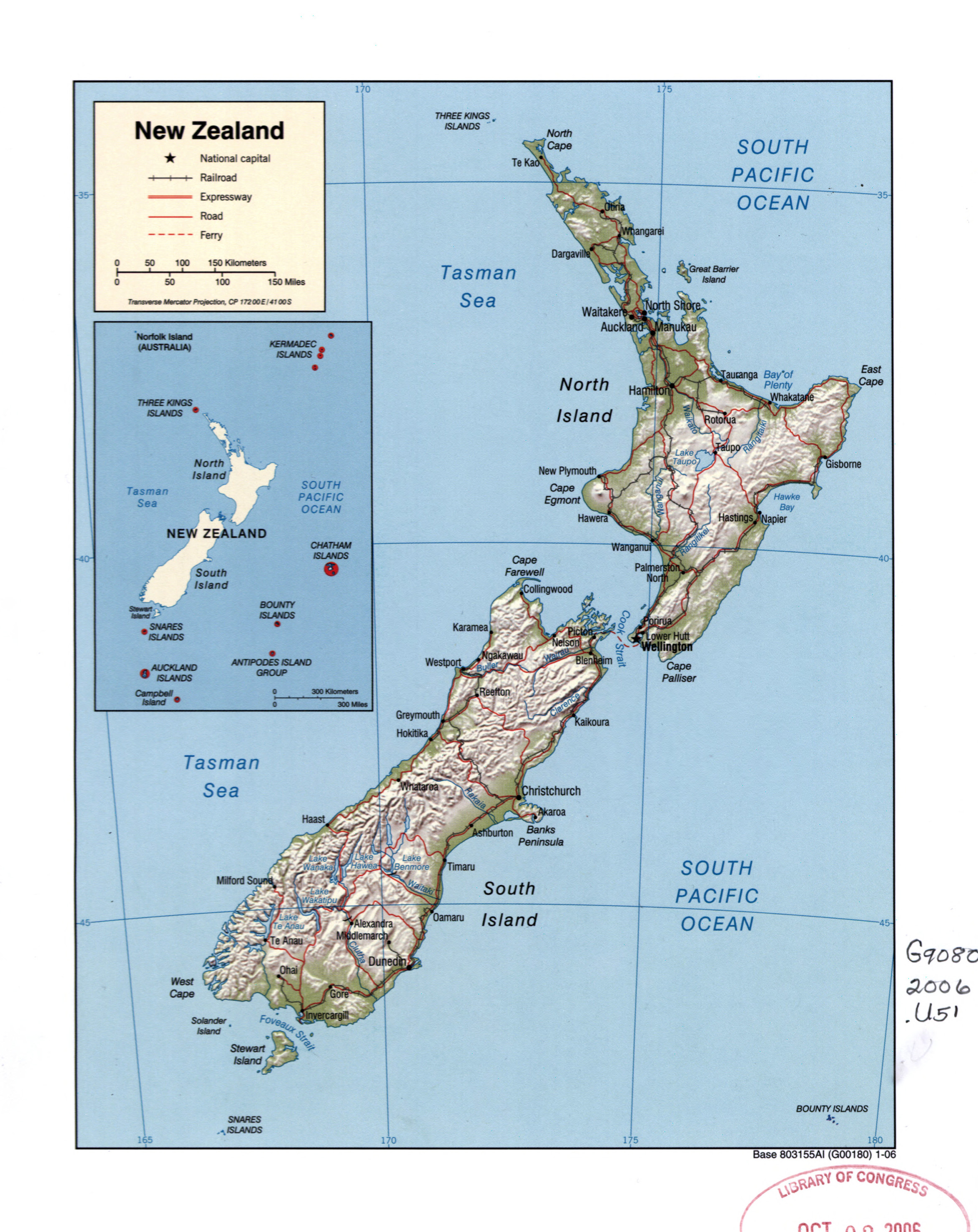
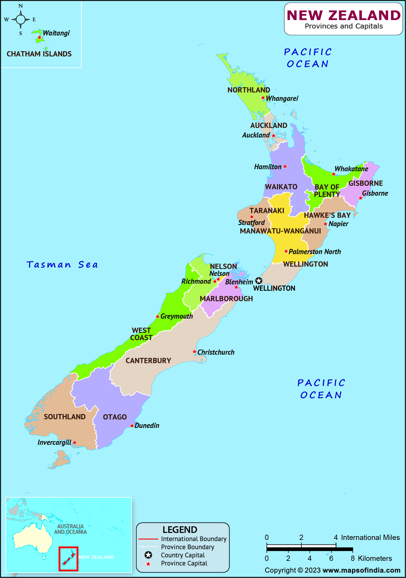
A large-scale political map of New Zealand provides an entirely different but equally valuable perspective on the country Beyond the natural terrain, this type of map illustrates the human infrastructure that connects New Zealand's communities — highways and state roads that thread through mountain passes and coastal valleys, the railroad lines that link major urban centers, and the distribution of towns and cities across islands. New divided into sixteen regions, each governing its own local administration, and a political map clearly delineates these boundaries alongside the locations of key cities such as Christchurch, Hamilton, Dunedin, Tauranga, and Queenstown. Transportation networks are particularly significant in country where geographic barriers like the Cook Strait — body of water separating the North and South Islands — require ferry services to maintain connectivity. Understanding how roads rail lines navigate challenging topography of New Zealand speaks to the ingenuity of its infrastructure planning From the winding coastal highways of the South Island's West Coast to the urban motorway systems of Auckland map tells a story of a nation that has built modern civilization atop one of the world's most dynamic varied landscapes.
Free Printable Map Of New Zealand
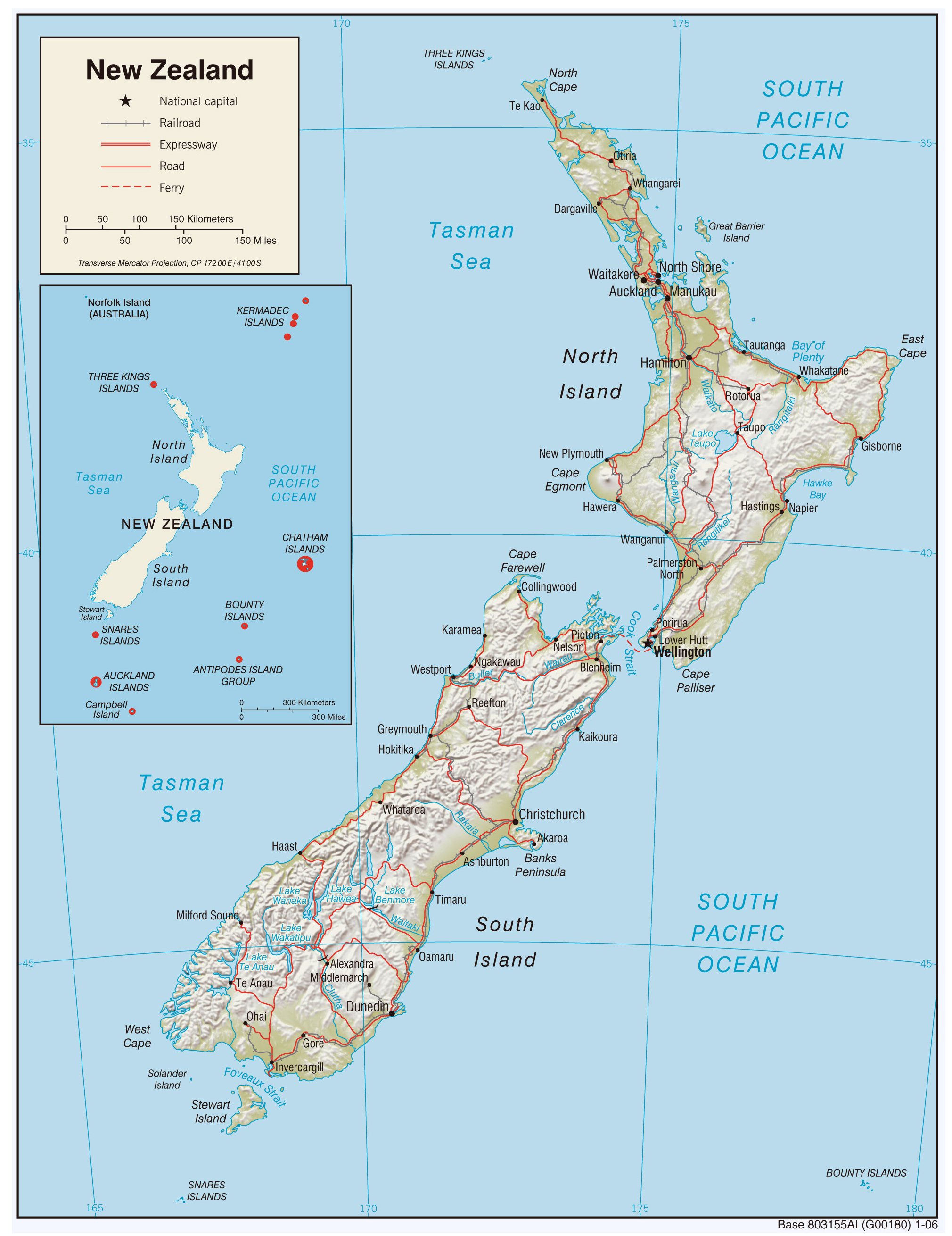
Free Printable Map Of New Zealand
Map Showing New Zealand
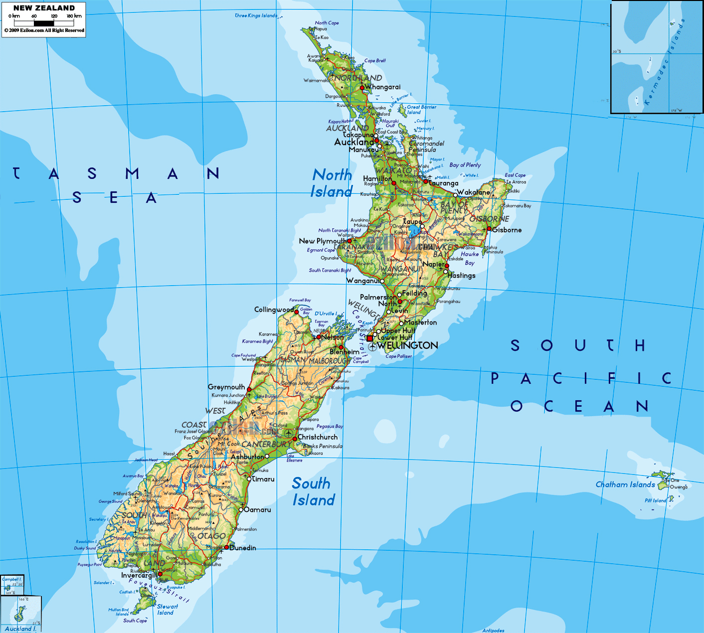
Map Showing New Zealand
New Zealand On Map Of World
New zealand on map of world