← Exploring the Map of Dubai, UAE: Your Ultimate Guide to Navigating the City of Gold Exploring the Philippines: A Visual Guide to Its Regions and Geography →
I've always believed that a map is more than just lines and labels — it's a story waiting to be read. And when I first sat down with a detailed map of South Korea, I found myself completely absorbed. This small yet incredibly dynamic country, tucked into the southeastern edge Korean Peninsula, packs an astonishing amount of geography, culture, and history into its roughly 100,000 square kilometers. Whether you're planning a trip, brushing up on your geography, or just curious like me, understanding map of South Korea opens up a whole new way of seeing this remarkable nation.
Understanding South Korea's Geographic Layout
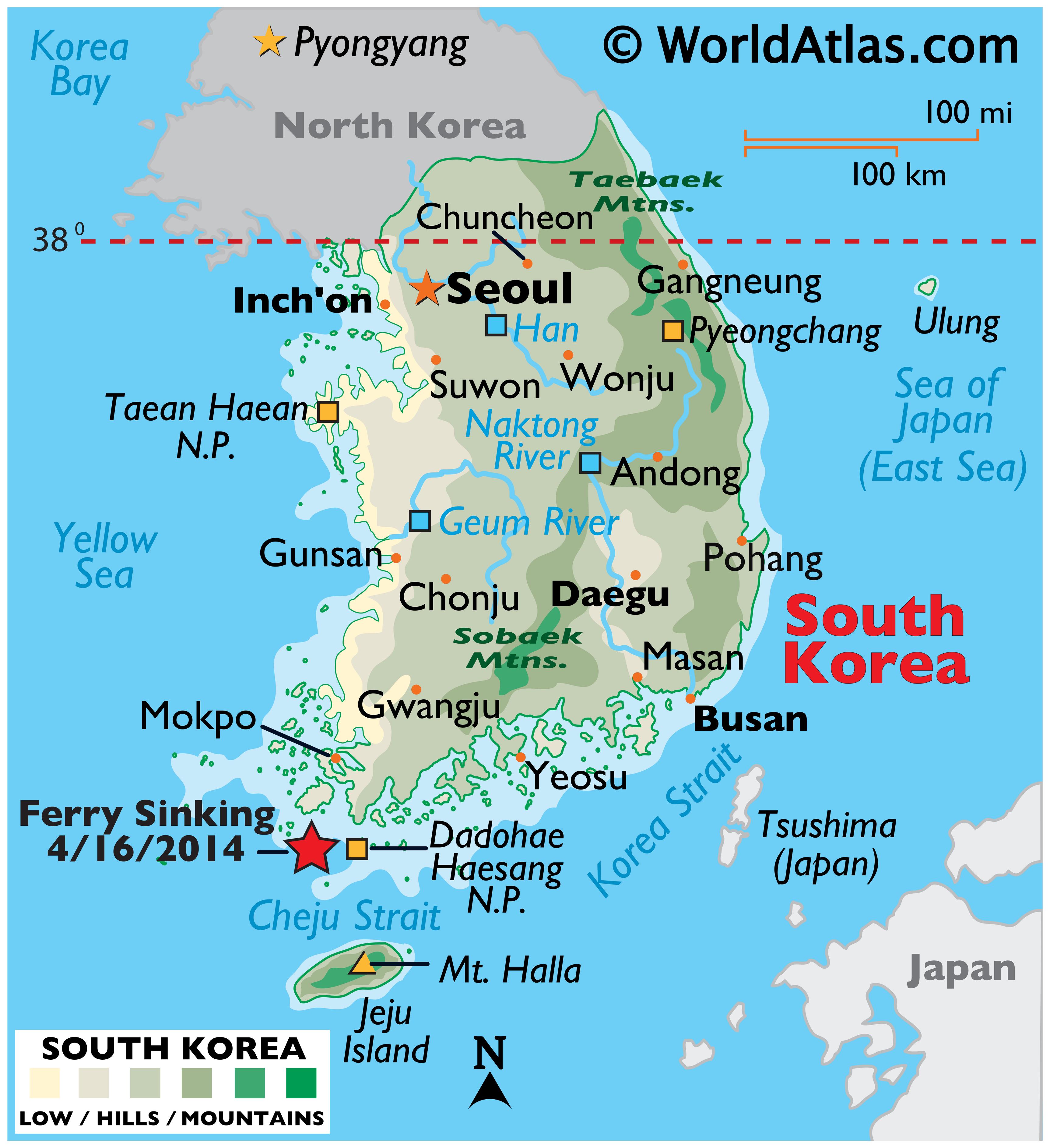
The first time I really studied comprehensive map of South Korea, I was struck by how much variety exists in such a compact space. The country shares its northern border with North Korea along the heavily fortified Demilitarized Zone (DMZ), while the western coastline hugs the Yellow Sea and the eastern runs along the Sea of Japan, also known as the East Sea. The southern opens up to the Korea Strait. What I found particularly fascinating is irregular almost jagged coastline — especially in the south west — dotted with thousands of islands. Jeju Island, sitting off the southern tip, is the largest arguably the most famous. Inland, the terrain shifts dramatically from low coastal plains to rugged mountain ranges like the Taebaek Mountains running along the eastern spine of the country. Seoul, the capital and the beating heart of the nation, sits in the northwest, connected by an intricate web of highways and high-speed rail lines that make the whole country feel surprisingly accessible.
Printable Maps and Planning Your South Korea Adventure
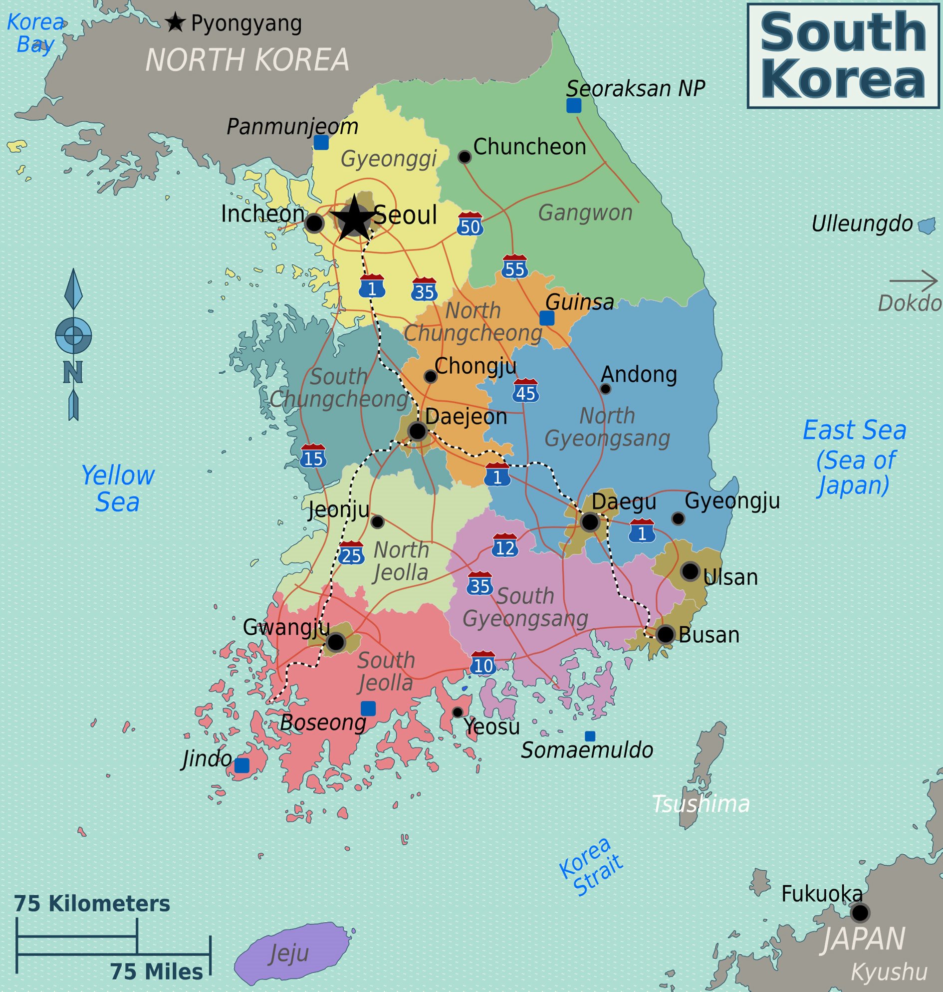
When I started planning a potential trip to South Korea, having a good printable map became absolutely essential. There's something deeply satisfying about spreading out a physical map and tracing possible routes with your finger. South Korea is divided into several distinct regions, each with its own personality. The capital region around Seoul and Incheon in the northwest is where modern skyscrapers meet ancient palaces. Head southeast you'll hit Gyeongju, often called the "museum without walls," packed with UNESCO World Heritage Sites from Silla dynasty Busan, the country's second-largest city, anchors the southeast coast with its famous beaches and vibrant food scene. The Jeolla region in the southwest celebrated for its rich culinary traditions and natural scenery. What really surprised me when looking at these detailed maps is how well-connected everything is — the KTX high-speed rail network means you can travel from Seoul to Busan in under three hours. Having a reliable map in hand whether printed or digital, transforms the way you engage with this country helps you appreciate just how thoughtfully compact navigable it really is.
South Korea's map is ultimately a gateway to understanding everything this country has to offer. From its mountainous interior sprawling coastlines to its ultra-modern cities and quiet rural towns, every corner of this nation tells a different story. I find myself returning to these maps again and again, each noticing something new — a small island hadn't considered visiting, a national park I'd overlooked, a coastal road that looks like it would be absolutely stunning at sunset. If you haven't spent quality time with a map of South Korea yet, I genuinely encourage you to do so. It's one of those rare experiences where the more you look, the more you want to explore
South Korea Maps & Facts - World Atlas
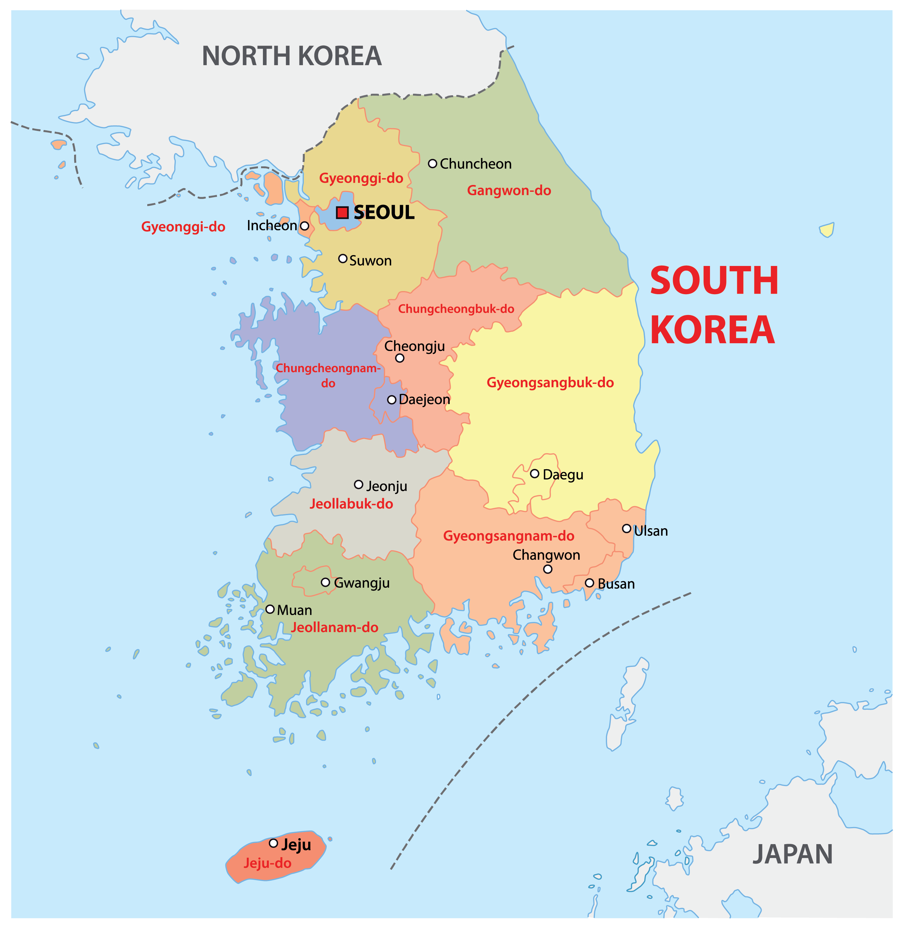
South Korea Maps & Facts - World Atlas
South Korea Map (Physical) - Worldometer
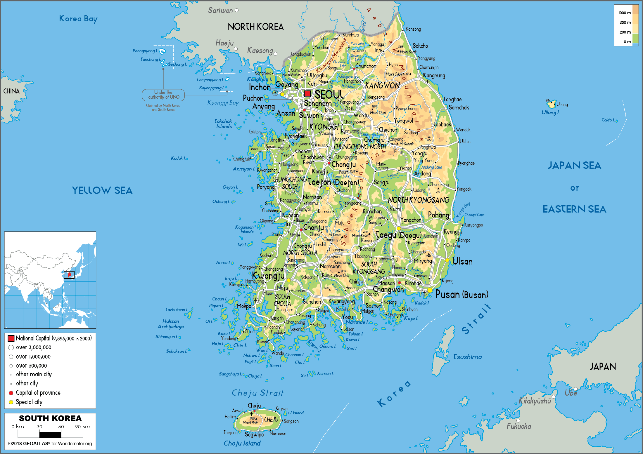
South Korea Map (Physical) - Worldometer
South Korea Map - Guide Of The World
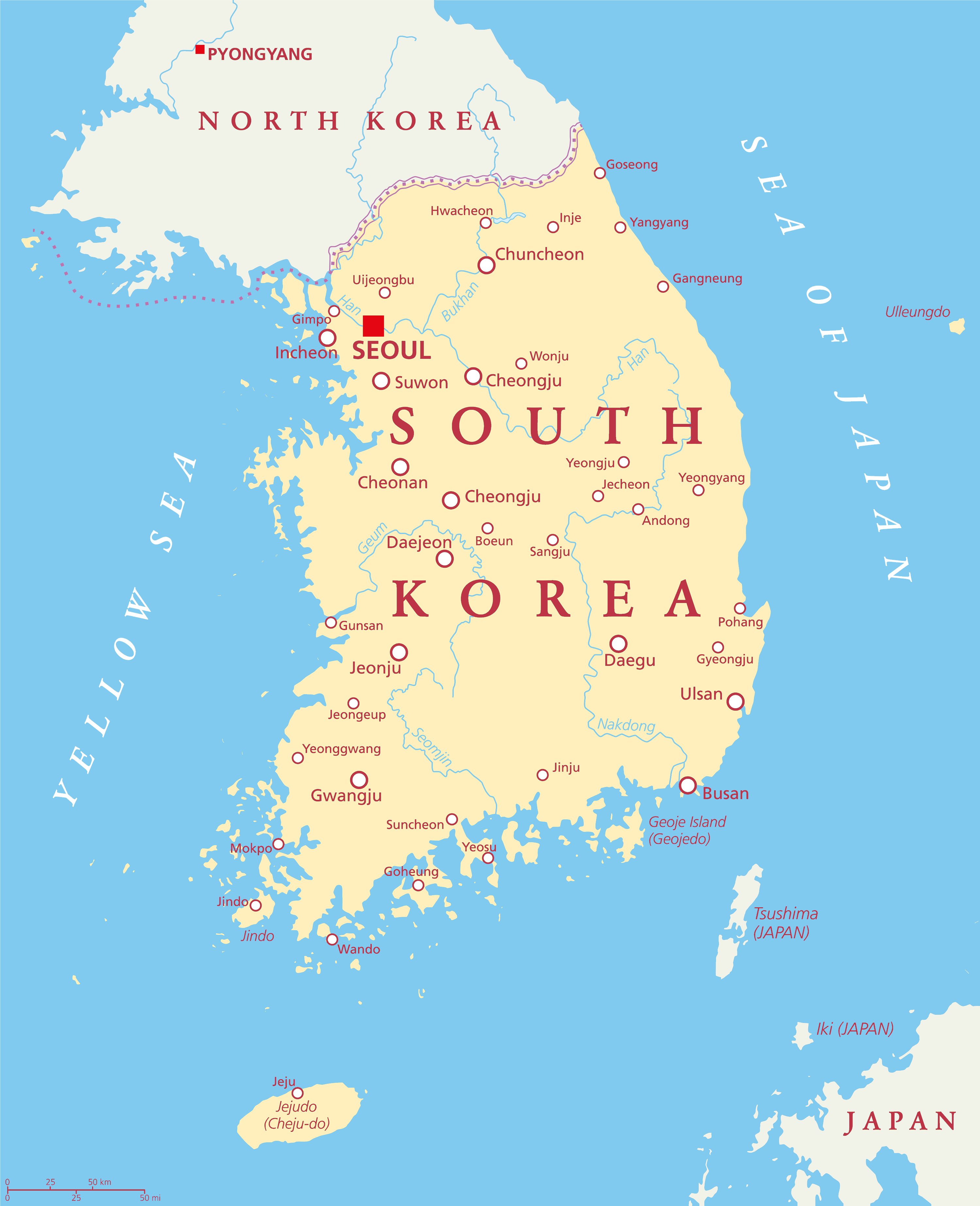
South Korea Map - Guide of the World