← Exploring the Map of South Korea: A Personal Journey Through the Land of the Morning Calm Map of Malaysia: A Comprehensive Geographic Overview →
The Philippines is an archipelago nation in Southeast Asia made up of more than 7,600 islands, stretching across the western Pacific Ocean. Positioned between the South China Sea and the Philippine Sea, this country holds a unique place on the Asian map — both geographically and culturally. Understanding the layout of the Philippines through its maps gives us a deeper appreciation of its rich diversity, from the mountainous highlands of Luzon to the pristine island chains of the Visayas and vast wilderness of Mindanao. Whether you are a traveler planning your next adventure, a student of geography, or simply someone drawn to the beauty of island nations, studying the map of the Philippines opens window into one of Asia's most fascinating and vibrant countries.
The Diverse Regions of the Philippines at a Glance
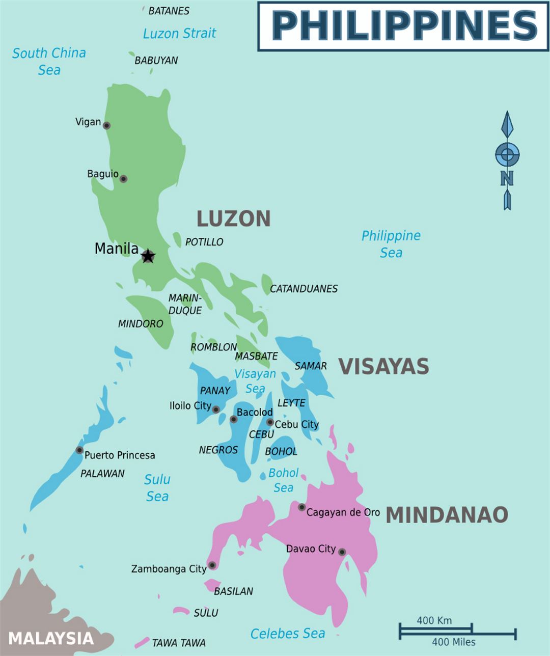
The Philippines is divided into 17 administrative regions, each carrying its own distinct identity, dialect, cuisine, and tradition. A detailed regional map reveals how these divisions spread across the three major island groups — Luzon in the north, the Visayas in the center, and Mindanao in the south. Luzon is the largest island home to Metro Manila, the bustling capital region that serves as the country's political, economic, and cultural heart. Moving south, the Visayas offer cluster of islands known for their warm communities world-class beaches, including-renowned Boracay and historic streets of Cebu City. Mindanao, the second-largest island, is a land of incredible natural resources, diverse indigenous cultures, and fertile agricultural plains. Studying the regional divisions of the Philippines helps travelers researchers alike understand how a nation of islands maintains cohesive identity while celebrating profound local differences Each region tells its own story, woven together into broader tapestry of Filipino lifeA General Overview of the Philippine Archipelago
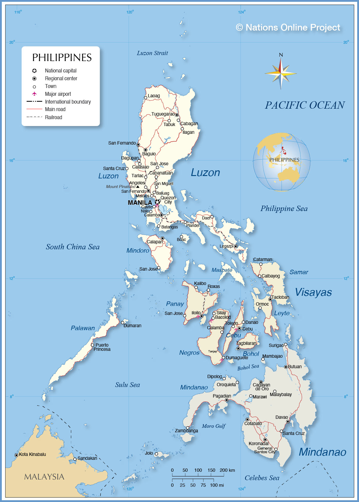
A general map of the Philippines paints a striking picture of an nation surrounded by significant bodies of water. To west lies the South China Sea, to the east the Philippine Sea, and to the south the Celebes Sea — all of which have shaped the country's history through centuries of trade, migration, and cultural exchange. The Philippines shares maritime borders with countries such as Taiwan to the north, Malaysia Indonesia to the south, and Vietnam to the west, placing it at the crossroads of major trade routes. Major cities like Manila, Cebu, Davao, and Zamboanga appear as vital nodes on the map, each serving as regional hubs that drive commerce culture. The general map also highlights the natural features that define the Philippine landscape, including the famous Palawan coastline, the Cordillera mountain range, and the active volcanic belt running through the archipelago. For anyone seeking to understand the Philippines as a whole, this birds-eye geographic view is perfect starting point for journey into one of Asia's most dynamic and beloved nations.
Map Of The Provinces And Regions Of The Philippines, 2012 | Regions Of

Map of the provinces and regions of the Philippines, 2012 | Regions of ...
Philippines Map (Physical) - Worldometer
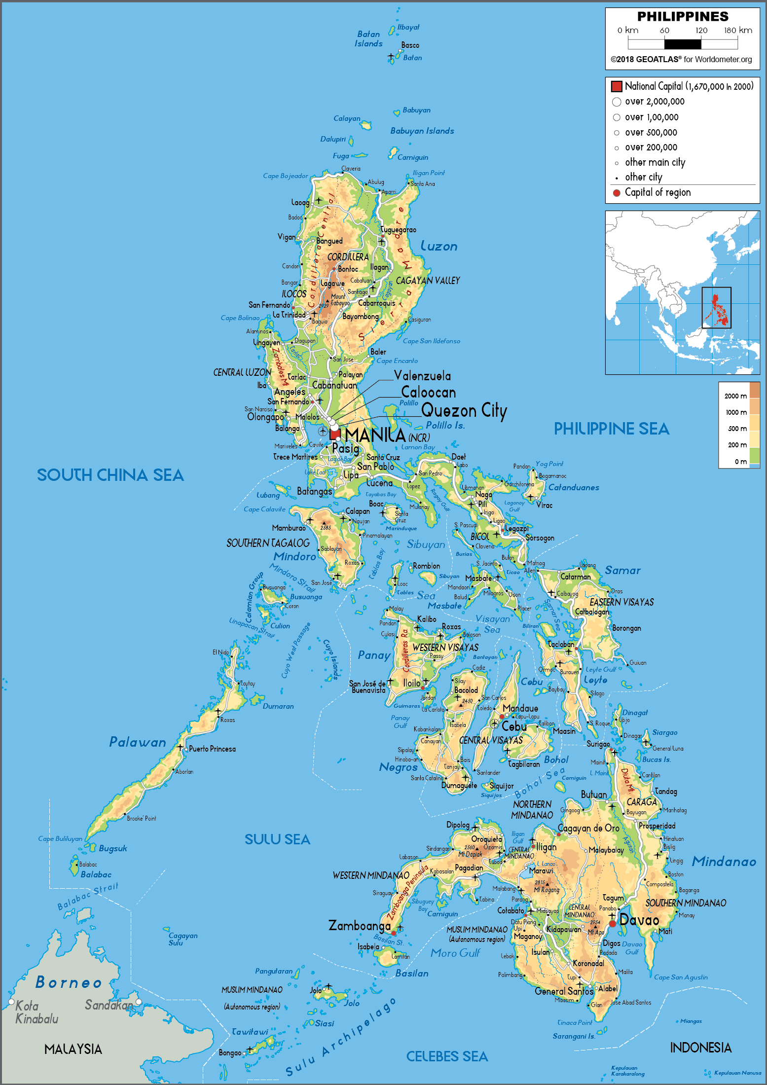
Philippines Map (Physical) - Worldometer
Maps Of Philippine | Map Library | Maps Of The World
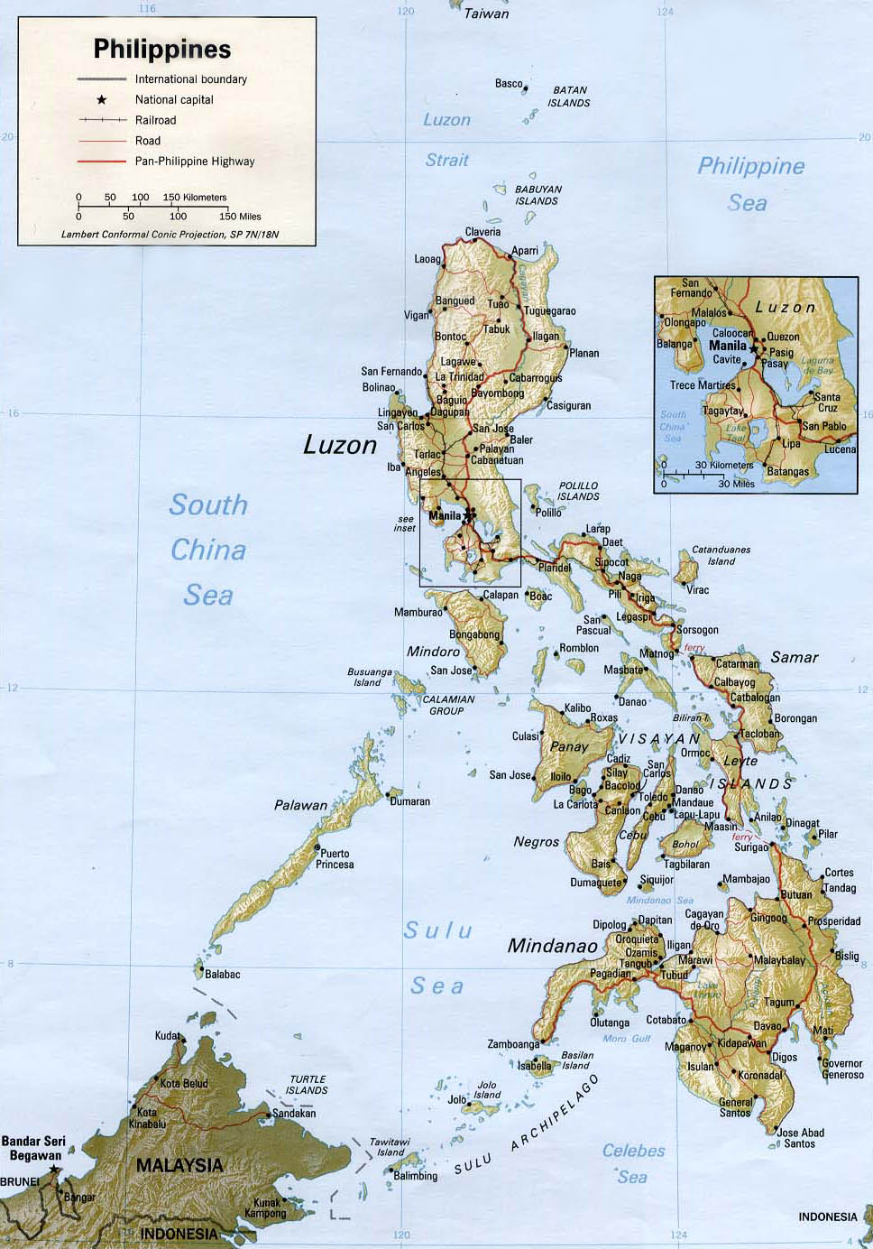
Maps of Philippine | Map Library | Maps of the World