← Exploring the Map of Russia: Geography, Regions, and Political Boundaries Exploring Turkey Through Maps: A Geographic Journey Across a Transcontinental Nation →
Thailand is a country of striking contrasts — from the mountainous north to the sun-drenched peninsulas of the south, its geography tells a story that spans centuries civilization, trade, and cultural exchange. Understanding the layout of Thailand through its maps reveals not only physical boundaries but also the cultural and administrative fabric that holds this Southeast Asian nation together. Whether you are a traveler planning your next journey a student of geography, or simply curious about the region diving into Thailand's cartographic detail offers a perspective that words alone cannot fully capture. The map of Thailand is more than a navigational tool — it is a window into the country's soul.
A Bird's Eye View of Thailand's Geographic Layout
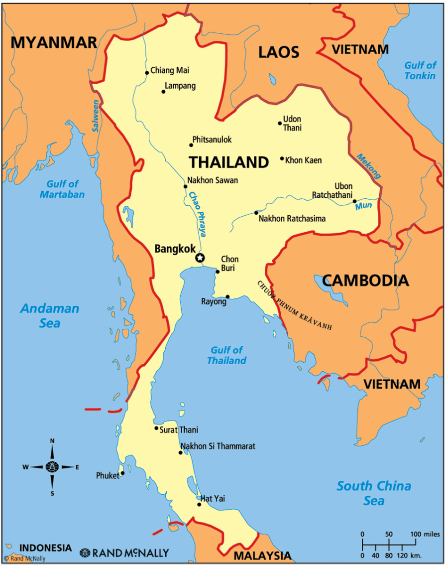
At first glance, Thailand's silhouette on a map is immediately recognizable — a broad northern body tapering into a long, narrow southern peninsula that stretches down toward Malaysia. The country shares with Myanmar to the north and west Laos to the northeast, Cambodia to the east, and Malaysia to the deep south. The Gulf of Thailand cradles the southeastern coastline, while the Andaman Sea defines the western edge of the peninsula central plains dominated by the Chao Phraya River basin, form the agricultural heartland of the nation. Bangkok, the sprawling capital, sits near the mouth of this river system, functioning as the political economic, and cultural hub of the entire country. The northern highlands give way to dense forests and elevated terrain home to hill tribes and a dramatically different way of life from the urban south. This general map establishes the foundational spatial context needed to appreciate the country's remarkable regional diversity.
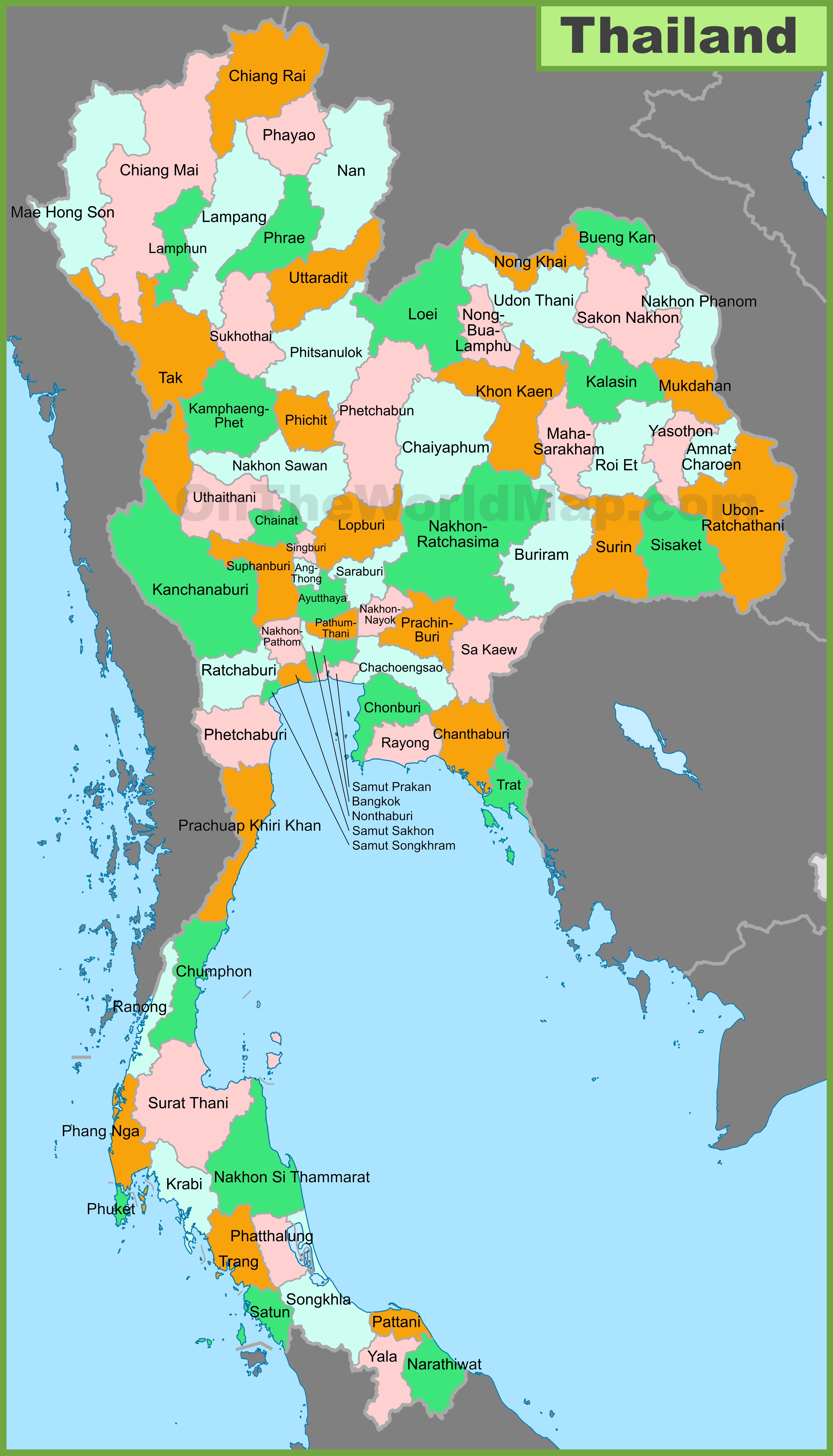
Thailand is divided into 77 provinces, each carrying its own identity, history, and regional character. The provinces Thailand breaks country into distinct units governed under centralized framework yet each province maintains its local traditions and governance structures. The northern region includes provinces such as Chiang Mai and Chiang Rai, renowned for their cooler climates, ancient temples, and proximity to the Golden Triangle. Moving through the northeast, the Isan plateau encompasses large cluster of provinces shaped by Lao and Khmer cultural influences, producing distinct dialect and cuisine. The central region, surrounding Bangkok, includes densely populated and economically active provinces that drive much of Thailand's industrial and agricultural output. In the south, provinces like Phuket, Krabi, and Surat Thani attract international attention through world-class beaches and marine ecosystems. Understanding provincial breakdown essential for anyone seeking to navigate Thailand with depth and intention as each province carries its own administrative systems, dialects, culinary traditions, and touristic offerings. The provinces a testament to the layered complexity hidden beneath Thailand's seemingly straightforward national outline.
Together, these maps paint a comprehensive picture of Thailand — a nation whose geographic diversity mirrors richness of its people heritage. From the high-altitude borders of the north to the tropical southern coastlines, every region offers something. Studying Thailand its maps is not merely an academic exercise; it is an invitation to explore one of Southeast Asia's most dynamic and culturally layered countries with sharper eyes and a deeper sense of direction
Political Map Of Thailand | Thailand Provinces Map
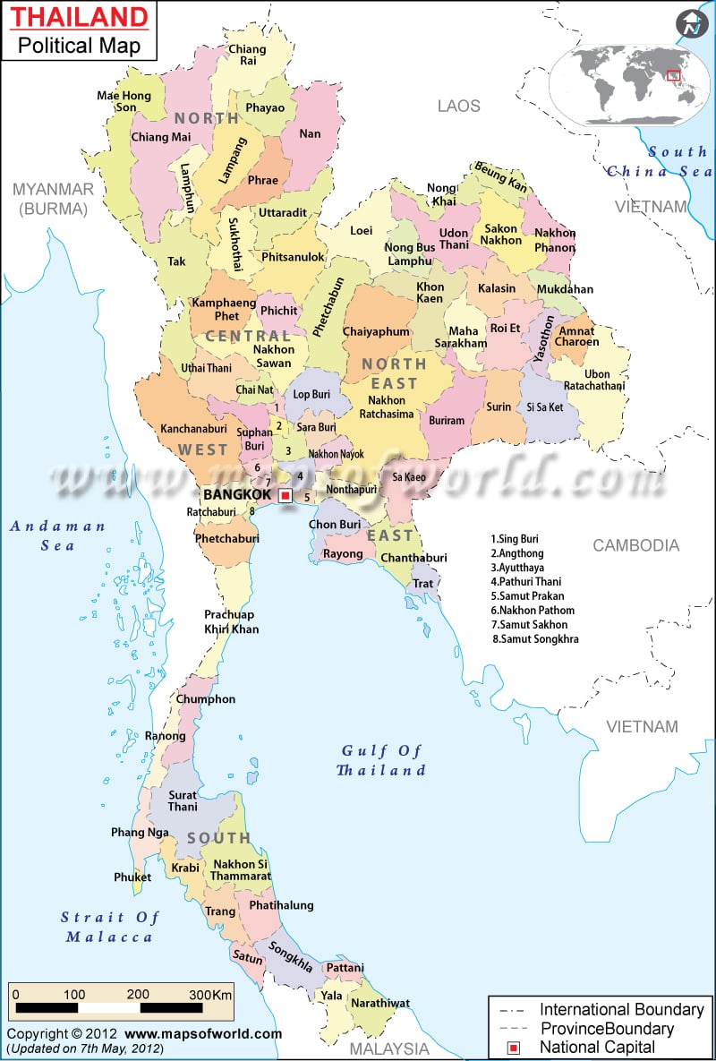
Political Map of Thailand | Thailand Provinces Map
Large Detailed Administrative Divisions Map Of Thailand - 2005
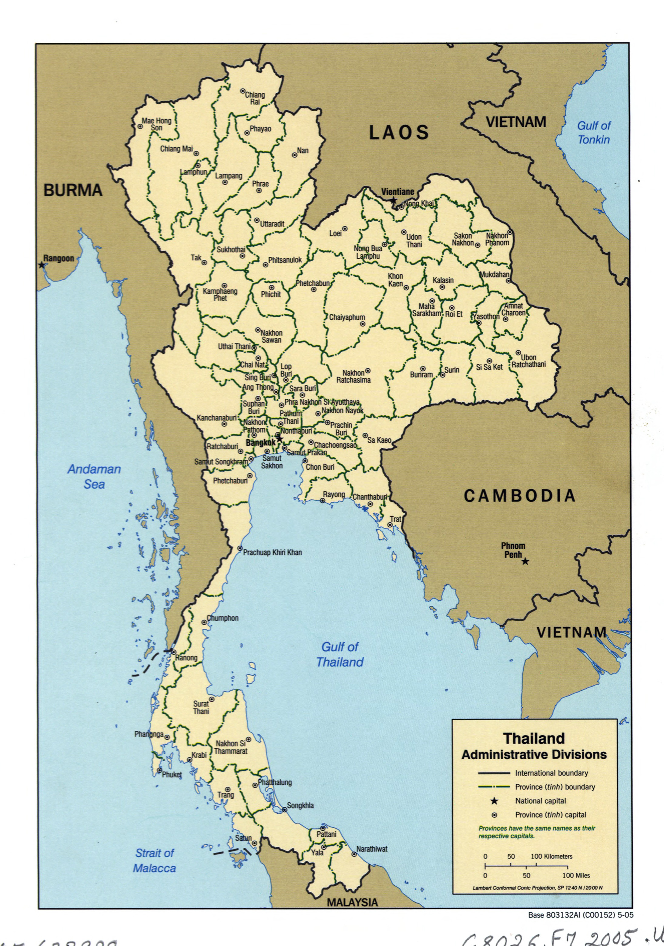
Large detailed administrative divisions map of Thailand - 2005 ...
Thailand Map - Guide Of The World
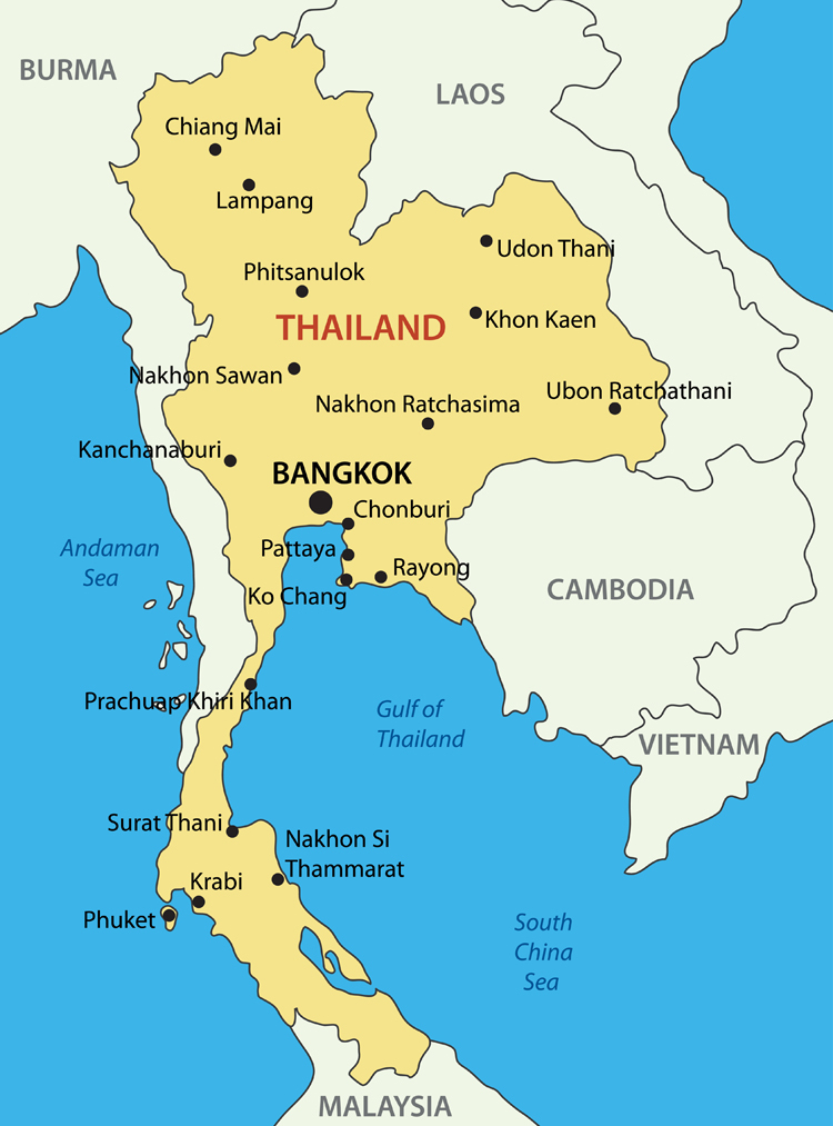
Thailand Map - Guide of the World