← Exploring the Map of Thailand: A Geographic and Provincial Guide Exploring Vietnam Through Maps: A Visual Guide to the Country's Geography and Regions →
Turkey is one of those rare countries that truly sits at the crossroads of the world — straddling Europe and Asia, bordered by the Black Sea to the north and the Mediterranean to the south. Understanding its geography is key to appreciating its rich cultural diversity, its strategic importance in global affairs, and the sheer variety of landscapes packed within its borders. Whether you're a traveler planning a trip, a student studying world geography, or simply someone with a curious mind, a good map of Turkey opens up a fascinating story told in mountains, coastlines, rivers, and cities.
Understanding Turkey's Political Landscape Through Maps
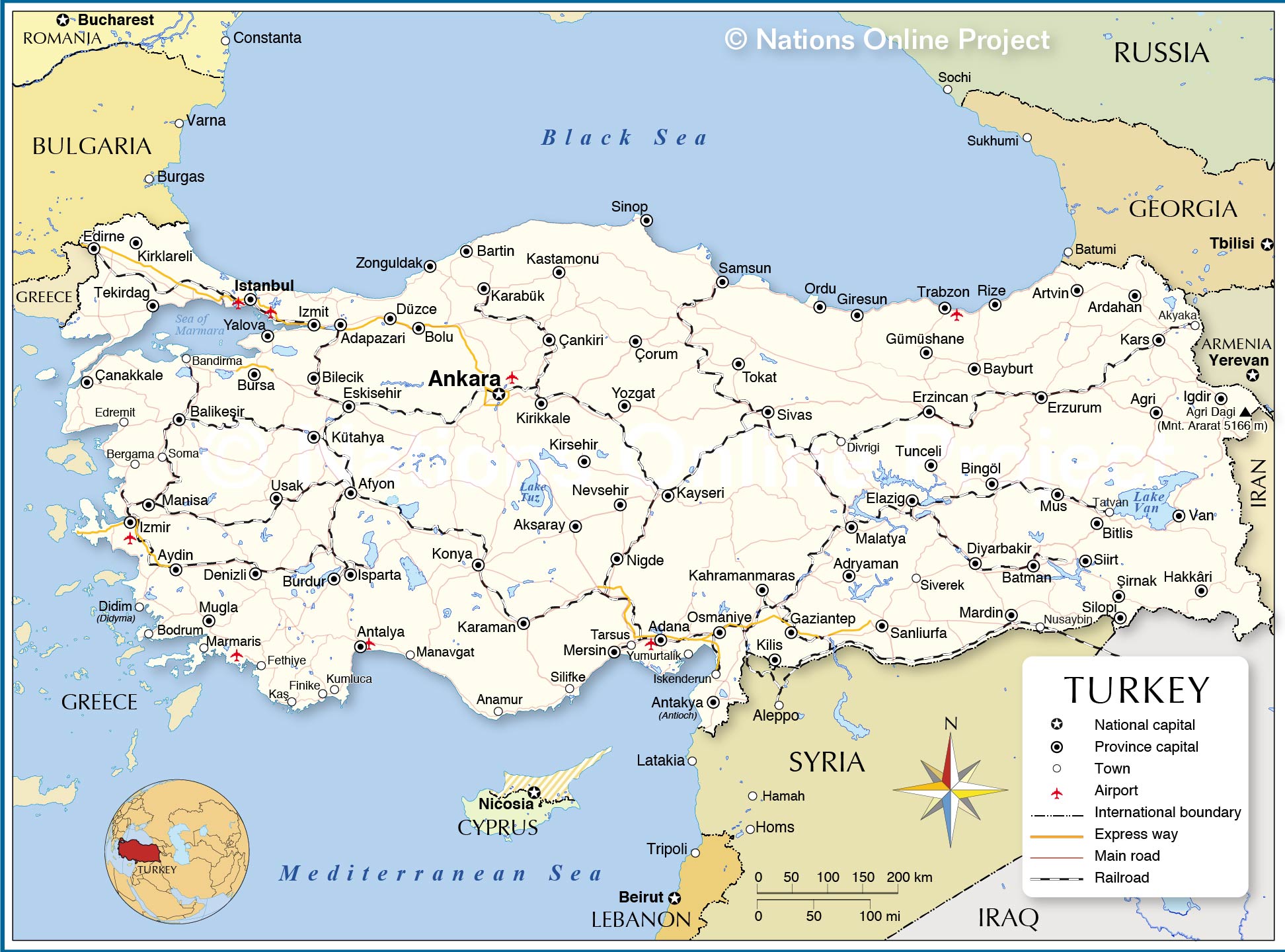
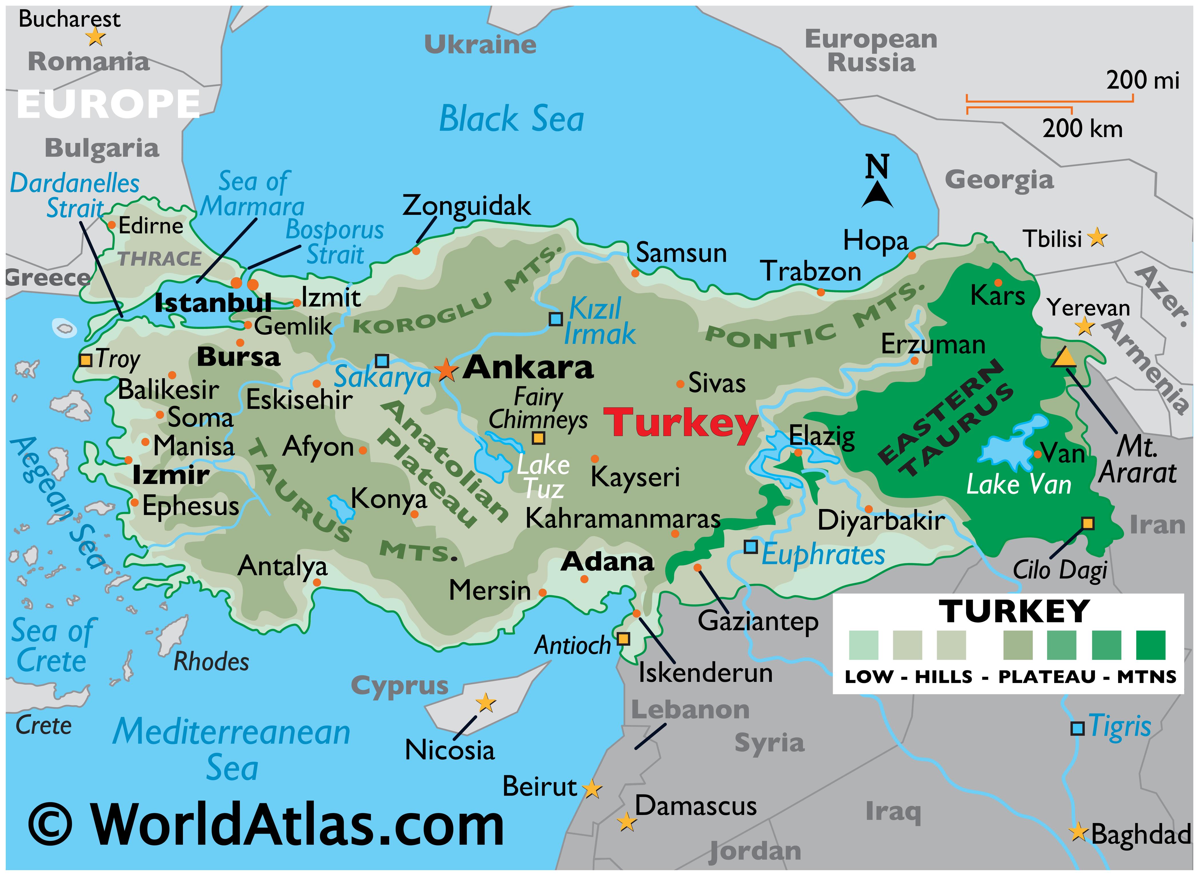
A political map of Turkey reveals just how complex and layered this nation really is. Spanning roughly 783000 square kilometers, Turkey is divided into 81 provinces, each with its own administrative capital. The political map makes it easy to trace's borders with eight countries Greece and Bulgaria to the northwest, Georgia Armenia, and Azerbaijan to the northeast, and Iran Iraq, and Syria to the east southeast. Major cities like Istanbul, Ankara (the capital), Izmir, Bursa, and Antalya stand out as population hubs, each playing a distinct economic and cultural role. Istanbul, straddling the Bosphorus Strait, remains the only city in the world that sits on two continents, making it a geographic marvel own right. Political maps also highlight the country's unique position between Aegean, Black, and Mediterranean Seas, reinforcing why has been a coveted territory throughout history — from the Byzantine Ottoman Empires to the modern republic founded by Mustafa Kemal Atatürk in 1923.
A Printable Map of Turkey for Travelers Explorers
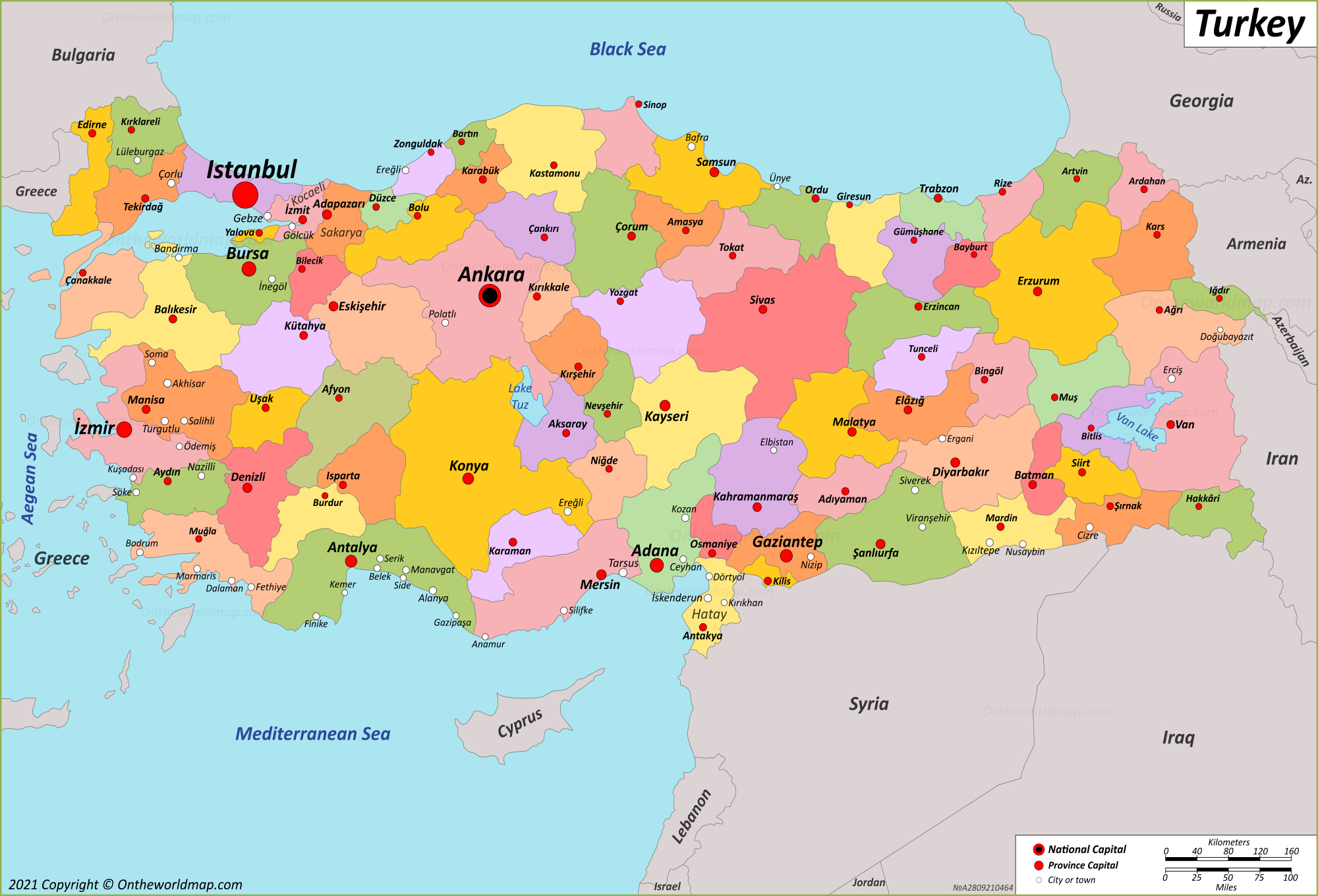
For those who prefer a hands-on approach to exploration, a printable map of Turkey is an invaluable tool. This type of map typically includes road networks, major highways, railways, and topographic features that help you visualize the physical terrain alongside the human-built infrastructure. Turkey's geography is anything but flat — the Anatolian Plateau dominates the interior, flanked by the Pontic Mountains to the north and the Taurus Mountains to the south. The eastern regions climb dramatically toward the Armenian Highlands, where Mount Ararat,'s highest peak at 5,137 meters, towers above the landscape. A detailed printable map also helps travelers navigate iconic destinations from the fairy-tale rock formations of Cappadocia and the travertine terraces of Pamukkale, to the ancient ruins of Ephesus along the Aegean coast. Having a physical or downloadable map on hand means you can plan road trips, trace historic trade routes like the Silk Road, and discover smaller towns that GPS apps sometimes overlook. Whether you're a backpacker, a history enthusiast, or a geography teacher building classroom materials, a good map of Turkey is your gateway to one of the most geographically and historically significant nations on Earth.
Printable Map Of Turkey
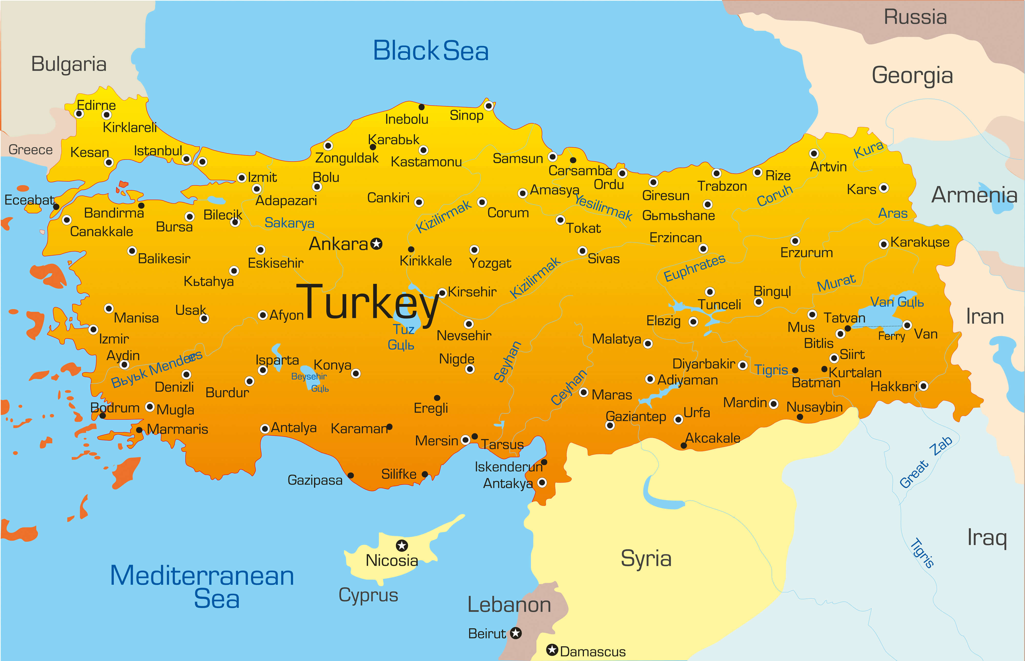
Printable Map Of Turkey
Capital Of Turkey Map
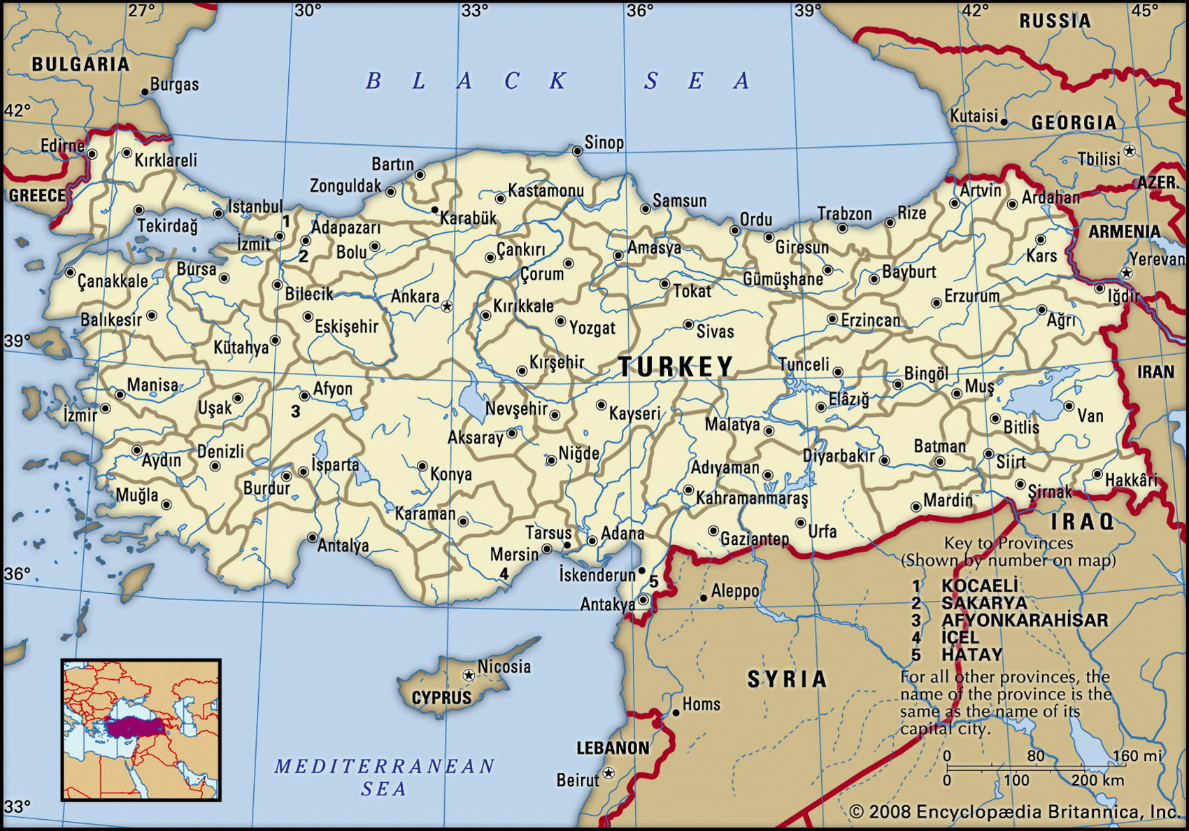
Capital Of Turkey Map
Turkey On The Map 60 фото - Beautyand.ru
Turkey on the map 60 фото - Beautyand.ru